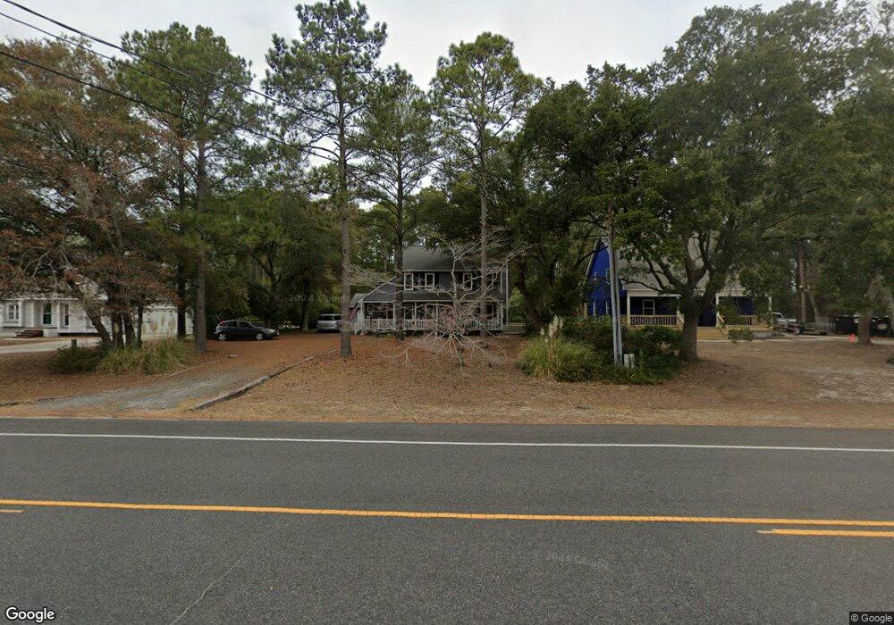
702 W 9th St Southport, NC 28461
Estimated Value: $311,000 - $448,000
3
Beds
2
Baths
1,500
Sq Ft
$262/Sq Ft
Est. Value
About This Home
This home is located at 702 W 9th St, Southport, NC 28461 and is currently estimated at $393,572, approximately $262 per square foot. 702 W 9th St is a home located in Brunswick County with nearby schools including Southport Elementary School, South Brunswick Middle School, and South Brunswick High School.
Ownership History
Date
Name
Owned For
Owner Type
Purchase Details
Closed on
May 18, 2007
Sold by
Clarkin Douglas and Clarkin Asheley
Bought by
Atchley Hans and Atchley Bridget
Current Estimated Value
Purchase Details
Closed on
Mar 28, 2005
Sold by
Russell James B
Bought by
Clarkin Douglas A and Clarkin Asheley M
Home Financials for this Owner
Home Financials are based on the most recent Mortgage that was taken out on this home.
Original Mortgage
$37,380
Interest Rate
5.74%
Mortgage Type
New Conventional
Create a Home Valuation Report for This Property
The Home Valuation Report is an in-depth analysis detailing your home's value as well as a comparison with similar homes in the area
Home Values in the Area
Average Home Value in this Area
Purchase History
| Date | Buyer | Sale Price | Title Company |
|---|---|---|---|
| Atchley Hans | $202,000 | None Available | |
| Clarkin Douglas A | $187,000 | None Available |
Source: Public Records
Mortgage History
| Date | Status | Borrower | Loan Amount |
|---|---|---|---|
| Previous Owner | Clarkin Douglas A | $37,380 | |
| Previous Owner | Clarkin Douglas A | $149,520 |
Source: Public Records
Tax History Compared to Growth
Tax History
| Year | Tax Paid | Tax Assessment Tax Assessment Total Assessment is a certain percentage of the fair market value that is determined by local assessors to be the total taxable value of land and additions on the property. | Land | Improvement |
|---|---|---|---|---|
| 2025 | $2,433 | $322,680 | $99,400 | $223,280 |
| 2024 | $2,433 | $322,680 | $99,400 | $223,280 |
| 2023 | $1,940 | $322,680 | $99,400 | $223,280 |
| 2022 | $1,940 | $189,060 | $36,000 | $153,060 |
| 2021 | $1,689 | $189,060 | $36,000 | $153,060 |
| 2020 | $1,689 | $189,060 | $36,000 | $153,060 |
| 2019 | $1,689 | $47,360 | $36,000 | $11,360 |
| 2018 | $1,468 | $43,350 | $30,000 | $13,350 |
| 2017 | $1,456 | $43,350 | $30,000 | $13,350 |
| 2016 | $1,350 | $43,350 | $30,000 | $13,350 |
| 2015 | $1,350 | $162,180 | $30,000 | $132,180 |
| 2014 | $1,430 | $182,613 | $60,000 | $122,613 |
Source: Public Records
Map
Nearby Homes
- 1100 Spincast Rd
- Lot 1 Maple Ave
- Tr-2 W 9th St
- Tr-1 W 9th St
- 742 Skipjack Cir
- 1028 Downrigger Trail
- 6253 Cattail Ct
- 667 Spartina Ct
- Lot 5b Hankinsville Rd
- 611 N Burrington Ave
- 638 Spartina Ct
- 607 Burrington Ave
- 617 Port Haven Way
- 27 Lots N Caswell Ave
- 679 Carolina Bay Ct
- Lot 5a N Caswell Ave
- 29 N Caswell Ave
- 826 N Caswell Ave
- 304 W 11th St
- 614 W Brown St Unit A
- 700 W 9th St
- 706 W 9th St
- 800 W 9th St
- 818 W 11th St
- 1121 Spincast Rd
- 1125 Spincast Rd
- 722 W 11th St
- 802 W 9th St
- 1129 Spincast Rd
- 602 W 9th St
- 1117 Shipmast Way Unit 17
- 1133 Spincast Rd
- 1117 Spincast Rd
- 1137 Spincast Rd
- 804 W 9th St
- 1141 Spincast Rd
- 1151 Spincast Rd
- 1120 Spincast Rd
- 1116 Spincast Rd
- 1116 Shipmast Way Unit 26