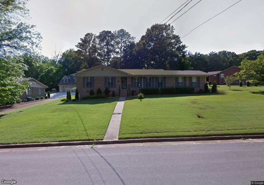
702 Watts Dr SE Huntsville, AL 35801
Blossomwood NeighborhoodEstimated Value: $417,000 - $521,000
--
Bed
--
Bath
1,678
Sq Ft
$278/Sq Ft
Est. Value
About This Home
This home is located at 702 Watts Dr SE, Huntsville, AL 35801 and is currently estimated at $466,542, approximately $278 per square foot. 702 Watts Dr SE is a home with nearby schools including Blossomwood Elementary School, Huntsville Junior High School, and Huntsville High School.
Ownership History
Date
Name
Owned For
Owner Type
Purchase Details
Closed on
Nov 4, 2006
Sold by
Williamson Carl G
Bought by
Whitt Martha Ann
Current Estimated Value
Home Financials for this Owner
Home Financials are based on the most recent Mortgage that was taken out on this home.
Original Mortgage
$102,400
Outstanding Balance
$60,144
Interest Rate
6.27%
Mortgage Type
New Conventional
Estimated Equity
$406,398
Create a Home Valuation Report for This Property
The Home Valuation Report is an in-depth analysis detailing your home's value as well as a comparison with similar homes in the area
Home Values in the Area
Average Home Value in this Area
Purchase History
| Date | Buyer | Sale Price | Title Company |
|---|---|---|---|
| Whitt Martha Ann | -- | -- |
Source: Public Records
Mortgage History
| Date | Status | Borrower | Loan Amount |
|---|---|---|---|
| Open | Whitt Martha Ann | $102,400 |
Source: Public Records
Tax History Compared to Growth
Tax History
| Year | Tax Paid | Tax Assessment Tax Assessment Total Assessment is a certain percentage of the fair market value that is determined by local assessors to be the total taxable value of land and additions on the property. | Land | Improvement |
|---|---|---|---|---|
| 2025 | $2,188 | $42,920 | $10,220 | $32,700 |
| 2024 | $2,188 | $40,160 | $9,020 | $31,140 |
| 2023 | $2,046 | $38,160 | $7,820 | $30,340 |
| 2022 | $1,726 | $33,940 | $6,020 | $27,920 |
| 2021 | $1,726 | $33,940 | $6,020 | $27,920 |
| 2020 | $1,366 | $26,940 | $5,110 | $21,830 |
| 2019 | $1,366 | $26,940 | $5,110 | $21,830 |
| 2018 | $1,349 | $26,620 | $0 | $0 |
| 2017 | $1,349 | $26,620 | $0 | $0 |
| 2016 | $1,349 | $26,620 | $0 | $0 |
| 2015 | $1,349 | $26,620 | $0 | $0 |
| 2014 | $1,294 | $25,560 | $0 | $0 |
Source: Public Records
Map
Nearby Homes
- 303 Ormond Cir SE
- 700 Fagan Springs Dr SE
- 103 Dill St SE
- 508 Owens Dr SE
- 2211 Toll Gate Rd SE
- 211 Knollridge Cir SE
- 117 Knollridge Dr
- 2212 Toll Gate Rd SE
- 904 Corinth Cir SE
- 1701 Toll Gate Rd SE
- 1611 Wells Ave SE
- 1 Maysville Rd SE
- 418 Owens Dr SE
- 416 Owens Dr SE
- 1411 Hermitage Ave SE
- 1721 Sandlin Ave SE
- 1733 Beirne Ave NE
- 1709 Sandlin Ave SE
- 1721 Beirne Ave NE
- 309 Cambridge St SE
- 704 Watts Dr SE
- 700 Watts Dr SE
- 705 Watts Dr SE
- 707 Watts Dr SE
- 703 Owens Dr SE
- 703 Watts Dr SE
- 706 Watts Dr SE
- 709 Watts Dr SE
- 705 Owens Dr SE
- 701 Watts Dr SE
- 711 Watts Dr SE
- 708 Watts Dr SE
- 631 Owens Dr SE
- 700 Cleermont Dr SE
- 618 Cleermont Dr SE
- 702 Owens Dr SE
- 620 Cleermont Dr SE
- 302 Ormond Cir SE
- 702 Cleermont Dr SE
- 713 Watts Dr SE