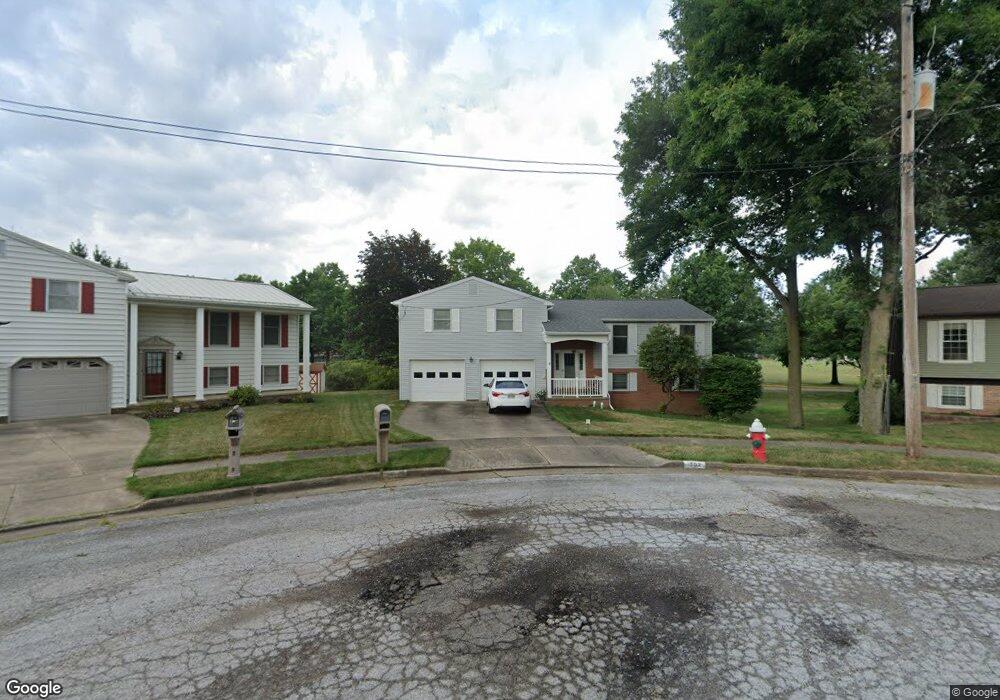
702 Wendy Cir NE North Canton, OH 44720
Estimated Value: $246,000 - $273,000
3
Beds
2
Baths
1,500
Sq Ft
$171/Sq Ft
Est. Value
About This Home
This home is located at 702 Wendy Cir NE, North Canton, OH 44720 and is currently estimated at $256,684, approximately $171 per square foot. 702 Wendy Cir NE is a home located in Stark County with nearby schools including North Canton Middle School, Hoover High School, and St Paul School.
Ownership History
Date
Name
Owned For
Owner Type
Purchase Details
Closed on
Feb 9, 2004
Sold by
Hines Michael W and Hines Delores M
Bought by
Stewart Todd M and Stewart Kristin M
Current Estimated Value
Home Financials for this Owner
Home Financials are based on the most recent Mortgage that was taken out on this home.
Original Mortgage
$113,520
Outstanding Balance
$49,221
Interest Rate
4.75%
Mortgage Type
Purchase Money Mortgage
Estimated Equity
$207,463
Purchase Details
Closed on
May 22, 1995
Sold by
Baker Robert B
Bought by
Hines Michael W and Hines Delores
Home Financials for this Owner
Home Financials are based on the most recent Mortgage that was taken out on this home.
Original Mortgage
$80,000
Interest Rate
8.42%
Mortgage Type
New Conventional
Create a Home Valuation Report for This Property
The Home Valuation Report is an in-depth analysis detailing your home's value as well as a comparison with similar homes in the area
Home Values in the Area
Average Home Value in this Area
Purchase History
| Date | Buyer | Sale Price | Title Company |
|---|---|---|---|
| Stewart Todd M | $141,900 | -- | |
| Hines Michael W | $120,000 | -- |
Source: Public Records
Mortgage History
| Date | Status | Borrower | Loan Amount |
|---|---|---|---|
| Open | Stewart Todd M | $113,520 | |
| Closed | Hines Michael W | $80,000 |
Source: Public Records
Tax History Compared to Growth
Tax History
| Year | Tax Paid | Tax Assessment Tax Assessment Total Assessment is a certain percentage of the fair market value that is determined by local assessors to be the total taxable value of land and additions on the property. | Land | Improvement |
|---|---|---|---|---|
| 2025 | -- | $78,790 | $15,260 | $63,530 |
| 2024 | -- | $78,790 | $15,260 | $63,530 |
| 2023 | $3,229 | $60,380 | $10,920 | $49,460 |
| 2022 | $1,552 | $60,380 | $10,920 | $49,460 |
| 2021 | $2,993 | $60,380 | $10,920 | $49,460 |
| 2020 | $2,912 | $52,750 | $9,490 | $43,260 |
| 2019 | $2,718 | $52,750 | $9,490 | $43,260 |
| 2018 | $2,818 | $52,750 | $9,490 | $43,260 |
| 2017 | $2,486 | $48,870 | $8,370 | $40,500 |
| 2016 | $2,496 | $48,870 | $8,370 | $40,500 |
| 2015 | $2,505 | $48,870 | $8,370 | $40,500 |
| 2014 | $292 | $41,730 | $7,530 | $34,200 |
| 2013 | $1,150 | $41,730 | $7,530 | $34,200 |
Source: Public Records
Map
Nearby Homes
- 825 6th St NE
- 945 Royal Oak Ave NE
- 870 Honeysuckle Cir NE
- 360 Woodside Ave NE
- 1031 Park Ave NE
- 1020 Pickforde Dr NE
- 1060 Park Ave NE
- 448 Hower St NE
- 406 Hower St NE
- 140 5th St NE
- 1240 7th St NE
- 434 Heather Cir NE
- 221 Briar Ave NE
- 1350 Overland Ave NE
- 0 Marquardt Ave
- 807 N Main St
- 455 Royer Ave NW
- 404 7th St NW
- 0 Marquardt Dr NW
- 701 Edgewood St SE
- 706 Wendy Cir NE
- 703 Wendy Cir NE
- 710 Wendy Cir NE
- 707 Wendy Cir NE
- 713 7th St NE
- 718 Wendy Cir NE
- 711 Wendy Cir NE
- 623 7th St NE
- 713 7th St SW
- 719 Wendy Cir NE
- 724 Wendy Cir NE
- 725 Wendy Cir NE
- 701 Woodside Ave NE
- 714 7th St NE
- 720 7th St NE
- 714 Woodside Ave NE
- 619 Woodside Ave NE
- 801 7th St NE
- 718 Woodside Ave NE
- 615 Woodside Ave NE