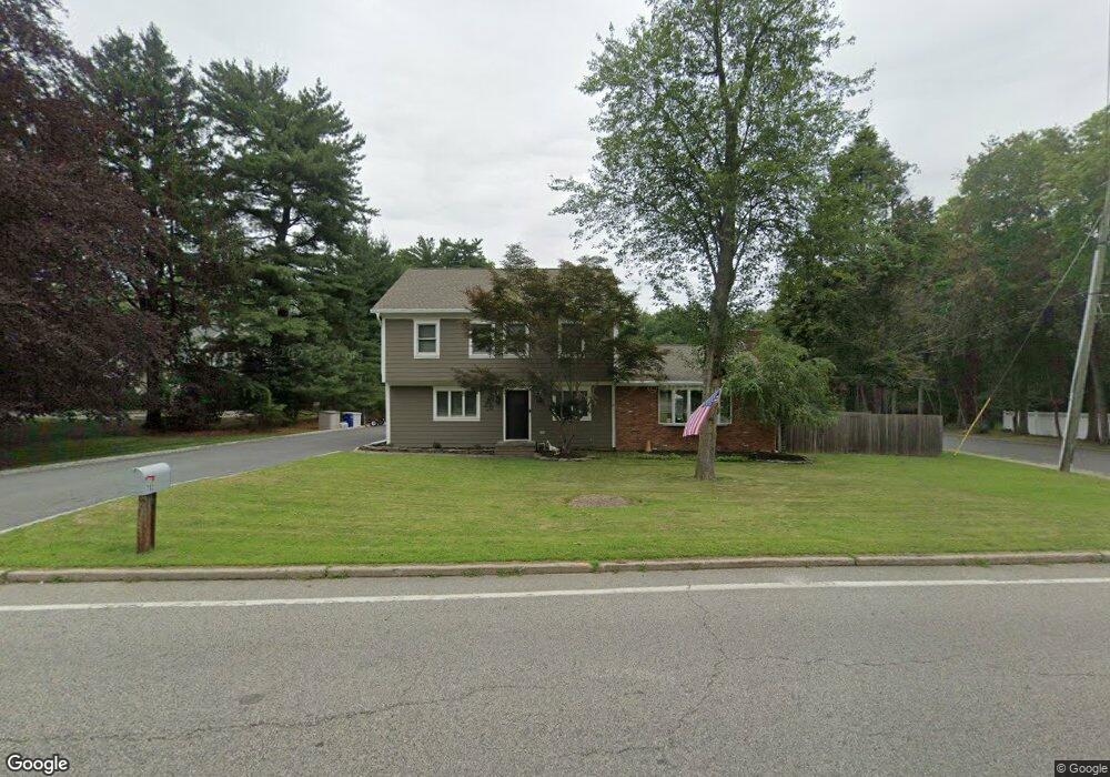
702 Westwood Ave Rivervale, NJ 07675
Estimated Value: $851,000 - $1,062,000
--
Bed
--
Bath
2,930
Sq Ft
$329/Sq Ft
Est. Value
About This Home
This home is located at 702 Westwood Ave, Rivervale, NJ 07675 and is currently estimated at $963,054, approximately $328 per square foot. 702 Westwood Ave is a home located in Bergen County with nearby schools including Pascack Valley High School and Primoris Academy.
Ownership History
Date
Name
Owned For
Owner Type
Purchase Details
Closed on
Jul 19, 2018
Sold by
Scott Stacey L and Bujas Dennis A
Bought by
Scott Stacey L
Current Estimated Value
Purchase Details
Closed on
Dec 29, 2016
Sold by
Scott Leonard E and Scottt Marion
Bought by
Bujas Stacey L and Bujas Dennis A
Home Financials for this Owner
Home Financials are based on the most recent Mortgage that was taken out on this home.
Original Mortgage
$2,500
Outstanding Balance
$1,999
Interest Rate
3.12%
Mortgage Type
Adjustable Rate Mortgage/ARM
Estimated Equity
$961,055
Create a Home Valuation Report for This Property
The Home Valuation Report is an in-depth analysis detailing your home's value as well as a comparison with similar homes in the area
Home Values in the Area
Average Home Value in this Area
Purchase History
| Date | Buyer | Sale Price | Title Company |
|---|---|---|---|
| Scott Stacey L | -- | -- | |
| Bujas Stacey L | $400,000 | First American Title |
Source: Public Records
Mortgage History
| Date | Status | Borrower | Loan Amount |
|---|---|---|---|
| Open | Bujas Stacey L | $2,500 |
Source: Public Records
Tax History Compared to Growth
Tax History
| Year | Tax Paid | Tax Assessment Tax Assessment Total Assessment is a certain percentage of the fair market value that is determined by local assessors to be the total taxable value of land and additions on the property. | Land | Improvement |
|---|---|---|---|---|
| 2025 | $16,588 | $607,400 | $350,000 | $257,400 |
| 2024 | $16,485 | $607,400 | $350,000 | $257,400 |
| 2023 | $16,066 | $607,400 | $350,000 | $257,400 |
| 2022 | $16,066 | $607,400 | $350,000 | $257,400 |
| 2021 | $15,689 | $607,400 | $350,000 | $257,400 |
| 2020 | $15,871 | $607,400 | $350,000 | $257,400 |
| 2019 | $15,507 | $607,400 | $350,000 | $257,400 |
| 2018 | $15,337 | $607,400 | $350,000 | $257,400 |
| 2017 | $15,112 | $607,400 | $350,000 | $257,400 |
| 2016 | $14,681 | $607,400 | $350,000 | $257,400 |
| 2015 | $14,012 | $483,900 | $350,000 | $133,900 |
| 2014 | $10,744 | $483,900 | $350,000 | $133,900 |
Source: Public Records
Map
Nearby Homes
- 271 Collignon Way Unit 4A
- 722 Wilson Ct
- 149 Brookside Ave
- 604 Florence Rd
- 111 Ivy Ln
- 276 River Dr
- 794 Blauvelt St
- 243 Kociemba Dr
- 803 Marshall Rd
- 557 Roosevelt Ave
- 558 Westwood Ave
- 23 Walter St
- 229 William St
- 208 Birchwood Rd
- 820 Clauss Ln
- 21 Birchwood Rd
- 502 Westwood Ave
- 12 Rickland Rd
- 404 Old Tappan Rd
- 258 Lynn St
- 696 Westwood Ave
- 708 Westwood Ave
- 205 Peters Place
- 673 Westwood Ave
- 692 Westwood Ave
- 712 Westwood Ave
- 705 Westwood Ave
- 714 Westwood Ave
- 714-716 Westwood Ave
- 716 Westwood Ave
- 707 Westwood Ave
- 680 Westwood Ave Unit 688
- 680-688 Westwood Ave Unit A
- 718 Westwood Ave
- 718 Westwood Ave
- 711 Westwood Ave
- 271 Collignon Way Unit 5B
- 271 Collignon Way Unit 1B
- 271 Collignon Way Unit 4B
- 271 Collignon Way Unit 7A