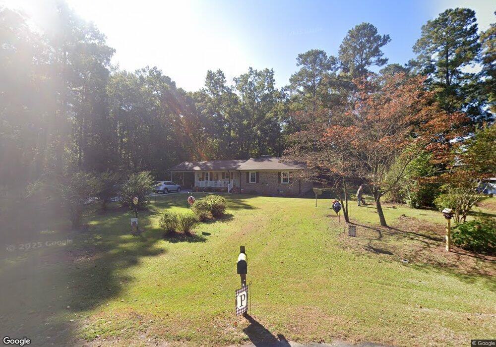
702 Willow Rd Clinton, NC 28328
Estimated Value: $249,000 - $262,000
3
Beds
2
Baths
1,520
Sq Ft
$170/Sq Ft
Est. Value
About This Home
This home is located at 702 Willow Rd, Clinton, NC 28328 and is currently estimated at $258,014, approximately $169 per square foot. 702 Willow Rd is a home located in Sampson County with nearby schools including Langdon C. Kerr Elementary School, Sunset Avenue Elementary School, and Butler Avenue Elementary School.
Ownership History
Date
Name
Owned For
Owner Type
Purchase Details
Closed on
Mar 28, 2008
Sold by
The Perko Family Lp
Bought by
Pope Patricia Kay
Current Estimated Value
Home Financials for this Owner
Home Financials are based on the most recent Mortgage that was taken out on this home.
Original Mortgage
$135,000
Outstanding Balance
$84,935
Interest Rate
5.84%
Mortgage Type
New Conventional
Estimated Equity
$173,079
Create a Home Valuation Report for This Property
The Home Valuation Report is an in-depth analysis detailing your home's value as well as a comparison with similar homes in the area
Home Values in the Area
Average Home Value in this Area
Purchase History
| Date | Buyer | Sale Price | Title Company |
|---|---|---|---|
| Pope Patricia Kay | $135,000 | -- |
Source: Public Records
Mortgage History
| Date | Status | Borrower | Loan Amount |
|---|---|---|---|
| Open | Pope Patricia Kay | $135,000 |
Source: Public Records
Tax History Compared to Growth
Tax History
| Year | Tax Paid | Tax Assessment Tax Assessment Total Assessment is a certain percentage of the fair market value that is determined by local assessors to be the total taxable value of land and additions on the property. | Land | Improvement |
|---|---|---|---|---|
| 2025 | $2,308 | $202,494 | $35,325 | $167,169 |
| 2024 | $2,187 | $202,494 | $35,325 | $167,169 |
| 2023 | $1,901 | $138,748 | $30,849 | $107,899 |
| 2022 | $1,901 | $138,748 | $30,849 | $107,899 |
| 2021 | $1,901 | $138,748 | $30,849 | $107,899 |
| 2020 | $1,901 | $138,748 | $30,849 | $107,899 |
| 2019 | $1,901 | $138,748 | $0 | $0 |
| 2018 | $1,860 | $135,783 | $0 | $0 |
| 2017 | $1,860 | $135,783 | $0 | $0 |
| 2016 | $1,867 | $135,783 | $0 | $0 |
| 2015 | $1,867 | $135,783 | $0 | $0 |
| 2014 | $1,867 | $135,783 | $0 | $0 |
Source: Public Records
Map
Nearby Homes
- 100 Fulton St
- 706 Walking Stick Trail
- 502 Raleigh Rd
- 45 Hb Lewis Rd
- 907 Raleigh Rd
- 1006 Raleigh Rd
- 1012 Raleigh Rd
- 816 Peachtree Rd
- 0 Pugh Rd
- 125 Cove Place
- 127 Cove Place
- 202 Jacobs St
- 612 Blaney St
- 807 Stewart Ave
- 512 Nicholson St
- 900 Beaman St
- 118 Northgate Ln
- 30 Northgate Ln
- 612 College St
- 105 Mcarthur Ln
- 408 Walking Stick Trail
- 410 Walking Stick Trail
- 406 Walking Stick Trail
- 500 Walking Stick Trail
- 404 Walking Stick Trail
- 409 Walking Stick Trail
- 411 Walking Stick Trail
- 407 Walking Stick Trail
- 109 Heritage Place
- 504 Walking Stick Trail
- 501 Walking Stick Trail
- 405 Walking Stick Trail
- 503 Walking Stick Trail
- 506 Walking Stick Trail
- 105 Heritage Place
- 505 Walking Stick Trail
- 406 Beaver Dam Dr
- 103 Heritage Place
- 410 Beaver Dam Dr
- 508 Walking Stick Trail