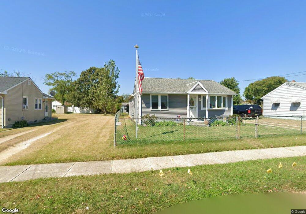
702 Wilson Ave Cape May, NJ 08204
Estimated Value: $425,268 - $710,000
--
Bed
--
Bath
1,288
Sq Ft
$465/Sq Ft
Est. Value
About This Home
This home is located at 702 Wilson Ave, Cape May, NJ 08204 and is currently estimated at $599,067, approximately $465 per square foot. 702 Wilson Ave is a home located in Cape May County with nearby schools including Carl T. Mitnick School, David C. Douglass Veterans Memorial School, and Maud Abrams School.
Ownership History
Date
Name
Owned For
Owner Type
Purchase Details
Closed on
Jan 20, 2010
Sold by
Zizza Robert L and Kenyon Zizza Judith A
Bought by
Zizza Robert L and Kenyon Zizza Judith A
Current Estimated Value
Home Financials for this Owner
Home Financials are based on the most recent Mortgage that was taken out on this home.
Original Mortgage
$221,126
Outstanding Balance
$145,917
Interest Rate
5.05%
Mortgage Type
New Conventional
Estimated Equity
$453,150
Purchase Details
Closed on
Aug 31, 1988
Sold by
Margrabia Joseph
Bought by
Zizza Robert and Zizza Kenyon,Judith A
Create a Home Valuation Report for This Property
The Home Valuation Report is an in-depth analysis detailing your home's value as well as a comparison with similar homes in the area
Home Values in the Area
Average Home Value in this Area
Purchase History
| Date | Buyer | Sale Price | Title Company |
|---|---|---|---|
| Zizza Robert L | -- | Service Link | |
| Zizza Robert | $79,000 | -- |
Source: Public Records
Mortgage History
| Date | Status | Borrower | Loan Amount |
|---|---|---|---|
| Open | Zizza Robert L | $221,126 |
Source: Public Records
Tax History Compared to Growth
Tax History
| Year | Tax Paid | Tax Assessment Tax Assessment Total Assessment is a certain percentage of the fair market value that is determined by local assessors to be the total taxable value of land and additions on the property. | Land | Improvement |
|---|---|---|---|---|
| 2025 | $4,494 | $221,600 | $117,300 | $104,300 |
| 2024 | $4,494 | $221,600 | $117,300 | $104,300 |
| 2023 | $4,430 | $221,600 | $117,300 | $104,300 |
| 2022 | $4,295 | $221,600 | $117,300 | $104,300 |
| 2021 | $4,166 | $221,600 | $117,300 | $104,300 |
| 2020 | $4,100 | $221,600 | $117,300 | $104,300 |
| 2019 | $3,998 | $221,600 | $117,300 | $104,300 |
| 2018 | $3,902 | $221,600 | $117,300 | $104,300 |
| 2017 | $3,907 | $221,600 | $117,300 | $104,300 |
| 2016 | $2,746 | $158,200 | $117,300 | $40,900 |
| 2015 | $2,658 | $158,200 | $117,300 | $40,900 |
| 2014 | $2,571 | $158,200 | $117,300 | $40,900 |
Source: Public Records
Map
Nearby Homes
- 712 Indian Ave
- 1400 Franklin Ave
- 508 Adriatic Ave
- 1500 Franklin Ave
- 712 Gorham Ave
- 711 Beach Dr
- 602 Gorham Ave
- 402 Whildam Ave
- 503 Beach Dr
- 702 Gordon Terrace
- 507 Scotty Blvd Unit 12
- 401 Beach Dr
- 305 Whildam Ave
- 1310 Browning Ave
- 1607 Scott Ave
- 3911 Bayshore Rd
- 113 Beachhurst Dr
- 219 Town Bank Rd
- 105 Orchard Dr
- 66 Beachhurst Dr
- 704 Wilson Ave
- 700 Wilson Ave
- 706 Wilson Ave
- 703 Wayne Ave
- 701 Wayne Ave
- 705 Wayne Ave
- 1000 Rosehill Pkwy
- 1002 Rosehill Pkwy
- 707 Wayne Ave
- 708 Wilson Ave
- 1004 Rose Hill Pkwy
- 1004 Rosehill Pkwy
- 703 Wilson Ave
- 705 Wilson Ave
- 701 Wilson Ave
- 1006 Rosehill Pkwy
- 709 Wayne Ave
- 707 Wilson Ave
- 908 Rosehill Pkwy
- 710 Wilson Ave