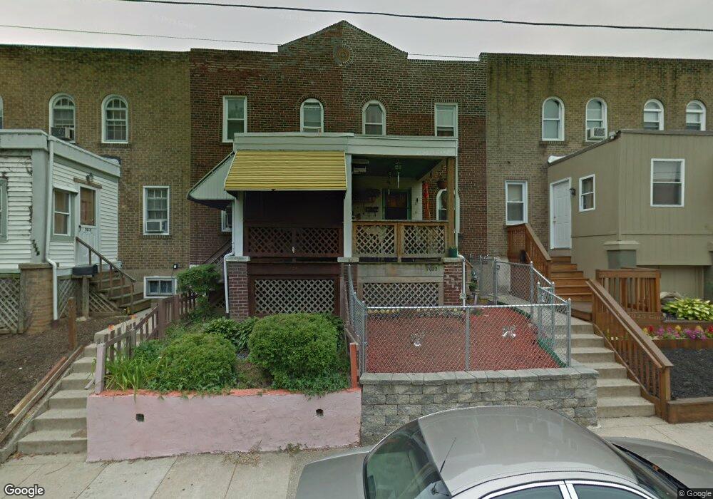
7020 Clinton Rd Upper Darby, PA 19082
Estimated Value: $62,000 - $153,000
2
Beds
1
Bath
1,252
Sq Ft
$90/Sq Ft
Est. Value
About This Home
This home is located at 7020 Clinton Rd, Upper Darby, PA 19082 and is currently estimated at $112,061, approximately $89 per square foot. 7020 Clinton Rd is a home located in Delaware County with nearby schools including Upper Darby Kdg Center, Upper Darby High School, and Lansdowne Friends School.
Ownership History
Date
Name
Owned For
Owner Type
Purchase Details
Closed on
Feb 5, 2025
Sold by
Leroy Guy
Bought by
Corinthian Capital Funding Llc
Current Estimated Value
Purchase Details
Closed on
Mar 20, 2024
Sold by
County Of Delaware
Bought by
Guy Leroy
Purchase Details
Closed on
Oct 21, 2023
Sold by
Jennings And Colon Real Estate Llc
Bought by
Colon Rafi
Purchase Details
Closed on
May 11, 2021
Sold by
Mond Jerome
Bought by
Jennings And Colon Real Estate Llc
Purchase Details
Closed on
Apr 25, 2003
Sold by
Weaver Margaret A
Bought by
Mond Jerome
Home Financials for this Owner
Home Financials are based on the most recent Mortgage that was taken out on this home.
Original Mortgage
$53,000
Interest Rate
5.82%
Mortgage Type
Purchase Money Mortgage
Create a Home Valuation Report for This Property
The Home Valuation Report is an in-depth analysis detailing your home's value as well as a comparison with similar homes in the area
Home Values in the Area
Average Home Value in this Area
Purchase History
| Date | Buyer | Sale Price | Title Company |
|---|---|---|---|
| Corinthian Capital Funding Llc | $28,000 | None Listed On Document | |
| Corinthian Capital Funding Llc | $28,000 | None Listed On Document | |
| Guy Leroy | $28,000 | None Listed On Document | |
| Colon Rafi | $15,000 | None Listed On Document | |
| Jennings And Colon Real Estate Llc | $5,000 | Mba Abstract Inc | |
| Mond Jerome | $53,000 | T A Title Insurance Company |
Source: Public Records
Mortgage History
| Date | Status | Borrower | Loan Amount |
|---|---|---|---|
| Previous Owner | Mond Jerome | $53,000 |
Source: Public Records
Tax History
| Year | Tax Paid | Tax Assessment Tax Assessment Total Assessment is a certain percentage of the fair market value that is determined by local assessors to be the total taxable value of land and additions on the property. | Land | Improvement |
|---|---|---|---|---|
| 2025 | $2,626 | $62,090 | $13,600 | $48,490 |
| 2024 | $2,626 | $62,090 | $13,600 | $48,490 |
| 2023 | $2,601 | $62,090 | $13,600 | $48,490 |
| 2022 | $2,531 | $62,090 | $13,600 | $48,490 |
| 2021 | $3,413 | $62,090 | $13,600 | $48,490 |
| 2020 | $2,346 | $36,270 | $12,360 | $23,910 |
| 2019 | $2,305 | $36,270 | $12,360 | $23,910 |
| 2018 | $2,278 | $36,270 | $0 | $0 |
| 2017 | $2,219 | $36,270 | $0 | $0 |
| 2016 | $199 | $36,270 | $0 | $0 |
| 2015 | $199 | $36,270 | $0 | $0 |
| 2014 | $199 | $36,270 | $0 | $0 |
Source: Public Records
Map
Nearby Homes
- 6993 Guilford Rd
- 7042 Clinton Rd
- 6997 Guilford Rd
- 7023 Guilford Rd
- 7043 Radbourne Rd
- 614 Littlecroft Rd
- 540 Snowden Rd
- 7160 Clover Ln
- 535 Wiltshire Rd
- 7000 Greenwood Ave
- 7123 Seaford Rd
- 7218 Radbourne Rd
- 519 Littlecroft Rd
- 7117 Atlantic Ave
- 402 Long Ln
- 607 Briarcliff Rd
- 7010 Atlantic Ave
- 424 Woodcliffe Rd
- 411 Millbank Rd
- 346 Long Ln
- 7018 Clinton Rd
- 7022 Clinton Rd
- 7016 Clinton Rd
- 7014 Clinton Rd
- 7026 Clinton Rd
- 7028 Clinton Rd
- 7038 Clinton Rd
- 7030 Clinton Rd
- 7012 Clinton Rd
- 7113 Radbourne Rd
- 7111 Radbourne Rd
- 7115 Radbourne Rd
- 7117 Radbourne Rd
- 7109 Radbourne Rd
- 7032 Clinton Rd
- 7010 Clinton Rd
- 7107 Radbourne Rd
- 7107 Radbourne Rd
- 7119 Radbourne Rd
- 7034 Clinton Rd
Your Personal Tour Guide
Ask me questions while you tour the home.