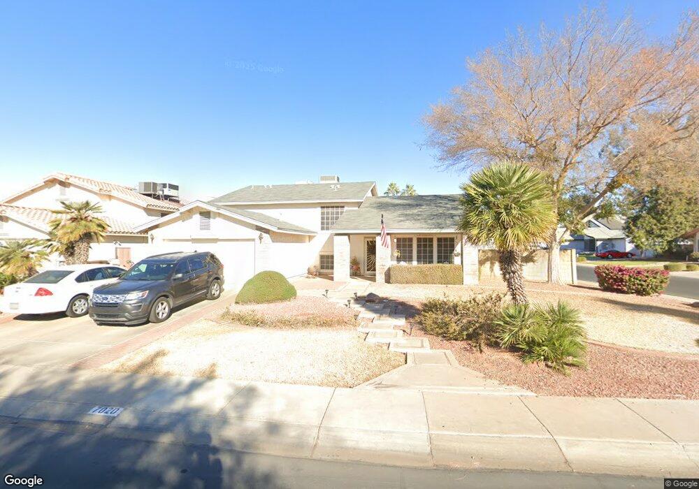
7020 W Columbine Dr Peoria, AZ 85381
Estimated Value: $493,106 - $604,000
5
Beds
3
Baths
2,835
Sq Ft
$201/Sq Ft
Est. Value
About This Home
This home is located at 7020 W Columbine Dr, Peoria, AZ 85381 and is currently estimated at $568,777, approximately $200 per square foot. 7020 W Columbine Dr is a home located in Maricopa County with nearby schools including Oakwood Elementary School, Cactus High School, and Legacy Traditional School - Glendale.
Ownership History
Date
Name
Owned For
Owner Type
Purchase Details
Closed on
Feb 26, 2004
Sold by
Campbell Madison and Campbell Elois J
Bought by
Dusing Ronald L and Dusing Lori G
Current Estimated Value
Home Financials for this Owner
Home Financials are based on the most recent Mortgage that was taken out on this home.
Original Mortgage
$180,000
Outstanding Balance
$83,829
Interest Rate
5.62%
Mortgage Type
Purchase Money Mortgage
Estimated Equity
$484,948
Purchase Details
Closed on
Apr 25, 2002
Sold by
Maas Karl F and Maas Patricia A
Bought by
Campbell Madison and Campbell Elois J
Home Financials for this Owner
Home Financials are based on the most recent Mortgage that was taken out on this home.
Original Mortgage
$216,300
Interest Rate
7.13%
Mortgage Type
VA
Purchase Details
Closed on
Jun 27, 2000
Sold by
Maas Karl F and Maas Patricia A
Bought by
Maas Karl F and Maas Patricia A
Create a Home Valuation Report for This Property
The Home Valuation Report is an in-depth analysis detailing your home's value as well as a comparison with similar homes in the area
Home Values in the Area
Average Home Value in this Area
Purchase History
| Date | Buyer | Sale Price | Title Company |
|---|---|---|---|
| Dusing Ronald L | $225,000 | Land Title Agency Of Az Inc | |
| Campbell Madison | $210,000 | Security Title Agency | |
| Maas Karl F | -- | -- |
Source: Public Records
Mortgage History
| Date | Status | Borrower | Loan Amount |
|---|---|---|---|
| Open | Dusing Ronald L | $180,000 | |
| Previous Owner | Campbell Madison | $216,300 |
Source: Public Records
Tax History Compared to Growth
Tax History
| Year | Tax Paid | Tax Assessment Tax Assessment Total Assessment is a certain percentage of the fair market value that is determined by local assessors to be the total taxable value of land and additions on the property. | Land | Improvement |
|---|---|---|---|---|
| 2025 | $1,745 | $23,047 | -- | -- |
| 2024 | $1,767 | $21,949 | -- | -- |
| 2023 | $1,767 | $37,630 | $7,520 | $30,110 |
| 2022 | $1,730 | $29,420 | $5,880 | $23,540 |
| 2021 | $1,852 | $26,750 | $5,350 | $21,400 |
| 2020 | $1,870 | $26,780 | $5,350 | $21,430 |
| 2019 | $1,809 | $23,810 | $4,760 | $19,050 |
| 2018 | $1,750 | $22,670 | $4,530 | $18,140 |
| 2017 | $1,750 | $21,520 | $4,300 | $17,220 |
| 2016 | $1,733 | $20,000 | $4,000 | $16,000 |
| 2015 | $1,617 | $19,960 | $3,990 | $15,970 |
Source: Public Records
Map
Nearby Homes
- 7126 W Columbine Dr
- 7214 W Columbine Dr
- 12709 N 72nd Ave
- 6845 W Charter Oak Rd
- 7220 W Larkspur Dr
- 6849 W Wethersfield Rd
- 7233 W Corrine Dr
- 6749 W Charter Oak Rd
- 6746 W Wethersfield Rd
- 6763 W Wethersfield Rd
- 6739 W Cactus Rd
- 7191 W Surrey Ave
- 6914 W Sunnyside Dr Unit 3
- 7301 W Sweetwater Ave
- 7157 W Cherry Hills Dr
- 6821 W Cherry Hills Dr
- 7113 W Sunnyside Dr
- 6938 W Jenan Dr
- 7266 W Cherry Hills Dr
- 7418 W Corrine Dr
- 7026 W Columbine Dr
- 7027 W Corrine Dr
- 12515 N 70th Dr
- 7021 W Columbine Dr
- 7032 W Columbine Dr
- 7015 W Columbine Dr
- 7035 W Corrine Dr
- 7035 W Corrine Dr
- 7027 W Columbine Dr
- 12525 N 70th Dr
- 7009 W Columbine Dr
- 7003 W Columbine Dr
- 12480 N 70th Ln
- 7043 W Corrine Dr
- 7020 W Bloomfield Rd
- 6946 W Columbine Dr
- 7014 W Bloomfield Rd
- 12470 N 70th Ln
- 7026 W Bloomfield Rd
- 7008 W Bloomfield Rd