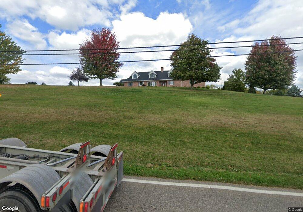
70200 Hayes Ln Bridgeport, OH 43912
Estimated Value: $495,000 - $595,586
4
Beds
4
Baths
4,906
Sq Ft
$111/Sq Ft
Est. Value
About This Home
This home is located at 70200 Hayes Ln, Bridgeport, OH 43912 and is currently estimated at $542,862, approximately $110 per square foot. 70200 Hayes Ln is a home with nearby schools including Bridgeport Elementary School, Bridgeport Middle School, and Bridgeport High School.
Ownership History
Date
Name
Owned For
Owner Type
Purchase Details
Closed on
Jul 27, 2022
Sold by
Knight Thomas J and Knight Marianne
Bought by
Macs Realty Llc
Current Estimated Value
Purchase Details
Closed on
Apr 28, 2014
Sold by
Knight Thomas J and Knight Marianne
Bought by
Knight Thomas J and Knight Marianne
Purchase Details
Closed on
Jul 15, 1993
Sold by
Knight Thomas J and Knight Mariann
Bought by
Knight Thomas J and Knight Mariann
Purchase Details
Closed on
Jan 1, 1986
Sold by
Hayes Eva J
Bought by
Hayes Eva J
Create a Home Valuation Report for This Property
The Home Valuation Report is an in-depth analysis detailing your home's value as well as a comparison with similar homes in the area
Home Values in the Area
Average Home Value in this Area
Purchase History
| Date | Buyer | Sale Price | Title Company |
|---|---|---|---|
| Macs Realty Llc | $465,000 | Spilman Thomas & Battle Pllc | |
| Knight Thomas J | -- | Attorney | |
| Knight Thomas J | $100,000 | -- | |
| Hayes Eva J | -- | -- |
Source: Public Records
Tax History Compared to Growth
Tax History
| Year | Tax Paid | Tax Assessment Tax Assessment Total Assessment is a certain percentage of the fair market value that is determined by local assessors to be the total taxable value of land and additions on the property. | Land | Improvement |
|---|---|---|---|---|
| 2024 | $6,960 | $188,500 | $24,760 | $163,740 |
| 2023 | $6,250 | $155,610 | $28,450 | $127,160 |
| 2022 | $6,141 | $155,607 | $28,452 | $127,155 |
| 2021 | $6,366 | $162,110 | $34,164 | $127,946 |
| 2020 | $5,682 | $135,090 | $28,470 | $106,620 |
| 2019 | $5,677 | $135,090 | $28,470 | $106,620 |
| 2018 | $6,556 | $135,090 | $28,470 | $106,620 |
| 2017 | $7,313 | $164,570 | $37,240 | $127,330 |
| 2016 | $7,315 | $164,570 | $37,240 | $127,330 |
| 2015 | $7,285 | $164,570 | $37,240 | $127,330 |
| 2014 | $6,853 | $157,790 | $30,460 | $127,330 |
| 2013 | $4,894 | $116,700 | $5,300 | $111,400 |
Source: Public Records
Map
Nearby Homes
- 69895 Woods Rd
- 56745 Ferryview Rd
- 70540 Colerain Rd
- 69282 Zelda Ave
- 69341 Old Cadiz Rd
- 57365 Washington Blvd
- 0 Ferryview Rd
- 55273 Poplar Ave
- 68511 Liston Ave
- 54980 Maple Ave
- 17 Sunset Dr
- 19 Sunset Dr
- 1836 Colerain Pike
- 16 Patterson Rd
- 70798 Lollini Rd
- 70610 Chermont Rd
- 16 Hillcrest Dr
- 69657 Chermont Rd
- 20 Locust Ave
- 68960 Pine Terrace Rd
- 70082 Sunset Heights
- 70112 Sunset Heights
- 70072 Sunset Heights
- 70139 Sunset Heights
- 70110 Sunset Heights
- 70170 Sunset Heights
- 70175 Sunset Heights
- 70180 Sunset Heights
- 72050 St Rt 250
- 72100 St Rt 250
- 70021 Sunset Heights
- 70182 Sunset Heights
- 70015 Sunset Heights
- 70012 Sunset Heights
- 70211 Sunset Heights
- 69879 Sunset Heights
- 69871 Sunset Heights
- 70033 Woods Rd
- 70023 Woods Rd
- 69995 Woods Rd