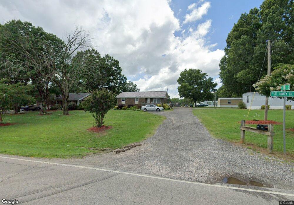
7021 Unity Church Rd Kannapolis, NC 28081
Estimated Value: $564,674 - $644,000
21
Beds
2
Baths
1,515
Sq Ft
$399/Sq Ft
Est. Value
About This Home
This home is located at 7021 Unity Church Rd, Kannapolis, NC 28081 and is currently estimated at $604,558, approximately $399 per square foot. 7021 Unity Church Rd is a home located in Rowan County with nearby schools including Millbridge Elementary School, Corriher Lipe Middle School, and South Rowan High School.
Ownership History
Date
Name
Owned For
Owner Type
Purchase Details
Closed on
Apr 15, 2010
Sold by
Roberts John
Bought by
King Danny Steven and King Karen Payne
Current Estimated Value
Home Financials for this Owner
Home Financials are based on the most recent Mortgage that was taken out on this home.
Original Mortgage
$325,000
Outstanding Balance
$41,033
Interest Rate
4.97%
Mortgage Type
Seller Take Back
Estimated Equity
$563,525
Create a Home Valuation Report for This Property
The Home Valuation Report is an in-depth analysis detailing your home's value as well as a comparison with similar homes in the area
Home Values in the Area
Average Home Value in this Area
Purchase History
| Date | Buyer | Sale Price | Title Company |
|---|---|---|---|
| King Danny Steven | $325,000 | None Available |
Source: Public Records
Mortgage History
| Date | Status | Borrower | Loan Amount |
|---|---|---|---|
| Open | King Danny Steven | $325,000 |
Source: Public Records
Tax History Compared to Growth
Tax History
| Year | Tax Paid | Tax Assessment Tax Assessment Total Assessment is a certain percentage of the fair market value that is determined by local assessors to be the total taxable value of land and additions on the property. | Land | Improvement |
|---|---|---|---|---|
| 2025 | $3,226 | $476,230 | $143,693 | $332,537 |
| 2024 | $3,226 | $476,230 | $143,693 | $332,537 |
| 2023 | $3,226 | $476,230 | $143,693 | $332,537 |
| 2022 | $2,797 | $370,507 | $121,034 | $249,473 |
| 2021 | $2,723 | $370,507 | $121,034 | $249,473 |
| 2020 | $2,723 | $370,507 | $121,034 | $249,473 |
| 2019 | $2,723 | $370,507 | $121,034 | $249,473 |
| 2018 | $2,413 | $331,031 | $105,033 | $225,998 |
| 2017 | $2,413 | $331,031 | $105,033 | $225,998 |
| 2016 | $2,706 | $331,031 | $105,033 | $225,998 |
| 2015 | $2,868 | $331,031 | $105,033 | $225,998 |
| 2014 | $2,371 | $282,816 | $83,205 | $199,611 |
Source: Public Records
Map
Nearby Homes
- 8282 Park Edwards Rd
- 260 Westen Acres Dr
- 6761 Fox Ridge Cir
- 860 Arrow Point Ln
- 0 Dogwood Dr
- 6489 Enochville Cir
- 0 Texas Place
- 6327 Fox Tail Ln
- 5850 Alexander Rd
- 1071 Reba Ln
- 145 Nathaniel Ln
- 1132 Reba Ln
- 0 Reba Ln Unit 12
- 256 Caleb Dr
- 634 Patterson Farm Rd
- 7740 Freeze Rd
- 7785 Crestwood Dr
- 632 Patterson Farm Rd
- 638 Patterson Farm Rd
- 10600 Archer Rd
- 6955 Unity Church Rd
- 7125 Unity Church Rd
- 7088 Unity Church Rd
- 162 Pete's Pond Rd
- 205 Cedar Brook Dr
- 111 Cedar Brook Dr
- 8475 Sunset End Ln
- 6851 Unity Church Rd
- 8480 Sunset End Ln
- 6840 Unity Church Rd
- 119 Cedar Brook Dr
- 213 Cedar Brook Dr
- 221 Cedar Brook Dr
- 198 Petes Pond Rd
- 198 Petes Pond Rd
- 7150 Unity Church Rd
- 112 Cedar Brook Dr
- 6830 Unity Church Rd
- 120 Cedar Brook Dr
- 00 Unity Church Rd