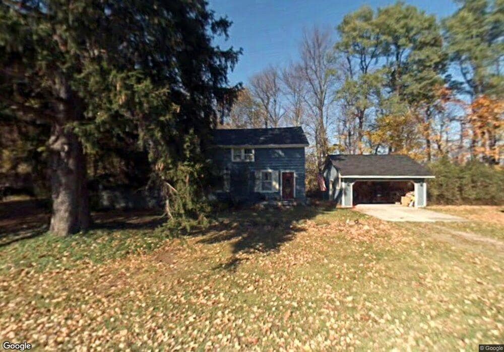
7022 Phillips Rd Clyde, MI 48049
Ruby NeighborhoodEstimated Value: $235,013 - $328,000
4
Beds
2
Baths
1,667
Sq Ft
$168/Sq Ft
Est. Value
About This Home
This home is located at 7022 Phillips Rd, Clyde, MI 48049 and is currently estimated at $280,753, approximately $168 per square foot. 7022 Phillips Rd is a home located in St. Clair County with nearby schools including Yale Senior High School.
Ownership History
Date
Name
Owned For
Owner Type
Purchase Details
Closed on
Dec 4, 2019
Sold by
Clark Michael Robert and Jowett Heather Ann
Bought by
Clark Michael Robert
Current Estimated Value
Purchase Details
Closed on
Dec 27, 2012
Sold by
Jowett Marshall W and Jowett Elizabeth
Bought by
Clark Michael Robert and Jowett Heather Ann
Purchase Details
Closed on
Sep 25, 2009
Sold by
Jowett Marshall and Lepla Miki
Bought by
Jowett Marshall W and Jowett Elizabeth D
Purchase Details
Closed on
Sep 28, 2000
Sold by
Jowett Wayne R and Jowett Elizabeth
Bought by
Jowett Wayne R and Jowett Marshall
Create a Home Valuation Report for This Property
The Home Valuation Report is an in-depth analysis detailing your home's value as well as a comparison with similar homes in the area
Home Values in the Area
Average Home Value in this Area
Purchase History
| Date | Buyer | Sale Price | Title Company |
|---|---|---|---|
| Clark Michael Robert | -- | None Available | |
| Clark Michael Robert | -- | Maritime Title Agency Llc | |
| Jowett Marshall W | -- | Maritime Title Agency Llc | |
| Jowett Wayne R | -- | None Available |
Source: Public Records
Tax History
| Year | Tax Paid | Tax Assessment Tax Assessment Total Assessment is a certain percentage of the fair market value that is determined by local assessors to be the total taxable value of land and additions on the property. | Land | Improvement |
|---|---|---|---|---|
| 2025 | $704 | $83,300 | $0 | $0 |
| 2024 | $683 | $77,400 | $0 | $0 |
| 2023 | $650 | $71,100 | $0 | $0 |
| 2022 | $1,501 | $64,000 | $0 | $0 |
| 2020 | $1,355 | $59,100 | $10,200 | $48,900 |
| 2019 | $1,324 | $56,400 | $0 | $0 |
| 2018 | $1,304 | $55,100 | $0 | $0 |
| 2017 | $1,289 | $52,600 | $0 | $0 |
| 2016 | $551 | $52,600 | $0 | $0 |
| 2015 | -- | $48,000 | $8,100 | $39,900 |
| 2014 | -- | $48,200 | $16,600 | $31,600 |
| 2013 | -- | $47,500 | $0 | $0 |
Source: Public Records
Map
Nearby Homes
- 7187 Phillips Rd
- 7241 Bryce Rd
- 0 Metcalf Rd Unit 20250029560
- 5426 Wildcat Rd
- 7560 Metcalf Rd
- 3766 Abbottsford Rd
- 6318 Rynn Rd
- 7669 Rynn Rd
- 3309 Rabidue Rd
- 0000 Conrad Dr
- 6433 Norman Rd
- 6550 Lapeer Rd
- 000 Metcalf Rd
- 00 Metcalf Rd
- 8860 Bryce Rd
- 3975 Wadhams Rd
- 7677 Hewitt Rd
- 00000 Lapeer Rd
- I-69 vac Taylor Dr
- 3947 Kilgore Rd
- 7078 Phillips Rd
- 4899 Rabidue Rd
- 6991 Phillips Rd
- 7082 Phillips Rd
- 7077 Phillips Rd
- 7099 Phillips Rd
- 7081 Phillips Rd
- 7090 Phillips Rd
- 6975 Phillips Rd
- 6975 Phillips Rd
- 4894 Rabidue Rd
- 6965 Phillips Rd
- 6960 Phillips Rd
- 6955 Phillips Rd
- 7093 Phillips Rd
- 7102 Phillips Rd
- 4878 Rabidue Rd
- 4878 Rabidue Rd
- 7097 Phillips Rd
- 4854 Rabidue Rd
Your Personal Tour Guide
Ask me questions while you tour the home.