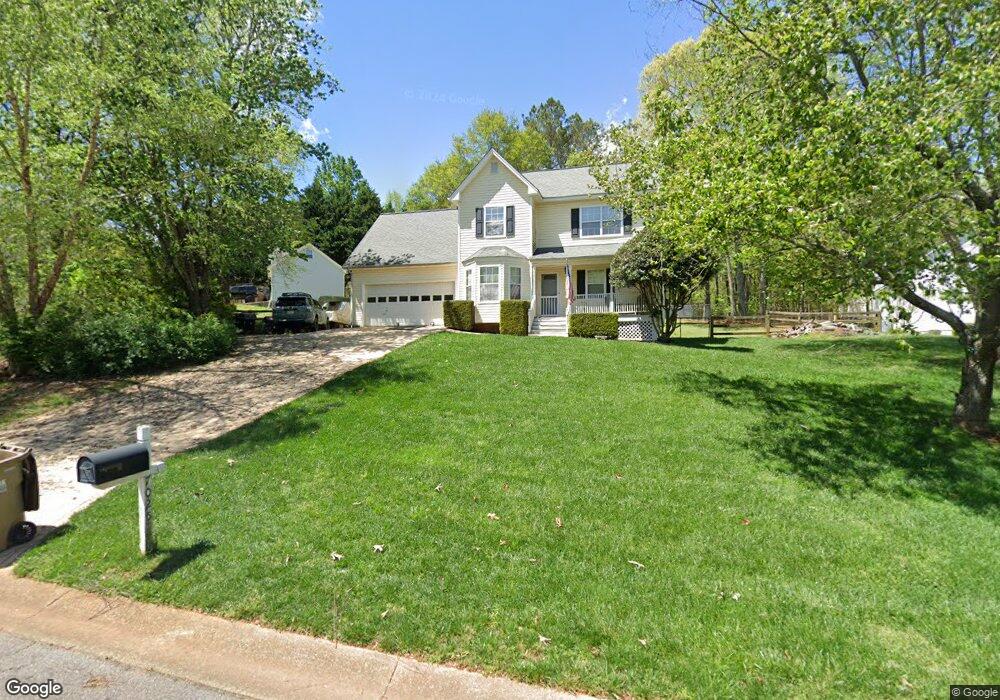
7025 Wessex Way Cumming, GA 30028
Estimated Value: $368,811 - $415,000
3
Beds
3
Baths
1,388
Sq Ft
$280/Sq Ft
Est. Value
About This Home
This home is located at 7025 Wessex Way, Cumming, GA 30028 and is currently estimated at $389,203, approximately $280 per square foot. 7025 Wessex Way is a home located in Forsyth County with nearby schools including Silver City Elementary School, North Forsyth Middle School, and North Forsyth High School.
Ownership History
Date
Name
Owned For
Owner Type
Purchase Details
Closed on
Mar 7, 2005
Sold by
Kundrat Paul I Deborah L
Bought by
Kundrat David C and Kundrat Nikki
Current Estimated Value
Home Financials for this Owner
Home Financials are based on the most recent Mortgage that was taken out on this home.
Original Mortgage
$124,000
Interest Rate
5.5%
Mortgage Type
New Conventional
Purchase Details
Closed on
Apr 12, 1996
Sold by
Countryside Homes Inc
Bought by
Kundrat Paul J Debra L
Create a Home Valuation Report for This Property
The Home Valuation Report is an in-depth analysis detailing your home's value as well as a comparison with similar homes in the area
Home Values in the Area
Average Home Value in this Area
Purchase History
| Date | Buyer | Sale Price | Title Company |
|---|---|---|---|
| Kundrat David C | -- | -- | |
| Kundrat Paul J Debra L | $103,000 | -- |
Source: Public Records
Mortgage History
| Date | Status | Borrower | Loan Amount |
|---|---|---|---|
| Previous Owner | Kundrat David C | $124,000 | |
| Closed | Kundrat Paul J Debra L | $0 |
Source: Public Records
Tax History Compared to Growth
Tax History
| Year | Tax Paid | Tax Assessment Tax Assessment Total Assessment is a certain percentage of the fair market value that is determined by local assessors to be the total taxable value of land and additions on the property. | Land | Improvement |
|---|---|---|---|---|
| 2025 | $2,975 | $125,652 | $36,000 | $89,652 |
| 2024 | $2,975 | $121,300 | $34,000 | $87,300 |
| 2023 | $2,927 | $118,904 | $26,000 | $92,904 |
| 2022 | $2,537 | $74,156 | $16,000 | $58,156 |
| 2021 | $2,048 | $74,156 | $16,000 | $58,156 |
| 2020 | $1,890 | $68,452 | $16,000 | $52,452 |
| 2019 | $1,812 | $65,508 | $16,000 | $49,508 |
| 2018 | $1,639 | $59,284 | $16,000 | $43,284 |
| 2017 | $1,518 | $54,692 | $16,000 | $38,692 |
| 2016 | $1,357 | $48,892 | $12,000 | $36,892 |
| 2015 | $1,359 | $48,892 | $12,000 | $36,892 |
| 2014 | $1,213 | $45,832 | $0 | $0 |
Source: Public Records
Map
Nearby Homes
- 7010 Devon Dr
- 7030 Wessex Way
- 7030 Devon Dr
- 7040 Wessex Way
- 7040 Devon Dr
- 7155 Bannister Park Ln
- 6330 Talking Tree Ct
- 6535 Riley Rd
- 6545 Riley Rd
- 0 Bannister Unit 27.55 ACRES 10274598
- 0 Concord Rd Unit 10483290
- 6910 Concord Brook Ln
- 6380 Concord Rd
- 8020 Estee Dr
- 7055 Concord Brook Ln
- 7840 Silversmith Ct
- 6245 Bannister Rd
- 6660 Wallace Farms Dr
- 5940 Violet Ln
- 7045 Wessex Way
- 7005 Wessex Way
- 0 Wessex Way
- 7055 Wessex Way
- 6915 Devon Dr
- 0 Devon Dr Unit 7136226
- 0 Devon Dr Unit 8758302
- 0 Devon Dr Unit 8746727
- 0 Devon Dr Unit 8283814
- 0 Devon Dr Unit 7269133
- 0 Devon Dr Unit 7042919
- 7015 Devon Dr
- 7015 Devon Dr Unit 21
- 7020 Wessex Way
- 6885 Bannister Park Ln
- 6875 Bannister Park Ln
- 7050 Wessex Way
- 7060 Wessex Way
- 6920 Devon Dr
- 7025 Devon Dr