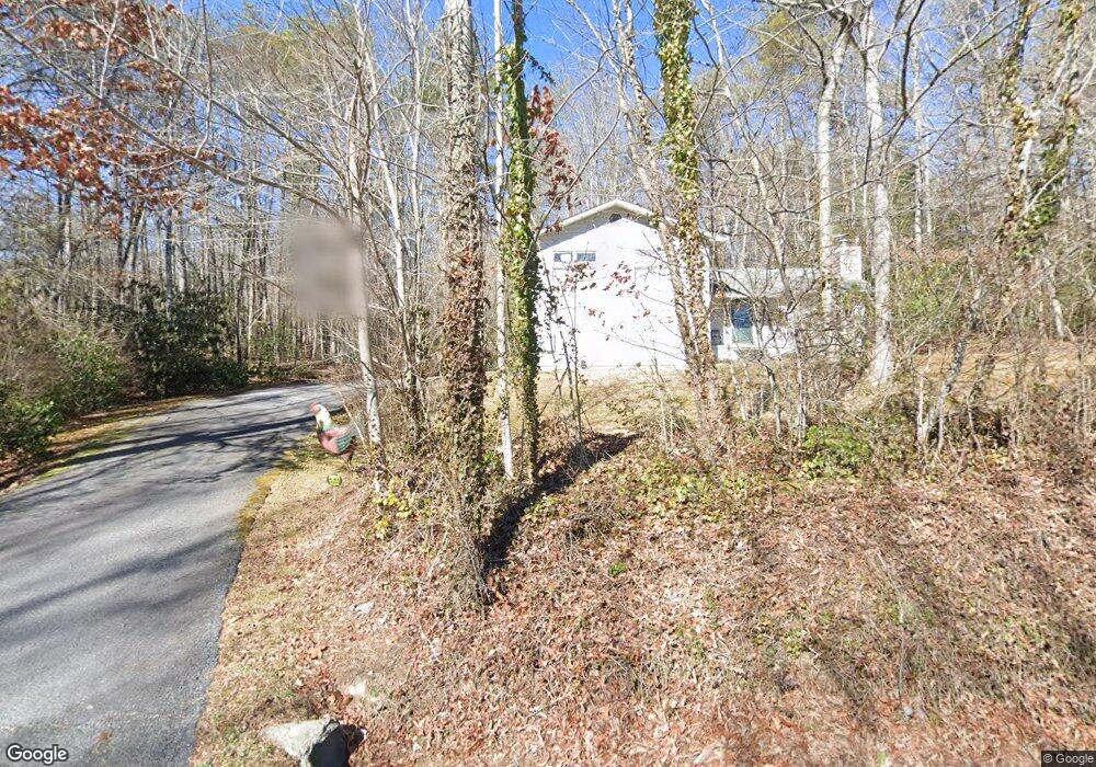
7025 Wolffork Rd Rabun Gap, GA 30568
Estimated Value: $290,079 - $443,000
3
Beds
2
Baths
2,000
Sq Ft
$191/Sq Ft
Est. Value
About This Home
This home is located at 7025 Wolffork Rd, Rabun Gap, GA 30568 and is currently estimated at $381,520, approximately $190 per square foot. 7025 Wolffork Rd is a home located in Rabun County with nearby schools including Rabun County Primary School, Rabun County High School, and Rabun Gap Nacoochee School.
Ownership History
Date
Name
Owned For
Owner Type
Purchase Details
Closed on
May 1, 2001
Current Estimated Value
Purchase Details
Closed on
Jul 1, 1993
Bought by
Thurmond Stephen Robert
Purchase Details
Closed on
Jan 1, 1991
Purchase Details
Closed on
Apr 1, 1989
Purchase Details
Closed on
Nov 1, 1980
Create a Home Valuation Report for This Property
The Home Valuation Report is an in-depth analysis detailing your home's value as well as a comparison with similar homes in the area
Home Values in the Area
Average Home Value in this Area
Purchase History
| Date | Buyer | Sale Price | Title Company |
|---|---|---|---|
| -- | -- | -- | |
| -- | -- | -- | |
| Thurmond Stephen Robert | $88,000 | -- | |
| Thurmond Stephen Robert | $88,000 | -- | |
| -- | $83,500 | -- | |
| -- | $83,500 | -- | |
| -- | $72,000 | -- | |
| -- | $72,000 | -- | |
| -- | $39,300 | -- | |
| -- | $39,300 | -- |
Source: Public Records
Tax History Compared to Growth
Tax History
| Year | Tax Paid | Tax Assessment Tax Assessment Total Assessment is a certain percentage of the fair market value that is determined by local assessors to be the total taxable value of land and additions on the property. | Land | Improvement |
|---|---|---|---|---|
| 2025 | $1,259 | $82,936 | $12,000 | $70,936 |
| 2024 | $1,225 | $78,293 | $12,000 | $66,293 |
| 2023 | $1,257 | $70,668 | $12,000 | $58,668 |
| 2022 | $1,216 | $68,460 | $12,000 | $56,460 |
| 2021 | $1,112 | $61,330 | $12,000 | $49,330 |
| 2020 | $1,032 | $55,199 | $12,000 | $43,199 |
| 2019 | $1,039 | $55,199 | $12,000 | $43,199 |
| 2018 | $1,043 | $55,199 | $12,000 | $43,199 |
| 2017 | $1,000 | $55,199 | $12,000 | $43,199 |
| 2016 | $973 | $53,592 | $12,000 | $41,592 |
| 2015 | $994 | $53,592 | $12,000 | $41,592 |
| 2014 | $999 | $53,592 | $12,000 | $41,592 |
Source: Public Records
Map
Nearby Homes
- 137 Olds Mountain Peak Rd
- 243 Degroff Ln
- 0 John Beck Dockins Rd Unit 10606531
- 786 Hope Haven Ln
- 1422 Wolffork Rd
- 0 Uplander Unit 10628218
- 0 Uplander Unit M181832
- 153 Coleman Heights Ln
- 5192 Wolffork Rd
- 52 Lucky Ln
- 0 Wolffork Rd Unit 10624471
- 0 Ov Justus Rd
- 0 N U S 441 NW Unit 10489249
- 784 Wolffork Church Rd
- 0 Us-441 S Unit 10226435
- 0 Stella Ln Unit 10485082
- 208 Colony Rd
- 108 Olds Mountain Peak Rd
- 476 Franklin St
- 5019 Wolffork Rd
- 69 Cathy Parker Ln
- 20 Bob Mark Trail
- 6959 Wolffork Rd
- 77 Cathy Parker Ln
- 2 Cathy Parker Ln
- 30 Cathy Parker Ln
- 74 Cathy Parker Ln
- 7165 Wolffork Rd
- 85 Sandy Ln
- 911 Bob Mark Trail
- 150 Cathy Parker Ln
- 1311 John Beck Dockins Rd
- 0 Betty's Creek Rd Unit 8438970
- 0 Wolffork Church Rd NW Unit TR2 8347982
- 0 Shake Hollow Rd Unit Lot 215 8389666
- 0 Shake Hollow Rd Unit Lot 213 8389415
- 0 Shake Hollow Rd Unit Lot 212 8389357
- 0 Penson View Ln Unit 8285621
- 216 Shake Hollow Unit 216
- 223 Shake Hollow Rd