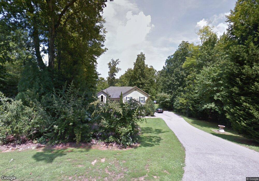
7027 Calais Dr Durham, NC 27712
Estimated Value: $398,000 - $505,000
3
Beds
3
Baths
2,429
Sq Ft
$186/Sq Ft
Est. Value
About This Home
This home is located at 7027 Calais Dr, Durham, NC 27712 and is currently estimated at $452,794, approximately $186 per square foot. 7027 Calais Dr is a home located in Durham County with nearby schools including Eno Valley Elementary, George L Carrington Middle, and Northern High School.
Ownership History
Date
Name
Owned For
Owner Type
Purchase Details
Closed on
Nov 12, 2020
Sold by
Walsh Kim Honeycutt
Bought by
Walsh Dennis J and Walsh Aimee E
Current Estimated Value
Home Financials for this Owner
Home Financials are based on the most recent Mortgage that was taken out on this home.
Original Mortgage
$225,000
Outstanding Balance
$200,218
Interest Rate
2.8%
Mortgage Type
New Conventional
Estimated Equity
$252,576
Create a Home Valuation Report for This Property
The Home Valuation Report is an in-depth analysis detailing your home's value as well as a comparison with similar homes in the area
Home Values in the Area
Average Home Value in this Area
Purchase History
| Date | Buyer | Sale Price | Title Company |
|---|---|---|---|
| Walsh Dennis J | $250,000 | None Available |
Source: Public Records
Mortgage History
| Date | Status | Borrower | Loan Amount |
|---|---|---|---|
| Open | Walsh Dennis J | $225,000 |
Source: Public Records
Tax History Compared to Growth
Tax History
| Year | Tax Paid | Tax Assessment Tax Assessment Total Assessment is a certain percentage of the fair market value that is determined by local assessors to be the total taxable value of land and additions on the property. | Land | Improvement |
|---|---|---|---|---|
| 2025 | $3,064 | $431,294 | $92,625 | $338,669 |
| 2024 | $2,589 | $253,247 | $34,037 | $219,210 |
| 2023 | $2,455 | $253,247 | $34,037 | $219,210 |
| 2022 | $2,359 | $253,247 | $34,037 | $219,210 |
| 2021 | $2,146 | $253,247 | $34,037 | $219,210 |
| 2020 | $2,101 | $250,434 | $34,037 | $216,397 |
| 2019 | $2,078 | $250,434 | $34,037 | $216,397 |
| 2018 | $2,057 | $230,261 | $38,880 | $191,381 |
| 2017 | $2,034 | $230,261 | $38,880 | $191,381 |
| 2016 | $1,948 | $230,261 | $38,880 | $191,381 |
| 2015 | $2,599 | $273,477 | $29,638 | $243,839 |
| 2014 | $2,599 | $273,477 | $29,638 | $243,839 |
Source: Public Records
Map
Nearby Homes
- 0 Russell Rd
- 1683 Terry Rd
- 1680 Terry Rd
- 5803 Lillie Dr
- 2712 Red Pine Rd
- 2423 Bivins Rd
- 1108 Prominence Dr
- 1112 Prominence Dr
- 1116 Prominence Dr
- 1109 Prominence Dr
- 2417 Bivins Rd
- 113 Laurston Ct
- Watauga Plan at The View
- Clark Plan at The View
- Winston Plan at The View
- McKimmon Plan at The View
- Brooks Plan at The View
- Nelson Plan at The View
- Azalea American Farmhouse Plan at The View
- Fairfield Craftsman Plan at The View
- 7031 Calais Dr
- 7023 Calais Dr
- 7035 Calais Dr
- 7019 Calais Dr
- 7024 Calais Dr
- 7039 Calais Dr
- 7020 Calais Dr
- 7040 Calais Dr
- 7043 Calais Dr
- 7004 Calais Dr
- 7044 Calais Dr
- 6928 Calais Dr
- 6901 Russell Rd
- 7049 Calais Dr
- 7050 Calais Dr
- 2606 Sherbrook Dr
- 7003 Calais Dr
- 6906 Calais Dr
- 2602 Sherbrook Dr
- 2602 Sherbrooke Dr