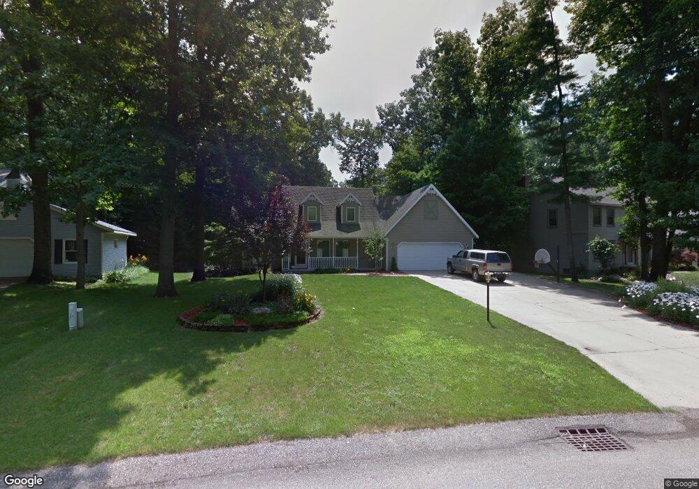
7028 Gettysburg Dr Hudsonville, MI 49426
Estimated Value: $418,841 - $474,000
4
Beds
3
Baths
1,992
Sq Ft
$225/Sq Ft
Est. Value
About This Home
This home is located at 7028 Gettysburg Dr, Hudsonville, MI 49426 and is currently estimated at $448,460, approximately $225 per square foot. 7028 Gettysburg Dr is a home located in Ottawa County with nearby schools including Bauer Elementary School, Baldwin Street Middle School, and Hudsonville Freshman Campus.
Ownership History
Date
Name
Owned For
Owner Type
Purchase Details
Closed on
Jan 4, 2024
Sold by
Langeland Scott A
Bought by
Langeland Susan L
Current Estimated Value
Purchase Details
Closed on
Oct 9, 2008
Sold by
Kraker David N and Kraker Sharon S
Bought by
Langeland Scott A and Langeland Susan L
Home Financials for this Owner
Home Financials are based on the most recent Mortgage that was taken out on this home.
Original Mortgage
$178,200
Interest Rate
5.73%
Mortgage Type
Purchase Money Mortgage
Create a Home Valuation Report for This Property
The Home Valuation Report is an in-depth analysis detailing your home's value as well as a comparison with similar homes in the area
Home Values in the Area
Average Home Value in this Area
Purchase History
| Date | Buyer | Sale Price | Title Company |
|---|---|---|---|
| Langeland Susan L | -- | None Listed On Document | |
| Langeland Scott A | $198,000 | Chicago Title |
Source: Public Records
Mortgage History
| Date | Status | Borrower | Loan Amount |
|---|---|---|---|
| Previous Owner | Langeland Scott A | $178,200 |
Source: Public Records
Tax History Compared to Growth
Tax History
| Year | Tax Paid | Tax Assessment Tax Assessment Total Assessment is a certain percentage of the fair market value that is determined by local assessors to be the total taxable value of land and additions on the property. | Land | Improvement |
|---|---|---|---|---|
| 2025 | $3,087 | $172,600 | $0 | $0 |
| 2024 | $2,671 | $171,000 | $0 | $0 |
| 2023 | $2,551 | $164,200 | $0 | $0 |
| 2022 | $2,825 | $153,100 | $0 | $0 |
| 2021 | $2,744 | $133,800 | $0 | $0 |
| 2020 | $2,716 | $124,400 | $0 | $0 |
| 2019 | $2,720 | $116,400 | $0 | $0 |
| 2018 | $2,535 | $110,300 | $0 | $0 |
| 2017 | $2,489 | $108,900 | $0 | $0 |
| 2016 | $2,475 | $102,800 | $0 | $0 |
| 2015 | $2,362 | $99,700 | $0 | $0 |
| 2014 | $2,362 | $92,600 | $0 | $0 |
Source: Public Records
Map
Nearby Homes
- 6863 Bridgeport Dr
- 6950 Meadowcreek Dr
- 6821 Bridgeport Dr
- 4101 Blair St
- 4106 Blair St
- 7068 Jasper Dr
- 4087 Baldwin St
- 0 Baldwin St
- 3617 Teton Dr
- 3646 Lenters Dr
- 3528 Tearose Dr
- 3808 Port Sheldon St
- 6584 Moss Lake Dr
- 6530 Van Dam Ave Unit 3
- 6561 Van Dam Ave
- 6500 Van Dam Ave Unit 1
- 6533 Moss Lake Dr
- 4663 Hidden Ridge Dr Unit lot 38
- 7918 Westside Dr
- 6207 Gemini Ct
- 7038 Gettysburg Dr
- 7012 Gettysburg Dr
- 7048 Gettysburg Dr
- 7043 Gettysburg Dr
- 4357 Gettysburg Ct
- 7009 Williamstown Dr
- 6990 Gettysburg Dr
- 7021 Williamstown Dr
- 7060 Gettysburg Dr
- 7063 Gettysburg Dr
- 6997 Williamstown Dr
- 4362 Gettysburg Ct
- 4273 Crestlane Dr
- 7033 Williamstown Dr
- 4365 Gettysburg Ct
- 6989 Gettysburg Dr
- 7072 Gettysburg Dr
- 7077 Gettysburg Dr
- 4261 Crestlane Dr
- 7045 Williamstown Dr