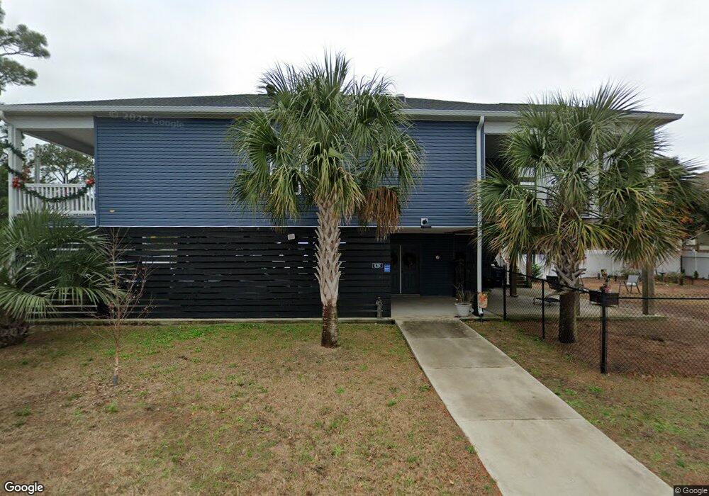
703 19th Ave S North Myrtle Beach, SC 29582
Crescent Beach NeighborhoodEstimated Value: $552,000 - $694,000
3
Beds
2
Baths
1,573
Sq Ft
$397/Sq Ft
Est. Value
About This Home
This home is located at 703 19th Ave S, North Myrtle Beach, SC 29582 and is currently estimated at $623,909, approximately $396 per square foot. 703 19th Ave S is a home located in Horry County with nearby schools including Ocean Drive Elementary School, North Myrtle Beach Middle School, and North Myrtle Beach High School.
Ownership History
Date
Name
Owned For
Owner Type
Purchase Details
Closed on
Oct 26, 2016
Sold by
Fuller Thomas E
Bought by
Fuller Thomas E and Fuller Mary J F
Current Estimated Value
Purchase Details
Closed on
Sep 2, 2014
Sold by
Fuller Thomas E
Bought by
Carter Donnie R and Carter Patrice B
Purchase Details
Closed on
Aug 9, 2006
Sold by
Fuller Mary Jo F
Bought by
Fuller Thomas E
Purchase Details
Closed on
Jun 3, 1999
Sold by
Lambeth Rodney L and Lambeth Donna C
Bought by
Fuller Thomas E and Fuller Mary Jo
Create a Home Valuation Report for This Property
The Home Valuation Report is an in-depth analysis detailing your home's value as well as a comparison with similar homes in the area
Home Values in the Area
Average Home Value in this Area
Purchase History
| Date | Buyer | Sale Price | Title Company |
|---|---|---|---|
| Fuller Thomas E | -- | -- | |
| Carter Donnie R | $72,500 | -- | |
| Fuller Thomas E | -- | None Available | |
| Fuller Thomas E | $38,000 | -- |
Source: Public Records
Tax History Compared to Growth
Tax History
| Year | Tax Paid | Tax Assessment Tax Assessment Total Assessment is a certain percentage of the fair market value that is determined by local assessors to be the total taxable value of land and additions on the property. | Land | Improvement |
|---|---|---|---|---|
| 2024 | $1,598 | $37,985 | $18,000 | $19,985 |
| 2023 | $1,598 | $12,975 | $3,635 | $9,340 |
| 2021 | $1,188 | $23,190 | $9,180 | $14,010 |
| 2020 | $1,372 | $23,190 | $9,180 | $14,010 |
| 2019 | $1,177 | $9,180 | $9,180 | $0 |
| 2018 | $0 | $4,741 | $4,741 | $0 |
| 2017 | $1,075 | $4,741 | $4,741 | $0 |
| 2016 | -- | $4,741 | $4,741 | $0 |
| 2015 | $1,066 | $4,742 | $4,742 | $0 |
| 2014 | $1,014 | $4,742 | $4,742 | $0 |
Source: Public Records
Map
Nearby Homes
- 1911 Madison Dr
- 1901 Highway 17 S
- 1909 Hwy 17 S
- 806 20th Ave S
- TBD Highway 17 S Unit .24 acres
- TBD Highway 17 S Unit next to Dick's Pawn
- 607 18th Ave S
- 505 19th Ave S
- 1807 Hillside Dr S
- 2010 Hillside Dr S
- 702 22nd Ave S
- 2005 Havens Dr
- 1621 Edge Dr Unit U14
- 2602 Holly Dr
- 1710 Holly Dr
- 511 22nd Ave S
- 1718 Perrin Dr
- 1706 Holly Dr
- 2012 Perrin Dr
- 405 21st Ave S Unit 2J
- 703 19th Ave S Unit Lot 14
- 1905 Madison Dr
- 1905 Madison Dr Unit Lot 11
- 1901 Madison Dr
- 1903 Madison Dr
- 1901 Madison Dr Unit D
- 1903 Madison Dr Unit Lot 12
- 1901 Madison Dr Unit C
- 1901 Madison Dr Unit B
- 1901 Madison Dr Unit 1901-B
- 1909 Madison Dr
- 1904 Edge Dr
- 705 19th Ave S
- 705 19th Ave S Unit Lot 15
- 1902 Edge Dr
- 1906 Edge Dr
- 1906 Edge Dr
- 1906 Edge Dr Unit A
- 1906 Edge Dr Unit C
- 1906 Edge Dr Unit B