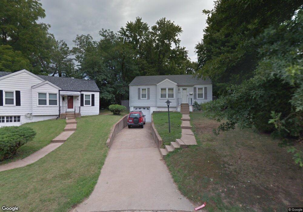
703 Denton Ct Saint Louis, MO 63126
Estimated Value: $218,629 - $271,000
2
Beds
1
Bath
873
Sq Ft
$278/Sq Ft
Est. Value
About This Home
This home is located at 703 Denton Ct, Saint Louis, MO 63126 and is currently estimated at $242,407, approximately $277 per square foot. 703 Denton Ct is a home located in St. Louis County with nearby schools including Crestwood Elementary School, Truman Middle School, and Lindbergh High School.
Ownership History
Date
Name
Owned For
Owner Type
Purchase Details
Closed on
Jun 27, 2000
Sold by
Akins Steven D
Bought by
Waller Patrick
Current Estimated Value
Home Financials for this Owner
Home Financials are based on the most recent Mortgage that was taken out on this home.
Original Mortgage
$75,360
Outstanding Balance
$27,399
Interest Rate
8.66%
Estimated Equity
$215,008
Purchase Details
Closed on
Apr 6, 1998
Sold by
Akins Sandra M
Bought by
Akins Steven D
Home Financials for this Owner
Home Financials are based on the most recent Mortgage that was taken out on this home.
Original Mortgage
$59,500
Interest Rate
7.04%
Create a Home Valuation Report for This Property
The Home Valuation Report is an in-depth analysis detailing your home's value as well as a comparison with similar homes in the area
Home Values in the Area
Average Home Value in this Area
Purchase History
| Date | Buyer | Sale Price | Title Company |
|---|---|---|---|
| Waller Patrick | $94,500 | -- | |
| Akins Steven D | -- | -- |
Source: Public Records
Mortgage History
| Date | Status | Borrower | Loan Amount |
|---|---|---|---|
| Open | Waller Patrick | $75,360 | |
| Previous Owner | Akins Steven D | $59,500 |
Source: Public Records
Tax History
| Year | Tax Paid | Tax Assessment Tax Assessment Total Assessment is a certain percentage of the fair market value that is determined by local assessors to be the total taxable value of land and additions on the property. | Land | Improvement |
|---|---|---|---|---|
| 2025 | $2,529 | $45,120 | $24,640 | $20,480 |
| 2024 | $2,529 | $36,260 | $15,850 | $20,410 |
| 2023 | $2,338 | $36,260 | $15,850 | $20,410 |
| 2022 | $2,379 | $32,870 | $17,590 | $15,280 |
| 2021 | $2,169 | $32,870 | $17,590 | $15,280 |
| 2020 | $2,085 | $30,460 | $15,850 | $14,610 |
| 2019 | $2,079 | $30,460 | $15,850 | $14,610 |
| 2018 | $1,743 | $23,090 | $8,950 | $14,140 |
| 2016 | $1,637 | $22,190 | $8,000 | $14,190 |
Source: Public Records
Map
Nearby Homes
- 614 Conover Ln
- 450 Forest Green Dr
- 689 Conover Ln
- 1024 Woodbine Dr
- 1048 Diversey Dr
- 904 Liggett Ave
- 14 Armin Ln
- 1139 Hawken Place Unit 6
- 1666 Crabapple Ln
- 649 S Sappington Rd
- 1412 Gardenia Dr
- 9 Holly Dr
- 51 Blackthorn Dr
- 0 Unknown Unit MIS25067424
- 0 Unknown Unit MIS25078799
- 0 Unknown Unit MIS26007827
- 1116 S Elm Ave
- 319 Baker Ave
- 1330 Drayton Ave
- 1323 Samoa Dr
Your Personal Tour Guide
Ask me questions while you tour the home.