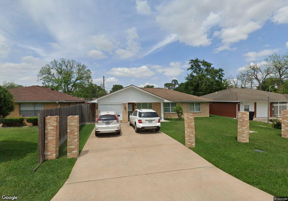
703 Innsdale Dr Houston, TX 77076
Northside-Northline NeighborhoodEstimated Value: $204,000 - $269,000
3
Beds
2
Baths
1,424
Sq Ft
$165/Sq Ft
Est. Value
About This Home
This home is located at 703 Innsdale Dr, Houston, TX 77076 and is currently estimated at $235,617, approximately $165 per square foot. 703 Innsdale Dr is a home located in Harris County with nearby schools including Lyons Elementary School, Burbank Middle School, and Sam Houston Math, Science & Technology Center.
Ownership History
Date
Name
Owned For
Owner Type
Purchase Details
Closed on
Oct 29, 1998
Sold by
Peterson Ruby
Bought by
Olvera Alfredo
Current Estimated Value
Home Financials for this Owner
Home Financials are based on the most recent Mortgage that was taken out on this home.
Original Mortgage
$66,500
Interest Rate
6.61%
Create a Home Valuation Report for This Property
The Home Valuation Report is an in-depth analysis detailing your home's value as well as a comparison with similar homes in the area
Home Values in the Area
Average Home Value in this Area
Purchase History
| Date | Buyer | Sale Price | Title Company |
|---|---|---|---|
| Olvera Alfredo | -- | Regency Title |
Source: Public Records
Mortgage History
| Date | Status | Borrower | Loan Amount |
|---|---|---|---|
| Closed | Olvera Alfredo | $66,500 |
Source: Public Records
Tax History Compared to Growth
Tax History
| Year | Tax Paid | Tax Assessment Tax Assessment Total Assessment is a certain percentage of the fair market value that is determined by local assessors to be the total taxable value of land and additions on the property. | Land | Improvement |
|---|---|---|---|---|
| 2025 | $3 | $237,050 | $72,923 | $164,127 |
| 2024 | $3 | $240,442 | $72,923 | $167,519 |
| 2023 | $3 | $240,442 | $72,923 | $167,519 |
| 2022 | $3,019 | $199,740 | $38,487 | $161,253 |
| 2021 | $2,906 | $147,397 | $38,487 | $108,910 |
| 2020 | $2,744 | $127,772 | $38,487 | $89,285 |
| 2019 | $2,607 | $127,772 | $38,487 | $89,285 |
| 2018 | $422 | $93,664 | $34,436 | $59,228 |
| 2017 | $2,368 | $93,664 | $34,436 | $59,228 |
| 2016 | $2,339 | $93,664 | $34,436 | $59,228 |
| 2015 | $1,458 | $84,108 | $24,308 | $59,800 |
| 2014 | $1,458 | $84,108 | $24,308 | $59,800 |
Source: Public Records
Map
Nearby Homes
- 415 Briarcliff Dr
- 283 Turner Dr
- 1105 Soren Ln
- 219 Heaney Dr
- 9907 Dipping Brook St
- 9905 Dipping Brook St
- 9920 Dipping Woods St
- 9916 Dipping Woods St
- 207 Dipping Stream St
- 9650 E Hardy Rd
- 9913 Dipping Woods St
- 9925 Dipping Woods St
- 9909 Dipping Woods St
- 702 Pennington St
- 202 Burbank St
- 9902 Clark Rd Unit D
- 9902 Clark Rd Unit I
- 9902 Clark Rd Unit G
- 318 Charlock St
- 9026 Mcgallion Rd
- 611 Innsdale Dr
- 707 Innsdale Dr
- 711 Innsdale Dr
- 715 Innsdale Dr
- 607 Innsdale Dr
- 702 Innsdale Dr
- 606 Innsdale Dr
- 706 Innsdale Dr
- 710 Innsdale Dr
- 0 Innsdale Dr
- 719 Innsdale Dr
- 714 Innsdale Dr
- 706 Turner Dr
- 706 Turner Dr Unit 1
- 706 Turner Dr Unit 3
- 817 Innsdale Dr
- 718 Innsdale Dr
- 815 Innsdale Dr
- 703 Dipping Ln
- 707 Dipping Ln