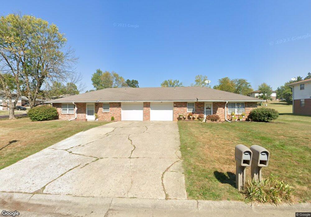
703 Pear Tree Cir Unit 705 Columbia, MO 65203
Cedar Lake NeighborhoodEstimated Value: $252,000 - $276,000
4
Beds
2
Baths
1,984
Sq Ft
$133/Sq Ft
Est. Value
About This Home
This home is located at 703 Pear Tree Cir Unit 705, Columbia, MO 65203 and is currently estimated at $264,557, approximately $133 per square foot. 703 Pear Tree Cir Unit 705 is a home located in Boone County with nearby schools including Mill Creek Elementary School, Ann Hawkins Gentry Middle School, and Rock Bridge High School.
Ownership History
Date
Name
Owned For
Owner Type
Purchase Details
Closed on
Dec 29, 2023
Sold by
Green Meadows Development Llc
Bought by
Black Fox Equity Llc
Current Estimated Value
Home Financials for this Owner
Home Financials are based on the most recent Mortgage that was taken out on this home.
Original Mortgage
$1,938,608
Outstanding Balance
$1,907,705
Interest Rate
7.44%
Mortgage Type
New Conventional
Estimated Equity
-$1,643,148
Purchase Details
Closed on
Nov 6, 2019
Sold by
Springer Gordon K and Hutt Susan L
Bought by
Green Meadows Development Llc
Purchase Details
Closed on
Mar 12, 2019
Sold by
Boone Sonja
Bought by
Springer Gordon K and Hutt Susan L
Create a Home Valuation Report for This Property
The Home Valuation Report is an in-depth analysis detailing your home's value as well as a comparison with similar homes in the area
Home Values in the Area
Average Home Value in this Area
Purchase History
| Date | Buyer | Sale Price | Title Company |
|---|---|---|---|
| Black Fox Equity Llc | -- | Boone Central Title | |
| Green Meadows Development Llc | -- | Boone Central Title Company | |
| Green Meadows Development Llc | -- | Boone Central Title Company | |
| Springer Gordon K | $67,000 | None Available |
Source: Public Records
Mortgage History
| Date | Status | Borrower | Loan Amount |
|---|---|---|---|
| Open | Black Fox Equity Llc | $1,938,608 |
Source: Public Records
Tax History Compared to Growth
Tax History
| Year | Tax Paid | Tax Assessment Tax Assessment Total Assessment is a certain percentage of the fair market value that is determined by local assessors to be the total taxable value of land and additions on the property. | Land | Improvement |
|---|---|---|---|---|
| 2025 | $1,519 | $23,199 | $4,237 | $18,962 |
| 2024 | $1,423 | $21,090 | $4,237 | $16,853 |
| 2023 | $1,411 | $21,090 | $4,237 | $16,853 |
| 2022 | $1,355 | $20,273 | $4,237 | $16,036 |
| 2021 | $1,357 | $20,273 | $4,237 | $16,036 |
| 2020 | $1,338 | $18,775 | $4,237 | $14,538 |
| 2019 | $1,338 | $18,775 | $4,237 | $14,538 |
| 2018 | $1,248 | $0 | $0 | $0 |
| 2017 | $1,230 | $17,385 | $4,237 | $13,148 |
| 2016 | $1,230 | $17,385 | $4,237 | $13,148 |
| 2015 | $1,130 | $17,385 | $4,237 | $13,148 |
| 2014 | -- | $17,385 | $4,237 | $13,148 |
Source: Public Records
Map
Nearby Homes
- 1101 W Southampton Dr
- 4520 E Bridgewood Dr
- LOT 136 Clear Creek Estates
- 4301 Forum Blvd
- LOT 129 Clear Creek Estates
- LOT 101 Clear Creek Estates
- LOT 128 Clear Creek Estates
- 4103 Nashua Ct
- 1317 Troon Dr
- 525 W Bethel Dr
- 504 Dustin Dr
- 4506 Kirkdale Ct
- 1707 Brookfield Manor
- 109 Seville Ave Unit A & B
- 809 Rutland Dr
- 1308 Vintage Dr
- 1421 Torrey Pines Dr
- 301 E Old Plank Rd
- 1714 Worcester Ln
- 3711 Shadow Glen Ct
- 723-725 Pear Tree Cir
- 723 Pear Tree Cir Unit 725
- 633-635 Pear Tree Cir
- 633 Pear Tree Cir Unit 635
- 725 Pear Tree Cir
- 702-704 Pear Tree Cir
- 652 Pear Tree Cir Unit 654
- 652-654 Pear Tree Cir
- 733-735 Pear Tree Cir
- 733-735 Pear Tree Cir Unit 2
- 733 Pear Tree Cir Unit 735
- 642 Pear Tree Cir Unit 644
- 712 Pear Tree Cir Unit 714
- 735 Pear Tree Cir
- 722 Pear Tree Cir Unit 724
- 702-4 Peartree Cr
- 702 Pear Tree Cir Unit 704
- 724 Pear Tree Cir
- 623 Pear Tree Cir Unit 625
- 732 Pear Tree Cir