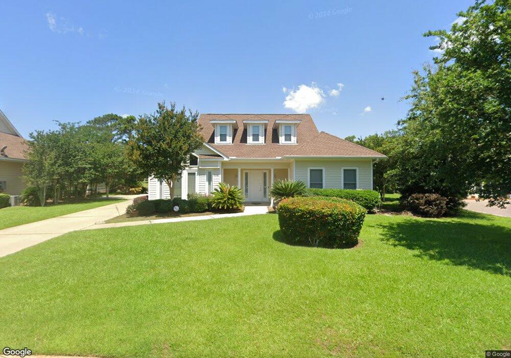
703 Saint Andrews Dr E Gulf Shores, AL 36542
Estimated Value: $438,000 - $624,577
3
Beds
4
Baths
2,384
Sq Ft
$225/Sq Ft
Est. Value
About This Home
This home is located at 703 Saint Andrews Dr E, Gulf Shores, AL 36542 and is currently estimated at $536,644, approximately $225 per square foot. 703 Saint Andrews Dr E is a home located in Baldwin County with nearby schools including Gulf Shores Elementary School, Gulf Shores Middle School, and Gulf Shores High School.
Ownership History
Date
Name
Owned For
Owner Type
Purchase Details
Closed on
Jul 29, 2005
Sold by
Wbw Llc
Bought by
Brierty Carolyn F
Current Estimated Value
Create a Home Valuation Report for This Property
The Home Valuation Report is an in-depth analysis detailing your home's value as well as a comparison with similar homes in the area
Home Values in the Area
Average Home Value in this Area
Purchase History
| Date | Buyer | Sale Price | Title Company |
|---|---|---|---|
| Brierty Carolyn F | -- | None Available |
Source: Public Records
Tax History Compared to Growth
Tax History
| Year | Tax Paid | Tax Assessment Tax Assessment Total Assessment is a certain percentage of the fair market value that is determined by local assessors to be the total taxable value of land and additions on the property. | Land | Improvement |
|---|---|---|---|---|
| 2024 | $824 | $31,800 | $8,100 | $23,700 |
| 2023 | $824 | $31,800 | $8,100 | $23,700 |
| 2022 | $824 | $45,020 | $0 | $0 |
| 2021 | $824 | $40,620 | $0 | $0 |
| 2020 | $824 | $41,500 | $0 | $0 |
| 2019 | $824 | $36,400 | $0 | $0 |
| 2018 | $824 | $33,840 | $0 | $0 |
| 2017 | $824 | $32,680 | $0 | $0 |
| 2016 | $824 | $31,800 | $0 | $0 |
| 2015 | -- | $30,820 | $0 | $0 |
| 2014 | -- | $28,040 | $0 | $0 |
| 2013 | -- | $26,480 | $0 | $0 |
Source: Public Records
Map
Nearby Homes
- 630 Pinehurst Dr
- 604 Saint Andrews Dr
- 619 Saint Andrews Dr
- 3691 Cypress Cir
- 21081 Live Oak Cir
- 603 Estates Dr
- 21069 Live Oak Cir
- 3660 Ancient Oaks Cir
- 601 Willow Point Ct
- 3606 Ancient Oaks Cir
- 0 Ancient Oaks Cir Unit 6
- 501 Cotton Creek Dr Unit 506
- 501 Cotton Creek Dr Unit 1302
- 501 Cotton Creek Dr Unit 1301
- 501 Cotton Creek Dr Unit 505
- 341 Olde Park Ct
- 3677 Ashton Ct
- 3695 Olde Park Rd
- 3687 Olde Park Rd
- 3659 Prestwick Cir
- 701 St Andrews Dr
- 701 Saint Andrews Dr E
- 709 Saint Andrews Dr E
- 711 Saint Andrews Dr E
- 732 Saint Andrews Dr E
- 607 Saint Andrews Dr E
- 643 Pinehurst Dr
- 728 Saint Andrews Dr E
- 713 Ea St Andrews Dr
- 713 E St Andrews Dr
- 700 Village Dr
- 646 Pinehurst Dr
- 702 Village Dr
- 639 Pinehurst Dr
- 704 Village Dr
- 715 Saint Andrews Dr E
- 644 Pinehurst Dr
- 720 Saint Andrews Dr E
- 706 Village Dr
- 717 Saint Andrews Dr E