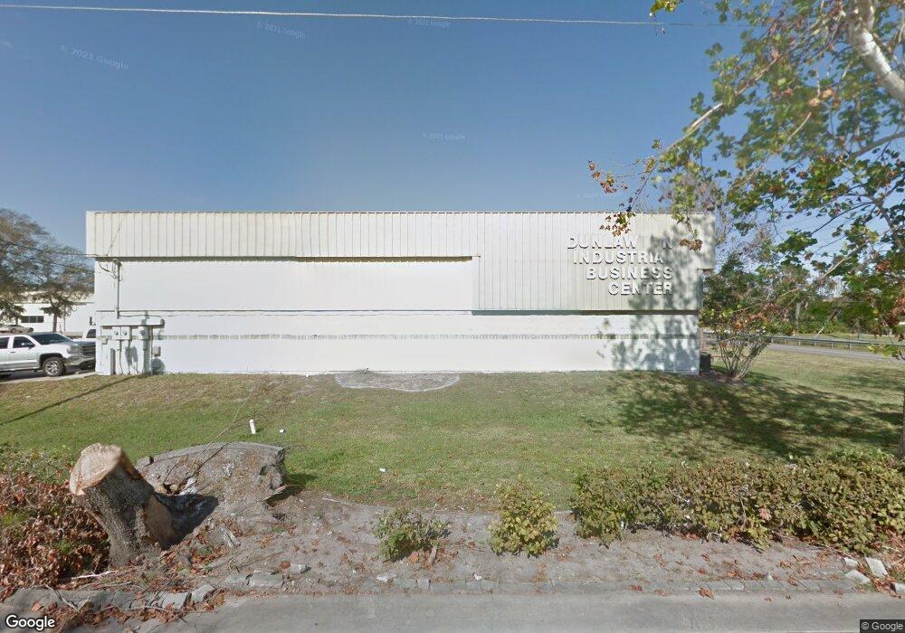
703 Samms Ave Unit K, L & M Port Orange, FL 32129
Estimated Value: $7,187,159
--
Bed
25
Baths
63,660
Sq Ft
$113/Sq Ft
Est. Value
About This Home
This home is located at 703 Samms Ave Unit K, L & M, Port Orange, FL 32129 and is currently estimated at $7,187,159, approximately $112 per square foot. 703 Samms Ave Unit K, L & M is a home located in Volusia County with nearby schools including Sugar Mill Elementary School, Silver Sands Middle School, and Spruce Creek High School.
Ownership History
Date
Name
Owned For
Owner Type
Purchase Details
Closed on
Mar 18, 2008
Sold by
Bowling Roberta L and Ronald Bowling F
Bought by
Port Orange Industrial Llc
Current Estimated Value
Home Financials for this Owner
Home Financials are based on the most recent Mortgage that was taken out on this home.
Original Mortgage
$1,400,000
Outstanding Balance
$866,547
Interest Rate
5.62%
Mortgage Type
Seller Take Back
Estimated Equity
$6,320,612
Purchase Details
Closed on
May 15, 1989
Bought by
Port Orange Industrial Llc
Purchase Details
Closed on
Aug 15, 1986
Bought by
Port Orange Industrial Llc
Purchase Details
Closed on
Oct 15, 1985
Bought by
Port Orange Industrial Llc
Purchase Details
Closed on
Dec 15, 1984
Bought by
Port Orange Industrial Llc
Purchase Details
Closed on
Aug 15, 1978
Bought by
Port Orange Industrial Llc
Create a Home Valuation Report for This Property
The Home Valuation Report is an in-depth analysis detailing your home's value as well as a comparison with similar homes in the area
Home Values in the Area
Average Home Value in this Area
Purchase History
| Date | Buyer | Sale Price | Title Company |
|---|---|---|---|
| Port Orange Industrial Llc | $3,800,000 | Attorney | |
| Port Orange Industrial Llc | $100 | -- | |
| Port Orange Industrial Llc | $100 | -- | |
| Port Orange Industrial Llc | $100 | -- | |
| Port Orange Industrial Llc | $125,000 | -- | |
| Port Orange Industrial Llc | $75,000 | -- |
Source: Public Records
Mortgage History
| Date | Status | Borrower | Loan Amount |
|---|---|---|---|
| Open | Port Orange Industrial Llc | $1,400,000 |
Source: Public Records
Tax History Compared to Growth
Tax History
| Year | Tax Paid | Tax Assessment Tax Assessment Total Assessment is a certain percentage of the fair market value that is determined by local assessors to be the total taxable value of land and additions on the property. | Land | Improvement |
|---|---|---|---|---|
| 2025 | $51,577 | $3,178,331 | $993,168 | $2,185,163 |
| 2024 | $51,577 | $3,151,187 | $993,168 | $2,158,019 |
| 2023 | $51,577 | $3,010,342 | $926,957 | $2,083,385 |
| 2022 | $44,239 | $2,231,272 | $869,022 | $1,362,250 |
| 2021 | $43,897 | $2,082,701 | $869,022 | $1,213,679 |
| 2020 | $43,865 | $2,105,289 | $869,022 | $1,236,267 |
| 2019 | $41,837 | $2,012,678 | $869,022 | $1,143,656 |
| 2018 | $41,995 | $1,973,686 | $869,022 | $1,104,664 |
| 2017 | $41,980 | $1,914,873 | $869,022 | $1,045,851 |
| 2016 | $41,608 | $1,860,573 | $0 | $0 |
| 2015 | $41,895 | $1,803,886 | $0 | $0 |
| 2014 | $42,148 | $1,790,737 | $0 | $0 |
Source: Public Records
Map
Nearby Homes
- 707 Samms Ave Unit K, L & M
- 2525 Spruce Creek Rd
- 830 Canal View Blvd
- 639 Powers Ave
- 840 Samms Ave
- 635 Powers Ave
- 3605 Joan Ln
- 809 Canal View Blvd
- 813 Canal View Blvd
- 3607 Joan Ln
- 817 Canal View Blvd
- 3611 Joan Ln
- 801 Canal View Blvd
- 819 Canal View Blvd
- 3615 Joan Ln
- 633 Powers Ave
- 3600 Socha Way
- 805 Canal View Blvd
- 731 Dunlawton Ave Unit 104
- 3617 Joan Ln