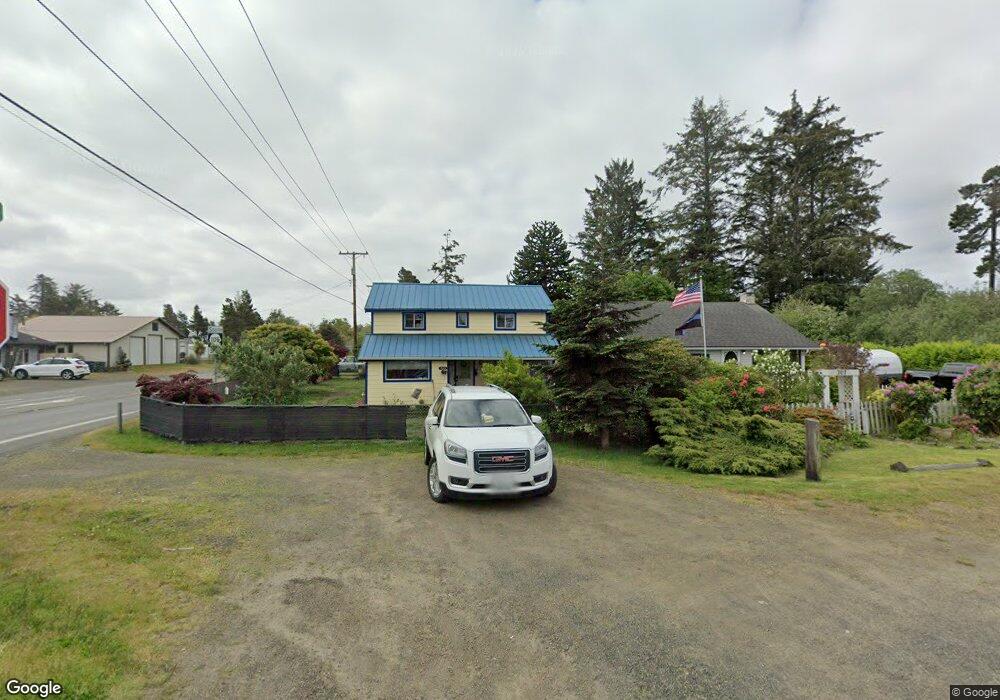
703 W Ocean Ave Westport, WA 98595
Estimated Value: $236,862 - $298,000
3
Beds
1
Bath
1,210
Sq Ft
$229/Sq Ft
Est. Value
About This Home
This home is located at 703 W Ocean Ave, Westport, WA 98595 and is currently estimated at $277,216, approximately $229 per square foot. 703 W Ocean Ave is a home located in Grays Harbor County with nearby schools including Ocosta Elementary School and Ocosta Junior/Senior High School.
Ownership History
Date
Name
Owned For
Owner Type
Purchase Details
Closed on
Dec 20, 2012
Sold by
Sheriff Linda
Bought by
Mcdaniel Patrick M and Mcdaniel Susan L
Current Estimated Value
Home Financials for this Owner
Home Financials are based on the most recent Mortgage that was taken out on this home.
Original Mortgage
$89,693
Outstanding Balance
$61,849
Interest Rate
3.27%
Mortgage Type
New Conventional
Estimated Equity
$215,367
Create a Home Valuation Report for This Property
The Home Valuation Report is an in-depth analysis detailing your home's value as well as a comparison with similar homes in the area
Home Values in the Area
Average Home Value in this Area
Purchase History
| Date | Buyer | Sale Price | Title Company |
|---|---|---|---|
| Mcdaniel Patrick M | $87,900 | Coast Title |
Source: Public Records
Mortgage History
| Date | Status | Borrower | Loan Amount |
|---|---|---|---|
| Open | Mcdaniel Patrick M | $89,693 |
Source: Public Records
Tax History Compared to Growth
Tax History
| Year | Tax Paid | Tax Assessment Tax Assessment Total Assessment is a certain percentage of the fair market value that is determined by local assessors to be the total taxable value of land and additions on the property. | Land | Improvement |
|---|---|---|---|---|
| 2025 | $84 | $173,155 | $56,867 | $116,288 |
| 2023 | $78 | $166,092 | $56,867 | $109,225 |
| 2022 | $96 | $105,771 | $19,950 | $85,821 |
| 2021 | $106 | $105,771 | $19,950 | $85,821 |
| 2020 | $109 | $90,893 | $19,000 | $71,893 |
| 2019 | $954 | $79,826 | $21,000 | $58,826 |
| 2018 | $941 | $74,478 | $21,000 | $53,478 |
| 2017 | $773 | $65,565 | $21,000 | $44,565 |
| 2016 | $802 | $65,565 | $21,000 | $44,565 |
| 2014 | -- | $64,340 | $21,000 | $43,340 |
| 2013 | -- | $96,270 | $25,000 | $71,270 |
Source: Public Records
Map
Nearby Homes
- 201 S Hoquiam St
- 0 N Forrest St Unit NWM2417282
- 0 Olympia St Unit NWM2367648
- 331 N Melbourne St
- 280 S Surf St
- 401 S Starr St
- 603 W Veterans Ave
- 507 W Veterans Ave
- 608 S Forrest St
- 200 E Harms Dr
- 0 Surf St Unit NWM2408053
- 703 S Broadway
- 710 S Hancock Ave Unit 419+
- 710 S Hancock Ave Unit 328
- 710 S Hancock Ave Unit 102&3
- 710 S Hancock Ave Unit 111
- 710 S Hancock Ave Unit 301
- 710 S Hancock Ave Unit 308
- 500 Starr St
- 0 XX Starr St
- 0 Idaho St N Baker Unit 22487456
- 707 W Ocean Ave
- 0 State Route 105 Spur Unit 1325146
- 0 S Forrest St Unit 762602
- 0 S Forrest St Unit 850409
- 0 105 Hwy Unit 776853
- 0 S Forrest St Unit 464452
- 0 State Route 105 Spur Unit 464450
- 0 State Route 105 Spur Unit 651333
- 0 Hwy 105 Unit 758562
- 0 State Route 105 Spur Unit 1043225
- 0 105 Hwy Unit 1047358
- 0 S Forrest St Unit 951221
- 0 S St Rt 105 Unit 73167
- 0 105 Hwy Unit 29131666
- 0 S Forrest St Unit 28193282
- 0 S Forrest St Unit 29051260
- 0 105 Hwy Unit 1219418
- 0 S Forrest St Unit NWM2428287
- 0 S Forrest St Unit NWM2374028