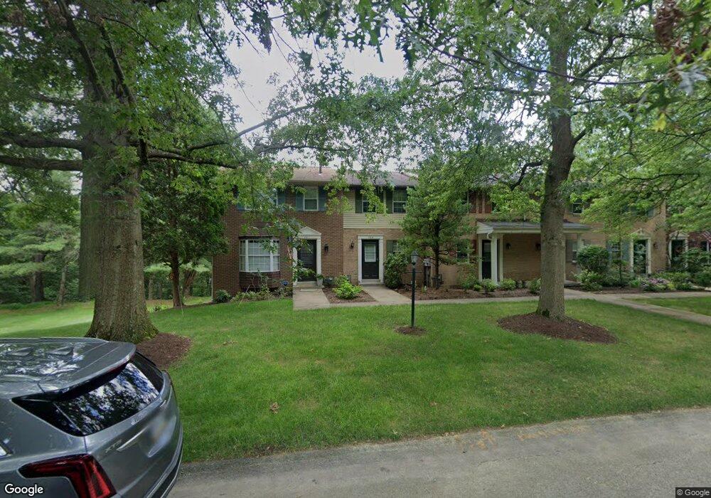
703 Westchester Dr Unit 703 Wexford, PA 15090
McCandless Township NeighborhoodEstimated Value: $222,659 - $239,000
2
Beds
2
Baths
1,156
Sq Ft
$201/Sq Ft
Est. Value
About This Home
This home is located at 703 Westchester Dr Unit 703, Wexford, PA 15090 and is currently estimated at $232,665, approximately $201 per square foot. 703 Westchester Dr Unit 703 is a home located in Allegheny County with nearby schools including McKnight Elementary School, Carson Middle School, and North Allegheny High School.
Ownership History
Date
Name
Owned For
Owner Type
Purchase Details
Closed on
Dec 30, 2020
Sold by
Baier Camille C and Baier George P
Bought by
Baier Elizabeth Curro
Current Estimated Value
Purchase Details
Closed on
Feb 26, 1999
Sold by
Russell Scott E and Russell Eileen
Bought by
Hebbert Ralph Scott
Purchase Details
Closed on
Aug 31, 1995
Sold by
Floyd Cynthia A
Bought by
Russell Scott E
Purchase Details
Closed on
Jan 1, 1900
Create a Home Valuation Report for This Property
The Home Valuation Report is an in-depth analysis detailing your home's value as well as a comparison with similar homes in the area
Home Values in the Area
Average Home Value in this Area
Purchase History
| Date | Buyer | Sale Price | Title Company |
|---|---|---|---|
| Baier Elizabeth Curro | -- | None Available | |
| Hebbert Ralph Scott | $87,400 | -- | |
| Russell Scott E | $82,500 | -- | |
| -- | -- | -- |
Source: Public Records
Tax History Compared to Growth
Tax History
| Year | Tax Paid | Tax Assessment Tax Assessment Total Assessment is a certain percentage of the fair market value that is determined by local assessors to be the total taxable value of land and additions on the property. | Land | Improvement |
|---|---|---|---|---|
| 2025 | $2,766 | $107,600 | -- | $107,600 |
| 2024 | $2,766 | $107,600 | -- | $107,600 |
| 2023 | $2,766 | $107,600 | $0 | $107,600 |
| 2022 | $3,153 | $107,600 | $0 | $107,600 |
| 2021 | $3,163 | $125,600 | $0 | $125,600 |
| 2020 | $3,153 | $125,600 | $0 | $125,600 |
| 2019 | $3,067 | $125,600 | $0 | $125,600 |
| 2018 | $594 | $125,600 | $0 | $125,600 |
| 2017 | $3,010 | $125,600 | $0 | $125,600 |
| 2016 | $594 | $125,600 | $0 | $125,600 |
| 2015 | $594 | $125,600 | $0 | $125,600 |
| 2014 | $2,943 | $125,600 | $0 | $125,600 |
Source: Public Records
Map
Nearby Homes
- 407 Westchester Commons
- 319 Blum Ave
- 9860 Neuhart Blvd
- 527 Cooper St
- 529 Cooper St
- 305 Gable Ct
- Adams II Plan at McCandless Square
- Atlas Plan at McCandless Square
- 9719 Hopkins St Unit 12
- 10107 Deer View Point
- 9905 Tomahawk Trail
- 9574 Toft Ct
- 205 Camelot Dr
- 190 Pine Creek Rd
- 9400 Pannier Rd
- 165 Ridge Ave
- 9755 Grosick Rd
- 9328 Cromwell Dr
- 699 Olivia St
- 9270 Old Perry Hwy
- 701 Westchester Dr
- 705 Westchester Dr Unit 705
- 709 Westchester Dr Unit 709
- 711 Westchester Dr
- 601 Westchester Dr
- 401 Westchester Commons Unit 401
- 1915 Saint James Place
- 603 Westchester Dr Unit 603
- 403 Westchester Commons Unit 403
- 405 Westchester Commons Unit 405
- 1913 Saint James Place
- 605 Westchester Dr
- 409 Westchester Commons
- 411 Westchester Commons
- 311 Westchester Commons
- 607 Westchester Dr
- 1911 Saint James Place
- 309 Westchester Commons
- 609 Westchester Dr
- 1909 Saint James Place