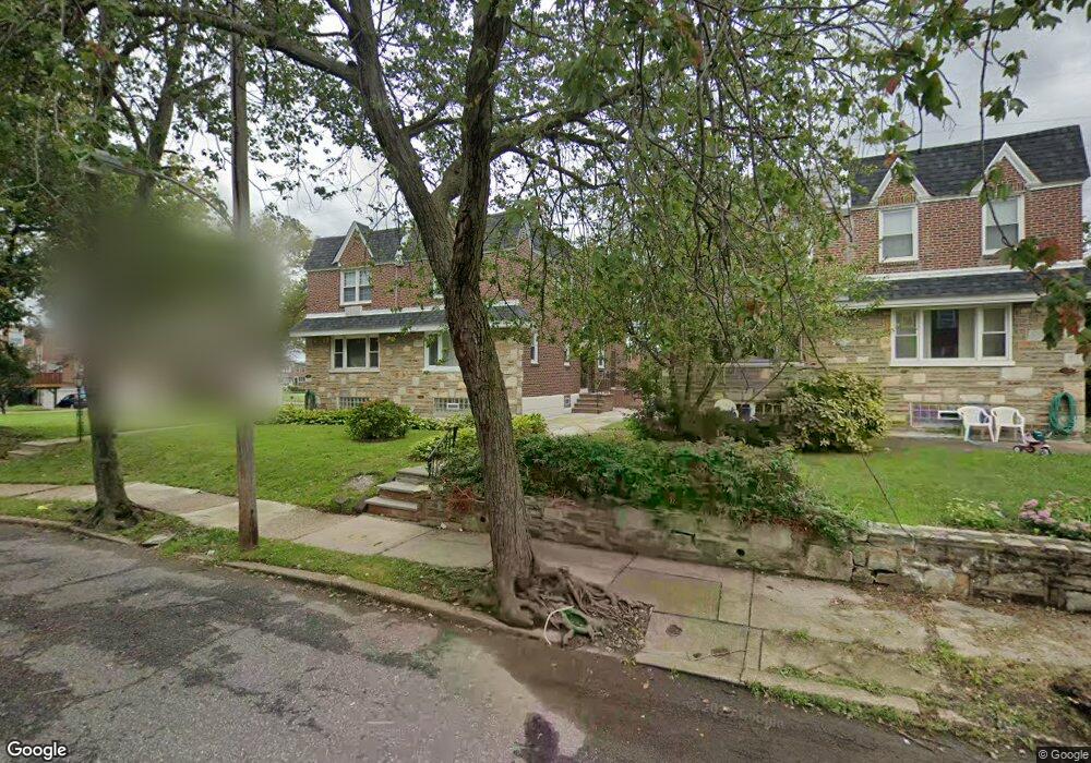
7032 Dorcas St Philadelphia, PA 19111
Castor Gardens NeighborhoodEstimated Value: $318,833 - $343,000
3
Beds
2
Baths
1,584
Sq Ft
$210/Sq Ft
Est. Value
About This Home
This home is located at 7032 Dorcas St, Philadelphia, PA 19111 and is currently estimated at $332,458, approximately $209 per square foot. 7032 Dorcas St is a home with nearby schools including J. Hampton Moore School, Castor Gardens Middle School, and Northeast High School.
Ownership History
Date
Name
Owned For
Owner Type
Purchase Details
Closed on
Apr 1, 2004
Sold by
Hamouroudis George
Bought by
Saint Cyr Jean Hugo
Current Estimated Value
Home Financials for this Owner
Home Financials are based on the most recent Mortgage that was taken out on this home.
Original Mortgage
$127,500
Outstanding Balance
$62,871
Interest Rate
6.35%
Mortgage Type
Purchase Money Mortgage
Estimated Equity
$269,587
Purchase Details
Closed on
Apr 24, 1995
Sold by
Mcglinn Robert G
Bought by
Hamouroudis George
Create a Home Valuation Report for This Property
The Home Valuation Report is an in-depth analysis detailing your home's value as well as a comparison with similar homes in the area
Home Values in the Area
Average Home Value in this Area
Purchase History
| Date | Buyer | Sale Price | Title Company |
|---|---|---|---|
| Saint Cyr Jean Hugo | $150,000 | -- | |
| Hamouroudis George | $85,000 | Industrial Valley Title Inc |
Source: Public Records
Mortgage History
| Date | Status | Borrower | Loan Amount |
|---|---|---|---|
| Open | Saint Cyr Jean Hugo | $127,500 |
Source: Public Records
Tax History Compared to Growth
Tax History
| Year | Tax Paid | Tax Assessment Tax Assessment Total Assessment is a certain percentage of the fair market value that is determined by local assessors to be the total taxable value of land and additions on the property. | Land | Improvement |
|---|---|---|---|---|
| 2025 | $3,406 | $288,500 | $57,700 | $230,800 |
| 2024 | $3,406 | $288,500 | $57,700 | $230,800 |
| 2023 | $3,406 | $243,300 | $48,660 | $194,640 |
| 2022 | $1,873 | $198,300 | $48,660 | $149,640 |
| 2021 | $2,503 | $0 | $0 | $0 |
| 2020 | $2,503 | $0 | $0 | $0 |
| 2019 | $2,402 | $0 | $0 | $0 |
| 2018 | $2,265 | $0 | $0 | $0 |
| 2017 | $2,265 | $0 | $0 | $0 |
| 2016 | $1,845 | $0 | $0 | $0 |
| 2015 | $1,766 | $0 | $0 | $0 |
| 2014 | -- | $161,800 | $52,290 | $109,510 |
| 2012 | -- | $22,400 | $3,327 | $19,073 |
Source: Public Records
Map
Nearby Homes
- 1055 Tyson Ave
- 1019 Disston St
- 1114 Brighton St
- 1012 Saint Vincent St
- 1116 Friendship St
- 1202 Disston St
- 6839 Summerdale Ave
- 1133 Knorr St
- 7146-50 Montour St
- 832 Knorr St
- 811 Knorr St
- 1216 Knorr St
- 1117 Unruh Ave
- 1238 Glenview St
- 1024 Unruh Ave
- 1305 Glenview St
- 1300 Glenview St
- 1116 Unruh Ave
- 1103 Fanshawe St
- 1341 Tyson Ave
- 7030 Dorcas St
- 7034 Dorcas St
- 7036 Dorcas St
- 7038 Dorcas St
- 7040 Dorcas St
- 1010 Brighton St
- 1012 Brighton St
- 7042 Dorcas St
- 7044 Dorcas St
- 1001 Brighton St
- 1014 Brighton St
- 1003 Brighton St
- 7046 Dorcas St
- 1017 Tyson Ave
- 1016 Brighton St
- 1011 Tyson Ave
- 1015 Tyson Ave
- 1013 Tyson Ave
- 1005 Brighton St
- 1019 Tyson Ave