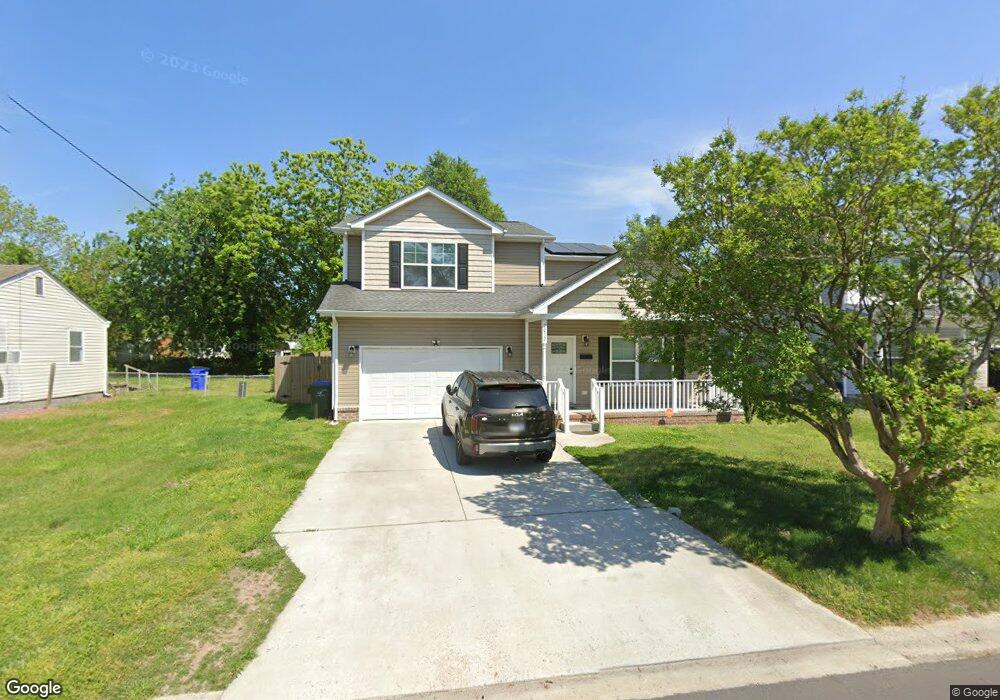
7032 Mamie Blvd Norfolk, VA 23513
Chesapeake Gardens/Mamie Homes NeighborhoodEstimated Value: $408,000 - $421,283
5
Beds
3
Baths
2,297
Sq Ft
$181/Sq Ft
Est. Value
About This Home
This home is located at 7032 Mamie Blvd, Norfolk, VA 23513 and is currently estimated at $414,821, approximately $180 per square foot. 7032 Mamie Blvd is a home located in Norfolk City with nearby schools including Frances E. Willard Model Elementary School, Norview Middle School, and Norview High School.
Ownership History
Date
Name
Owned For
Owner Type
Purchase Details
Closed on
Jul 6, 2016
Sold by
Legacy Home Solution Llc A Virginia Limi
Bought by
Deroux Wesley D and Deroux Evonne
Current Estimated Value
Home Financials for this Owner
Home Financials are based on the most recent Mortgage that was taken out on this home.
Original Mortgage
$268,143
Outstanding Balance
$214,609
Interest Rate
3.66%
Mortgage Type
VA
Estimated Equity
$200,212
Purchase Details
Closed on
Oct 14, 2015
Sold by
Macklin Jean E
Bought by
Legacy Home Solutions Inc
Home Financials for this Owner
Home Financials are based on the most recent Mortgage that was taken out on this home.
Original Mortgage
$133,000
Interest Rate
3.9%
Mortgage Type
Land Contract Argmt. Of Sale
Create a Home Valuation Report for This Property
The Home Valuation Report is an in-depth analysis detailing your home's value as well as a comparison with similar homes in the area
Home Values in the Area
Average Home Value in this Area
Purchase History
| Date | Buyer | Sale Price | Title Company |
|---|---|---|---|
| Deroux Wesley D | $262,500 | Advance Title & Abstract Inc | |
| Legacy Home Solutions Inc | $52,000 | Attorney |
Source: Public Records
Mortgage History
| Date | Status | Borrower | Loan Amount |
|---|---|---|---|
| Open | Deroux Wesley D | $268,143 | |
| Previous Owner | Legacy Home Solutions Inc | $133,000 |
Source: Public Records
Tax History Compared to Growth
Tax History
| Year | Tax Paid | Tax Assessment Tax Assessment Total Assessment is a certain percentage of the fair market value that is determined by local assessors to be the total taxable value of land and additions on the property. | Land | Improvement |
|---|---|---|---|---|
| 2025 | $5,025 | $402,000 | $77,400 | $324,600 |
| 2024 | $4,903 | $398,600 | $77,400 | $321,200 |
| 2023 | $4,504 | $360,300 | $77,400 | $282,900 |
| 2022 | $4,219 | $337,500 | $54,600 | $282,900 |
| 2021 | $3,713 | $297,000 | $45,500 | $251,500 |
| 2020 | $3,581 | $286,500 | $39,600 | $246,900 |
| 2019 | $3,523 | $281,800 | $39,600 | $242,200 |
| 2018 | $3,386 | $270,900 | $39,600 | $231,300 |
| 2017 | $3,015 | $262,200 | $39,600 | $222,600 |
| 2016 | $3,015 | $93,900 | $39,600 | $54,300 |
| 2015 | $1,072 | $93,900 | $39,600 | $54,300 |
| 2014 | $1,072 | $93,900 | $39,600 | $54,300 |
Source: Public Records
Map
Nearby Homes
- 7021 University Dr
- 1041 Tifton St
- 1044 Kane St
- 901 Lasser Dr
- 809 Craten Rd
- 1072 Kane St
- 983 Widgeon Rd
- 936 Widgeon Rd
- 977 Avenue G
- 977 Wolcott Ave
- 985 Wolcott Ave
- 837 Tifton St
- 720 Nickoles Ln
- 7446 Davidson St
- 955 Marietta Ave
- 7446 Tyndale Ct
- 974 Philpotts Rd
- 935 Avenue I
- 1038 Philpotts Rd
- 1037 Philpotts Rd
- 7036 Mamie Blvd
- 7028 Mamie Blvd
- 7025 Selma Ave
- 7040 Mamie Blvd
- 7024 Mamie Blvd
- 7017 Selma Ave
- 7033 Mamie Blvd
- 7029 Mamie Blvd
- 7029 Selma Ave
- 7037 Mamie Blvd
- 7020 Mamie Blvd
- 7025 Mamie Blvd
- 1005 Johnstons Rd
- 1001 Johnstons Rd
- 7041 Mamie Blvd
- 1009 Johnstons Rd
- 7021 Mamie Blvd
- 7033 Selma Ave
- 7016 Mamie Blvd
- 7028 University Dr