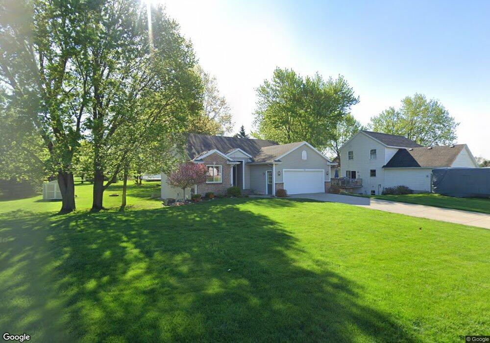
7032 Maplelawn Dr Hudsonville, MI 49426
Estimated Value: $416,364 - $445,000
4
Beds
3
Baths
2,350
Sq Ft
$185/Sq Ft
Est. Value
About This Home
This home is located at 7032 Maplelawn Dr, Hudsonville, MI 49426 and is currently estimated at $434,591, approximately $184 per square foot. 7032 Maplelawn Dr is a home located in Ottawa County with nearby schools including Baldwin Street Middle School, Hudsonville Freshman Campus, and Hudsonville High School.
Ownership History
Date
Name
Owned For
Owner Type
Purchase Details
Closed on
Jun 25, 2019
Sold by
Bowman Michael T and Ricketson Bowman Melisa A
Bought by
Bowman Michael Todd and Ricketson Bowman Melisa A
Current Estimated Value
Purchase Details
Closed on
Mar 27, 2018
Sold by
Ricketson Bowman Melisa A
Bought by
Bowman Michael T and Ricketson Bowman Melisa A
Home Financials for this Owner
Home Financials are based on the most recent Mortgage that was taken out on this home.
Original Mortgage
$159,000
Interest Rate
4.4%
Mortgage Type
New Conventional
Purchase Details
Closed on
Jul 3, 2003
Sold by
Brower Gary and Brower Carmen
Bought by
Ricketson Robert P and Ricketson Melisa A
Home Financials for this Owner
Home Financials are based on the most recent Mortgage that was taken out on this home.
Original Mortgage
$183,200
Interest Rate
5.3%
Mortgage Type
Purchase Money Mortgage
Create a Home Valuation Report for This Property
The Home Valuation Report is an in-depth analysis detailing your home's value as well as a comparison with similar homes in the area
Home Values in the Area
Average Home Value in this Area
Purchase History
| Date | Buyer | Sale Price | Title Company |
|---|---|---|---|
| Bowman Michael Todd | -- | None Available | |
| Bowman Michael T | -- | None Available | |
| Ricketson Robert P | $185,000 | Metropolitan Title Company |
Source: Public Records
Mortgage History
| Date | Status | Borrower | Loan Amount |
|---|---|---|---|
| Closed | Bowman Michael T | $159,000 | |
| Closed | Ricketson Robert P | $183,200 |
Source: Public Records
Tax History Compared to Growth
Tax History
| Year | Tax Paid | Tax Assessment Tax Assessment Total Assessment is a certain percentage of the fair market value that is determined by local assessors to be the total taxable value of land and additions on the property. | Land | Improvement |
|---|---|---|---|---|
| 2025 | $2,930 | $176,900 | $0 | $0 |
| 2024 | $2,535 | $167,200 | $0 | $0 |
| 2023 | $2,421 | $140,000 | $0 | $0 |
| 2022 | $2,301 | $125,300 | $0 | $0 |
| 2021 | $2,571 | $121,100 | $0 | $0 |
| 2020 | $2,545 | $113,800 | $0 | $0 |
| 2019 | $2,549 | $111,100 | $0 | $0 |
| 2018 | $2,376 | $108,600 | $0 | $0 |
| 2017 | $2,332 | $108,900 | $0 | $0 |
| 2016 | $2,319 | $101,700 | $0 | $0 |
| 2015 | $2,213 | $97,500 | $0 | $0 |
| 2014 | $2,213 | $86,200 | $0 | $0 |
Source: Public Records
Map
Nearby Homes
- 7313 Valhalla Dr
- 2921 N Wentward Ct
- 6760 N Wentward Ct
- 7381 Rolling Hills Dr
- 2969 Osprey Dr Unit 27
- 6722 N Wentward Ct Unit 77
- 7318 Alycia Dr
- 6714 Cedar Grove W
- 2698 Cedargrove N
- 3528 Tearose Dr
- 6724 28th Ave
- V/L Port Sheldon St
- 3204 Port Sheldon St
- 3544 Nobb Hill Dr
- 3617 Teton Dr
- 6340 Summer Dr
- 2323 Rosewood St
- 2682 Thrush Dr
- 2934 Parkside Dr Unit 54
- 2194 Oak Hollow Dr
- 5 Maplelawn Dr
- 7016 Maplelawn Dr
- 7048 Maplelawn Dr
- 3085 Rosewood St
- 7043 Maplelawn Dr
- 3096 Maplepond Dr
- 3151 Rosewood St
- 7064 Maplelawn Dr
- 7029 Maplelawn Dr
- 3114 Maplepond Dr
- 3069 Rosewood St
- 3084 Rosewood St
- 3068 Rosewood St
- 3161 Rosewood St
- 3102 Rosewood St
- 7084 Maplelawn Dr
- 3128 Maplepond Dr
- 3088 Rosewood St
- 3150 Rosewood St
- 3083 Maplepond Dr