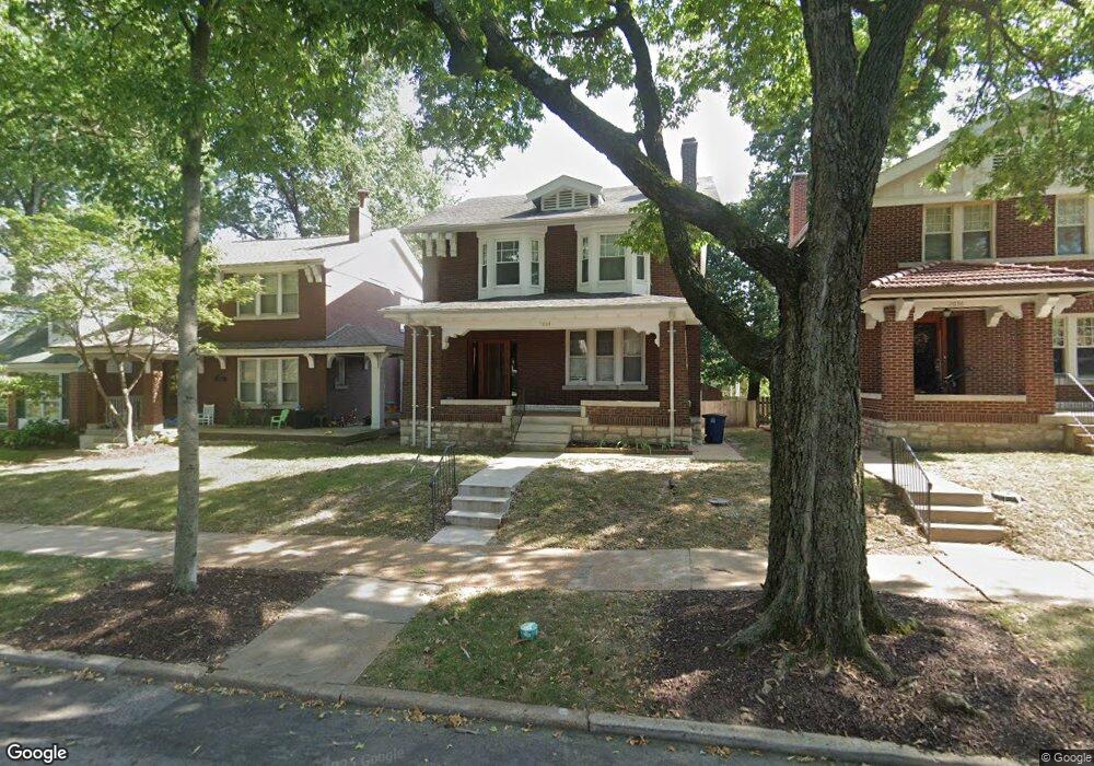
7034 Pershing Ave Saint Louis, MO 63130
Estimated Value: $434,880 - $566,000
2
Beds
2
Baths
1,864
Sq Ft
$263/Sq Ft
Est. Value
About This Home
This home is located at 7034 Pershing Ave, Saint Louis, MO 63130 and is currently estimated at $490,220, approximately $262 per square foot. 7034 Pershing Ave is a home located in St. Louis County with nearby schools including Flynn Park Elementary, Brittany Woods Middle School, and University City High School.
Ownership History
Date
Name
Owned For
Owner Type
Purchase Details
Closed on
Oct 22, 2007
Sold by
Davies Nigel
Bought by
The Washington University
Current Estimated Value
Purchase Details
Closed on
Sep 24, 2003
Sold by
Stirler Bonnie W
Bought by
Davies Nigel
Home Financials for this Owner
Home Financials are based on the most recent Mortgage that was taken out on this home.
Original Mortgage
$160,000
Interest Rate
4.87%
Mortgage Type
Purchase Money Mortgage
Create a Home Valuation Report for This Property
The Home Valuation Report is an in-depth analysis detailing your home's value as well as a comparison with similar homes in the area
Home Values in the Area
Average Home Value in this Area
Purchase History
| Date | Buyer | Sale Price | Title Company |
|---|---|---|---|
| The Washington University | $310,000 | Fatco Com | |
| Davies Nigel | $282,000 | -- |
Source: Public Records
Mortgage History
| Date | Status | Borrower | Loan Amount |
|---|---|---|---|
| Previous Owner | Davies Nigel | $160,000 |
Source: Public Records
Tax History
| Year | Tax Paid | Tax Assessment Tax Assessment Total Assessment is a certain percentage of the fair market value that is determined by local assessors to be the total taxable value of land and additions on the property. | Land | Improvement |
|---|---|---|---|---|
| 2025 | -- | $74,940 | $51,510 | $23,430 |
| 2024 | -- | $70,490 | $38,630 | $31,860 |
| 2023 | -- | $70,490 | $38,630 | $31,860 |
| 2022 | -- | $61,600 | $34,330 | $27,270 |
| 2021 | $0 | $61,600 | $34,330 | $27,270 |
| 2020 | $0 | $66,860 | $30,630 | $36,230 |
| 2019 | $0 | $66,860 | $30,630 | $36,230 |
| 2018 | $0 | $55,460 | $30,630 | $24,830 |
| 2017 | $0 | $55,460 | $30,630 | $24,830 |
| 2016 | -- | $55,500 | $23,960 | $31,540 |
| 2015 | -- | $55,500 | $23,960 | $31,540 |
| 2014 | -- | $56,830 | $13,360 | $43,470 |
Source: Public Records
Map
Nearby Homes
- 7144 Waterman Ave
- 7162 Pershing Ave
- 6810 Pershing Ave
- 7133 Washington Ave
- 7120 Lindell Blvd
- 7224 Pershing Ave
- 6603 Pershing Ave
- 7249 Forsyth Blvd
- 7267 Lindell Blvd
- 524 Warren Ave
- 7330 Kingsbury Blvd
- 7121 Cornell Ave
- 7106 Stanford Ave
- 738 Kingsland Ave
- 7298 Greenway Ave
- 6924 Amherst Ave
- 7320 Forsyth Blvd Unit 204
- 6916 Amherst Ave
- 760 Syracuse Ave
- 710 Leland Ave
- 7030 Pershing Ave
- 7036 Pershing Ave
- 7026 Pershing Ave
- 7040 Pershing Ave
- 7024 Pershing Ave
- 7044 Pershing Ave
- 7046 Pershing Ave
- 7020 Pershing Ave
- 7035 Pershing Ave
- 7033 Pershing Ave
- 7039 Pershing Ave
- 7050 Pershing Ave
- 7031 Pershing Ave
- 7043 Pershing Ave
- 7027 Pershing Ave
- 7045 Pershing Ave
- 7052 Pershing Ave
- 7023 Pershing Ave
- 7049 Pershing Ave
- 7019 Pershing Ave
Your Personal Tour Guide
Ask me questions while you tour the home.