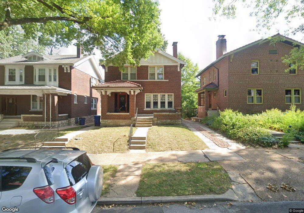
7036 Pershing Ave Saint Louis, MO 63130
Estimated Value: $690,614
3
Beds
2
Baths
1,816
Sq Ft
$380/Sq Ft
Est. Value
About This Home
This home is located at 7036 Pershing Ave, Saint Louis, MO 63130 and is currently estimated at $690,614, approximately $380 per square foot. 7036 Pershing Ave is a home located in St. Louis County with nearby schools including Flynn Park Elementary, Brittany Woods Middle School, and University City High School.
Ownership History
Date
Name
Owned For
Owner Type
Purchase Details
Closed on
Mar 14, 2008
Sold by
Krebs Martin D and Krebs Pamela S
Bought by
The Washington University
Current Estimated Value
Purchase Details
Closed on
May 18, 2006
Sold by
Reid Christopher and Delaney Jennifer
Bought by
Krebs Martin D and Krebs Pamela S
Home Financials for this Owner
Home Financials are based on the most recent Mortgage that was taken out on this home.
Original Mortgage
$210,000
Interest Rate
6.75%
Mortgage Type
Fannie Mae Freddie Mac
Create a Home Valuation Report for This Property
The Home Valuation Report is an in-depth analysis detailing your home's value as well as a comparison with similar homes in the area
Home Values in the Area
Average Home Value in this Area
Purchase History
| Date | Buyer | Sale Price | Title Company |
|---|---|---|---|
| The Washington University | $380,000 | None Available | |
| Krebs Martin D | $360,000 | None Available |
Source: Public Records
Mortgage History
| Date | Status | Borrower | Loan Amount |
|---|---|---|---|
| Previous Owner | Krebs Martin D | $210,000 |
Source: Public Records
Tax History Compared to Growth
Tax History
| Year | Tax Paid | Tax Assessment Tax Assessment Total Assessment is a certain percentage of the fair market value that is determined by local assessors to be the total taxable value of land and additions on the property. | Land | Improvement |
|---|---|---|---|---|
| 2025 | -- | $68,650 | $24,700 | $43,950 |
| 2024 | -- | $60,440 | $19,760 | $40,680 |
| 2023 | -- | $60,440 | $19,760 | $40,680 |
| 2022 | -- | $48,660 | $14,820 | $33,840 |
| 2021 | $0 | $48,660 | $14,820 | $33,840 |
| 2020 | $0 | $39,940 | $7,110 | $32,830 |
| 2019 | $0 | $39,940 | $7,110 | $32,830 |
| 2018 | $0 | $29,110 | $0 | $29,110 |
| 2017 | $0 | $29,110 | $0 | $29,110 |
| 2016 | -- | $54,740 | $23,960 | $30,780 |
Source: Public Records
Map
Nearby Homes
- 7061 Westmoreland Dr
- 7118 Pershing Ave
- 7022 Washington Ave
- 7162 Pershing Ave
- 7120 Lindell Blvd
- 7267 Lindell Blvd
- 7321 Westmoreland Dr
- 6603 Pershing Ave
- 22 Princeton Ave
- 400 Melville Ave
- 708 Trinity Ave
- 739 Radcliffe Ave
- 409 Westgate Ave
- 6924 Amherst Ave
- 7124 Amherst Ave
- 7281 Princeton Ave
- 6918 Dartmouth Ave
- 710 Leland Ave
- 603 Westgate Ave Unit 603C
- 8 Carrswold Dr
- 7040 Pershing Ave
- 7034 Pershing Ave
- 7044 Pershing Ave
- 7030 Pershing Ave
- 7046 Pershing Ave
- 7026 Pershing Ave
- 7050 Pershing Ave
- 7024 Pershing Ave
- 7039 Pershing Ave
- 7043 Pershing Ave
- 7035 Pershing Ave
- 7052 Pershing Ave
- 7020 Pershing Ave
- 7045 Pershing Ave
- 7033 Pershing Ave
- 7049 Pershing Ave
- 7031 Pershing Ave
- 7056 Pershing Ave
- 7051 Pershing Ave
- 7027 Pershing Ave
