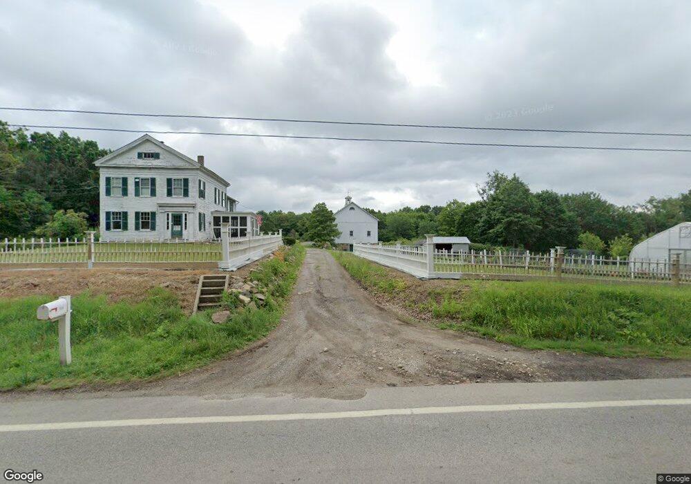
7036 State Route 44 Ravenna, OH 44266
Estimated Value: $605,000 - $840,857
6
Beds
3
Baths
2,656
Sq Ft
$272/Sq Ft
Est. Value
About This Home
This home is located at 7036 State Route 44, Ravenna, OH 44266 and is currently estimated at $722,929, approximately $272 per square foot. 7036 State Route 44 is a home located in Portage County with nearby schools including West Park Elementary School, Brown Middle School, and Ravenna High School.
Ownership History
Date
Name
Owned For
Owner Type
Purchase Details
Closed on
Jun 23, 2010
Sold by
Webb Norman J and Webb Connie M
Bought by
Chrin Michael A and Chrin Cynthia M
Current Estimated Value
Home Financials for this Owner
Home Financials are based on the most recent Mortgage that was taken out on this home.
Original Mortgage
$322,000
Interest Rate
4.81%
Mortgage Type
New Conventional
Purchase Details
Closed on
Nov 2, 2004
Sold by
Webb Richard C and Webb Susan K
Bought by
Webb Norman J
Purchase Details
Closed on
Jun 27, 2003
Sold by
Webb Richard C
Bought by
Webb Richard C and Mcgovern Martha G
Create a Home Valuation Report for This Property
The Home Valuation Report is an in-depth analysis detailing your home's value as well as a comparison with similar homes in the area
Home Values in the Area
Average Home Value in this Area
Purchase History
| Date | Buyer | Sale Price | Title Company |
|---|---|---|---|
| Chrin Michael A | $425,000 | Bennett Land Title Agency | |
| Webb Norman J | $270,000 | Approved Statewide Title Age | |
| Webb Richard C | -- | -- |
Source: Public Records
Mortgage History
| Date | Status | Borrower | Loan Amount |
|---|---|---|---|
| Closed | Chrin Michael A | $322,000 |
Source: Public Records
Tax History Compared to Growth
Tax History
| Year | Tax Paid | Tax Assessment Tax Assessment Total Assessment is a certain percentage of the fair market value that is determined by local assessors to be the total taxable value of land and additions on the property. | Land | Improvement |
|---|---|---|---|---|
| 2024 | $5,520 | $178,230 | $73,540 | $104,690 |
| 2023 | $5,760 | $155,720 | $56,530 | $99,190 |
| 2022 | $5,741 | $155,720 | $56,530 | $99,190 |
| 2021 | $5,731 | $155,720 | $56,530 | $99,190 |
| 2020 | $5,345 | $131,120 | $56,530 | $74,590 |
| 2019 | $5,349 | $131,120 | $56,530 | $74,590 |
| 2018 | $6,729 | $128,560 | $42,530 | $86,030 |
| 2017 | $6,729 | $128,560 | $42,530 | $86,030 |
| 2016 | $6,159 | $128,560 | $42,530 | $86,030 |
| 2015 | $6,166 | $128,560 | $42,530 | $86,030 |
| 2014 | $5,672 | $128,560 | $42,530 | $86,030 |
| 2013 | $5,639 | $128,560 | $42,530 | $86,030 |
Source: Public Records
Map
Nearby Homes
- 6972 State Route 44
- 6942 State Route 44
- 4078 Dawley Rd
- 6768 Terrill St
- 0 Sumner St
- 7319 Infirmary Rd
- 255 North Ave
- 3487 Lovers Ln
- 6615 Cleveland Rd Unit K2
- 510 Day St
- 4852 Lovers Ln
- 550 Washington Ave
- 6704 Wall St
- 242 W Highland Ave
- 656 W Highland Ave
- 7017 Peck Rd
- 0 S Sycamore St
- 3461 Mabel Ave
- 825 W Highland Ave
- 7219 Birchview Dr W Unit 19
- 7068 State Route 44
- 7035 State Route 44
- 6986 State Route 44
- 7015 Rte 44
- 6997 State Route 44
- 7106 State Route 44
- 7015 State Route 44
- 7101 State Route 44
- 6958 State Route 44
- 7128 State Route 44
- 0 Ohio 14
- 4442 Ohio 14
- Sublot 7 NE Enterprise Pkwy
- Sublot3A Enterprise Pkwy
- Lot 7 Enterprise Pkwy
- 6912 State Route 44
- Sublot 5 Enterprise Pkwy
- Sublot 7 Enterprise Pkwy
- 5 R Enterprise Pkwy
- .54 Enterprise Pkwy