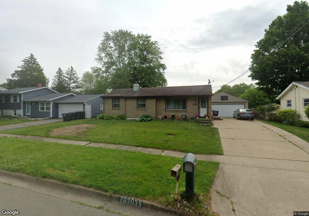
7039 Rockford St Portage, MI 49024
Estimated Value: $203,609 - $250,000
--
Bed
--
Bath
1,020
Sq Ft
$225/Sq Ft
Est. Value
About This Home
This home is located at 7039 Rockford St, Portage, MI 49024 and is currently estimated at $229,652, approximately $225 per square foot. 7039 Rockford St is a home located in Kalamazoo County with nearby schools including Woodland Elementary School, Portage West Middle School, and Portage Northern High School.
Ownership History
Date
Name
Owned For
Owner Type
Purchase Details
Closed on
Mar 10, 2021
Sold by
Basa Marvin M
Bought by
Basa Marvin M and Marvin M Basa Trust
Current Estimated Value
Purchase Details
Closed on
Dec 20, 2016
Sold by
Willin Gerald D
Bought by
Basa Marvin
Home Financials for this Owner
Home Financials are based on the most recent Mortgage that was taken out on this home.
Original Mortgage
$97,000
Outstanding Balance
$79,534
Interest Rate
4.03%
Mortgage Type
New Conventional
Estimated Equity
$150,118
Purchase Details
Closed on
Jun 23, 2009
Sold by
Willin Duane L and Willin Ella M
Bought by
Willin Gerald D
Create a Home Valuation Report for This Property
The Home Valuation Report is an in-depth analysis detailing your home's value as well as a comparison with similar homes in the area
Home Values in the Area
Average Home Value in this Area
Purchase History
| Date | Buyer | Sale Price | Title Company |
|---|---|---|---|
| Basa Marvin M | -- | None Available | |
| Basa Marvin | $100,000 | Title Source | |
| Willin Gerald D | -- | None Available |
Source: Public Records
Mortgage History
| Date | Status | Borrower | Loan Amount |
|---|---|---|---|
| Open | Basa Marvin | $97,000 |
Source: Public Records
Tax History Compared to Growth
Tax History
| Year | Tax Paid | Tax Assessment Tax Assessment Total Assessment is a certain percentage of the fair market value that is determined by local assessors to be the total taxable value of land and additions on the property. | Land | Improvement |
|---|---|---|---|---|
| 2025 | $3,034 | $87,500 | $0 | $0 |
| 2024 | $2,671 | $86,000 | $0 | $0 |
| 2023 | $2,546 | $76,600 | $0 | $0 |
| 2022 | $2,751 | $67,800 | $0 | $0 |
| 2021 | $2,659 | $64,000 | $0 | $0 |
| 2020 | $2,601 | $59,100 | $0 | $0 |
| 2019 | $234 | $56,800 | $0 | $0 |
| 2018 | $0 | $57,700 | $0 | $0 |
| 2017 | $0 | $56,900 | $0 | $0 |
| 2016 | -- | $53,700 | $0 | $0 |
| 2015 | -- | $49,800 | $0 | $0 |
| 2014 | -- | $47,500 | $0 | $0 |
Source: Public Records
Map
Nearby Homes
- 1710 Greenview Ave
- 6827 Marlow St
- 1828 Woodland Dr
- 6803 Fescue St
- 7403 Rockford St
- 7337 Starbrook St
- 6803 Bluegrass St
- 1010 Romence Rd
- 1531 Redstock Ave
- 6745 Oakland Dr
- 7160 Crown Pointe Cir
- 6514 Marlow St
- 2029 Brighton Ln Unit 7
- 1998 Brighton Ln Unit 16
- 6748 Trotwood St
- 1922 Brighton Ln Unit 31
- 2604 Radcliffe Ave
- 6636 Trotwood St
- 7784 Primrose Ln
- 1318 Ashton Woods Ct
- 7031 Rockford St
- 7047 Rockford St
- 7082 Marfield St
- 7068 Marfield St
- 7025 Rockford St
- 7103 Rockford St
- 7100 Marfield St
- 7040 Rockford St
- 7052 Marfield St
- 7048 Rockford St
- 7032 Rockford St
- 7017 Rockford St
- 7111 Rockford St
- 7114 Marfield St
- 7026 Rockford St
- 7034 Marfield St
- 7112 Rockford St
- 7009 Rockford St
- 7119 Rockford St
- 7083 Marfield St