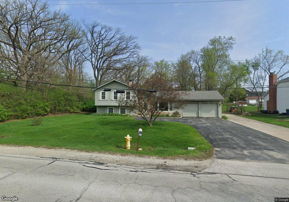
704 39th St Downers Grove, IL 60515
Estimated Value: $453,712 - $594,000
--
Bed
--
Bath
1,198
Sq Ft
$439/Sq Ft
Est. Value
About This Home
This home is located at 704 39th St, Downers Grove, IL 60515 and is currently estimated at $525,428, approximately $438 per square foot. 704 39th St is a home located in DuPage County with nearby schools including Highland Elementary School, Herrick Middle School, and Downer Grove North High School.
Ownership History
Date
Name
Owned For
Owner Type
Purchase Details
Closed on
Feb 22, 2017
Sold by
Krauskopf Timothy K
Bought by
Chicago Title Land Trust Company and Trust #8002373770
Current Estimated Value
Purchase Details
Closed on
Dec 2, 2002
Sold by
Lasalle Bank National Assn
Bought by
Krauskopf Timothy K
Purchase Details
Closed on
Apr 28, 2000
Sold by
Hanes Joseph P and Hanes Helen M
Bought by
Lasalle Bank National Assn and Trust #123127
Home Financials for this Owner
Home Financials are based on the most recent Mortgage that was taken out on this home.
Original Mortgage
$171,000
Interest Rate
8.26%
Mortgage Type
Purchase Money Mortgage
Create a Home Valuation Report for This Property
The Home Valuation Report is an in-depth analysis detailing your home's value as well as a comparison with similar homes in the area
Home Values in the Area
Average Home Value in this Area
Purchase History
| Date | Buyer | Sale Price | Title Company |
|---|---|---|---|
| Chicago Title Land Trust Company | -- | Attorney | |
| Krauskopf Timothy K | $284,000 | Ctic | |
| Lasalle Bank National Assn | $180,000 | -- |
Source: Public Records
Mortgage History
| Date | Status | Borrower | Loan Amount |
|---|---|---|---|
| Previous Owner | Lasalle Bank National Assn | $171,000 |
Source: Public Records
Tax History Compared to Growth
Tax History
| Year | Tax Paid | Tax Assessment Tax Assessment Total Assessment is a certain percentage of the fair market value that is determined by local assessors to be the total taxable value of land and additions on the property. | Land | Improvement |
|---|---|---|---|---|
| 2024 | $8,308 | $152,910 | $44,921 | $107,989 |
| 2023 | $7,941 | $141,400 | $41,540 | $99,860 |
| 2022 | $7,655 | $135,920 | $39,930 | $95,990 |
| 2021 | $7,063 | $132,540 | $38,940 | $93,600 |
| 2020 | $6,916 | $129,640 | $38,090 | $91,550 |
| 2019 | $6,630 | $123,250 | $36,210 | $87,040 |
| 2018 | $6,077 | $112,180 | $32,960 | $79,220 |
| 2017 | $5,821 | $106,900 | $31,410 | $75,490 |
| 2016 | $5,624 | $100,710 | $29,590 | $71,120 |
| 2015 | $5,501 | $93,830 | $27,570 | $66,260 |
| 2014 | $5,459 | $90,550 | $26,500 | $64,050 |
| 2013 | $5,455 | $91,820 | $26,870 | $64,950 |
Source: Public Records
Map
Nearby Homes
- 3910 Sterling Rd
- 3919 Washington St
- 3730 Sterling Rd
- 4133 Lindley St
- Lot 3910 Sterling Rd
- 4117 Sterling Rd
- 525 36th St
- 4111 Douglas Rd
- 4225 Highland Ave
- 4043 Saratoga Ave Unit D221
- 1136 Barneswood Dr
- 4218 Florence Ave
- 4224 Saratoga Ave Unit 105
- 4250 Saratoga Ave Unit 305
- 4224 Saratoga Ave Unit 110
- 248 41st St
- 4133 Saratoga Ave Unit B220
- 425 Sherman St
- 727 Grant St
- 2919 35th St
- 702 39th St
- 718 39th St
- 715 39th St
- 711 39th St
- 3854 Glendenning Rd
- 3848 Glendenning Rd
- 3901 Earlston Rd
- 720 39th St
- 3900 Glendenning Rd
- 3846 Glendenning Rd
- 3844 Glendenning Rd
- 3909 Earlston Rd
- 3910 Glendenning Rd
- 3834 Glendenning Rd
- 722 39th St
- 3904 Earlston Rd
- 625 39th St
- 3919 Earlston Rd
- 3847 Glendenning Rd
- 3828 Glendenning Rd