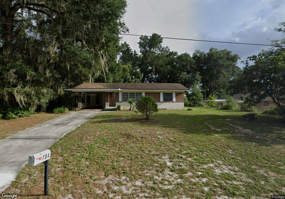
704 E Indiana Ave Deland, FL 32724
Estimated Value: $204,000 - $234,000
2
Beds
1
Bath
1,156
Sq Ft
$190/Sq Ft
Est. Value
About This Home
This home is located at 704 E Indiana Ave, Deland, FL 32724 and is currently estimated at $219,241, approximately $189 per square foot. 704 E Indiana Ave is a home located in Volusia County with nearby schools including Blue Lake Elementary School, Deland High School, and Deland Middle School.
Ownership History
Date
Name
Owned For
Owner Type
Purchase Details
Closed on
May 26, 2022
Sold by
Tibbetts Gordon G
Bought by
Evergreene Holdings Group Llc
Current Estimated Value
Purchase Details
Closed on
Mar 25, 2000
Sold by
Hayes Carolyn T and Stoute Christine
Bought by
Tibbetts Gordon G
Purchase Details
Closed on
Dec 15, 1986
Bought by
Tibbetts Gordon G
Purchase Details
Closed on
Jul 15, 1973
Bought by
Tibbetts Gordon G
Create a Home Valuation Report for This Property
The Home Valuation Report is an in-depth analysis detailing your home's value as well as a comparison with similar homes in the area
Home Values in the Area
Average Home Value in this Area
Purchase History
| Date | Buyer | Sale Price | Title Company |
|---|---|---|---|
| Evergreene Holdings Group Llc | $132,500 | Cornerstone National Title | |
| Evergreene Holdings Group Llc | $132,500 | Cornerstone National Title | |
| Tibbetts Gordon G | -- | -- | |
| Tibbetts Gordon G | $45,000 | -- | |
| Tibbetts Gordon G | $25,800 | -- |
Source: Public Records
Tax History Compared to Growth
Tax History
| Year | Tax Paid | Tax Assessment Tax Assessment Total Assessment is a certain percentage of the fair market value that is determined by local assessors to be the total taxable value of land and additions on the property. | Land | Improvement |
|---|---|---|---|---|
| 2025 | $3,020 | $199,896 | $67,014 | $132,882 |
| 2024 | $3,020 | $201,377 | $67,014 | $134,363 |
| 2023 | $3,020 | $161,039 | $33,163 | $127,876 |
| 2022 | $2,338 | $151,446 | $31,992 | $119,454 |
| 2021 | $2,166 | $117,352 | $23,409 | $93,943 |
| 2020 | $1,977 | $106,904 | $19,508 | $87,396 |
| 2019 | $1,878 | $96,494 | $15,606 | $80,888 |
| 2018 | $1,765 | $85,471 | $10,924 | $74,547 |
| 2017 | $1,656 | $76,706 | $10,899 | $65,807 |
| 2016 | $1,436 | $62,535 | $0 | $0 |
| 2015 | $1,366 | $58,144 | $0 | $0 |
| 2014 | $1,265 | $52,106 | $0 | $0 |
Source: Public Records
Map
Nearby Homes
- 139 N Boston Ave
- 330 E Wisconsin Ave
- 1301 E Wisconsin Ave
- 0 E Wisconsin Ave Unit MFRO6190518
- 137 S Chandler Ave
- 141 N McDonald Ave
- 524 E Church St
- 322 N Frankfort Ave
- 230 S Chandler Ave
- 502 E Howry Ave
- 455 E Church St
- 449 E Church St
- 135 S Arlington Ave
- 443, 449 & 455 E Church St
- 706 E Minnesota Ave Unit C
- 419 N Frankfort Ave
- 109 S Colorado Ave
- 406 N Kentucky Ave
- 401 N McDonald Ave
- 437 N Boston Ave Unit 437
- 121 N Boston Ave
- 724 E Indiana Ave
- 715 E New York Ave
- 701 E New York Ave
- 705 E Indiana Ave
- 133 N Boston Ave
- 733 E Indiana Ave
- 130 N Boston Ave
- 735 E Indiana Ave
- 132 N Boston Ave
- 630 E Indiana Ave
- 706 E Rich Ave
- 708 E Rich Ave
- 712 E Rich Ave
- 134 N Boston Ave
- 645 E Indiana Ave
- 626 E Indiana Ave
- 127 N Phippen Ave
- 716 E Rich Ave
- 724 E New York Ave