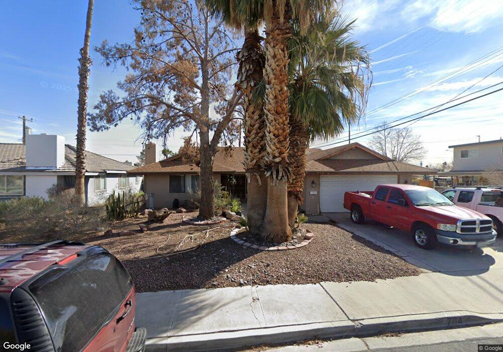
704 Hogan Dr Las Vegas, NV 89107
Twin Lakes NeighborhoodEstimated Value: $345,000 - $439,000
4
Beds
2
Baths
1,755
Sq Ft
$221/Sq Ft
Est. Value
About This Home
This home is located at 704 Hogan Dr, Las Vegas, NV 89107 and is currently estimated at $386,986, approximately $220 per square foot. 704 Hogan Dr is a home located in Clark County with nearby schools including E.W. Griffith Elementary School, Robert O Gibson Middle School, and Western High School.
Ownership History
Date
Name
Owned For
Owner Type
Purchase Details
Closed on
Sep 10, 2003
Sold by
Barber Richard B and Barber Janice Elaine
Bought by
Urban Lynn V
Current Estimated Value
Home Financials for this Owner
Home Financials are based on the most recent Mortgage that was taken out on this home.
Original Mortgage
$121,250
Outstanding Balance
$52,393
Interest Rate
5.25%
Mortgage Type
Unknown
Estimated Equity
$334,593
Create a Home Valuation Report for This Property
The Home Valuation Report is an in-depth analysis detailing your home's value as well as a comparison with similar homes in the area
Home Values in the Area
Average Home Value in this Area
Purchase History
| Date | Buyer | Sale Price | Title Company |
|---|---|---|---|
| Urban Lynn V | $143,000 | National Title Company |
Source: Public Records
Mortgage History
| Date | Status | Borrower | Loan Amount |
|---|---|---|---|
| Open | Urban Lynn V | $121,250 |
Source: Public Records
Tax History Compared to Growth
Tax History
| Year | Tax Paid | Tax Assessment Tax Assessment Total Assessment is a certain percentage of the fair market value that is determined by local assessors to be the total taxable value of land and additions on the property. | Land | Improvement |
|---|---|---|---|---|
| 2025 | $1,260 | $59,099 | $32,200 | $26,899 |
| 2024 | $1,167 | $59,099 | $32,200 | $26,899 |
| 2023 | $1,167 | $58,277 | $33,950 | $24,327 |
| 2022 | $1,081 | $51,800 | $30,100 | $21,700 |
| 2021 | $1,001 | $45,754 | $25,550 | $20,204 |
| 2020 | $927 | $44,466 | $24,850 | $19,616 |
| 2019 | $869 | $40,256 | $21,350 | $18,906 |
| 2018 | $829 | $35,317 | $17,500 | $17,817 |
| 2017 | $1,154 | $35,189 | $17,500 | $17,689 |
| 2016 | $777 | $30,303 | $13,300 | $17,003 |
| 2015 | $774 | $25,578 | $9,100 | $16,478 |
| 2014 | $752 | $22,247 | $5,950 | $16,297 |
Source: Public Records
Map
Nearby Homes
- 4301 Fortune Ave
- 309 Estella Ave
- 800 Langtry Dr
- 821 Mar Jay Ct
- 312 Estella Ave
- 605 N Yale St
- 424 Stanford St
- 605 Stanford St
- 4901 Nebraska Ave
- 604 N Minnesota St
- 5004 Cannon Blvd
- 504 N Minnesota St
- 1221 Oak Tree Ln
- 304 N Minnesota St
- 104 Stanford St
- 1300 Oak Tree Ln
- 1317 Pyramid Dr
- 1325 Pyramid Dr
- 1112 Hazard Ave
- 5117 Arbor Way
- 708 Hogan Dr
- 4332 Snead Dr
- 4324 Snead Dr
- 704 Glen Abbey Cir
- 712 Hogan Dr
- 4401 Saint Andrews Cir
- 4401 St Andrews Cir
- 700 Glen Abbey Cir
- 4320 Snead Dr
- 4400 Snead Dr
- 716 Hogan Dr
- 708 Glen Abbey Cir
- 4405 Saint Andrews Cir
- 4316 Snead Dr
- 4400 Saint Andrews Cir
- 631 Hogan Dr
- 4329 Snead Dr
- 4325 Snead Dr
- 800 Hogan Dr
- 701 Glen Abbey Cir