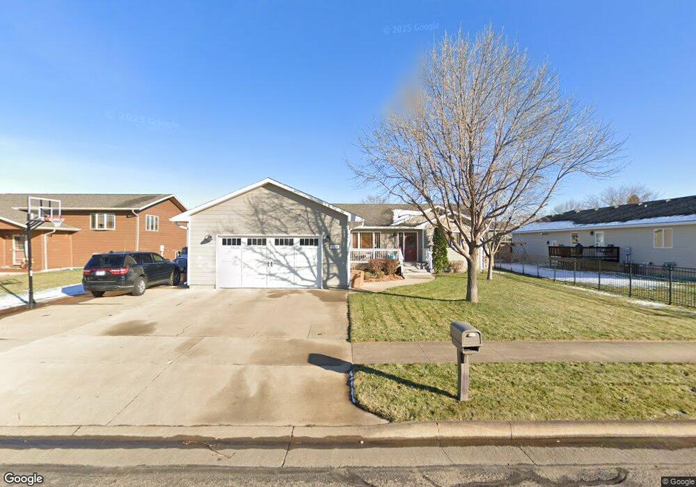
704 Kennedy Loop Pierre, SD 57501
Estimated Value: $372,426 - $477,000
--
Bed
3
Baths
1,582
Sq Ft
$267/Sq Ft
Est. Value
About This Home
This home is located at 704 Kennedy Loop, Pierre, SD 57501 and is currently estimated at $422,607, approximately $267 per square foot. 704 Kennedy Loop is a home with nearby schools including T.F. Riggs High School and Pierre SDA School.
Ownership History
Date
Name
Owned For
Owner Type
Purchase Details
Closed on
Nov 27, 2007
Sold by
Nesladek Jonathan and Nesladek Joette
Bought by
Broers John D and Broers Michelle L
Current Estimated Value
Purchase Details
Closed on
Aug 25, 2006
Sold by
Kennedy Property Development Llc
Bought by
Nesladek Jonathan and Nesladek Joette
Home Financials for this Owner
Home Financials are based on the most recent Mortgage that was taken out on this home.
Original Mortgage
$125,000
Interest Rate
6.77%
Create a Home Valuation Report for This Property
The Home Valuation Report is an in-depth analysis detailing your home's value as well as a comparison with similar homes in the area
Home Values in the Area
Average Home Value in this Area
Purchase History
| Date | Buyer | Sale Price | Title Company |
|---|---|---|---|
| Broers John D | $210,000 | -- | |
| Nesladek Jonathan | $36,000 | -- |
Source: Public Records
Mortgage History
| Date | Status | Borrower | Loan Amount |
|---|---|---|---|
| Previous Owner | Nesladek Jonathan | $125,000 |
Source: Public Records
Tax History
| Year | Tax Paid | Tax Assessment Tax Assessment Total Assessment is a certain percentage of the fair market value that is determined by local assessors to be the total taxable value of land and additions on the property. | Land | Improvement |
|---|---|---|---|---|
| 2025 | $3,966 | $338,445 | $50,833 | $287,612 |
| 2024 | $3,959 | $324,749 | $50,833 | $273,916 |
| 2023 | $3,634 | $315,879 | $48,644 | $267,235 |
| 2022 | $3,419 | $269,024 | $46,328 | $222,696 |
| 2021 | $3,349 | $240,200 | $41,364 | $198,836 |
| 2020 | $3,429 | $233,204 | $40,159 | $193,045 |
| 2019 | $3,423 | $233,204 | $40,159 | $193,045 |
| 2018 | $3,278 | $226,411 | $38,989 | $187,422 |
| 2017 | -- | $215,629 | $37,132 | $178,497 |
| 2016 | $3,431 | $215,629 | $37,132 | $178,497 |
| 2015 | -- | $209,348 | $36,050 | $173,298 |
| 2014 | -- | $203,250 | $35,000 | $168,250 |
| 2013 | -- | $203,250 | $35,000 | $168,250 |
| 2011 | -- | $190,507 | $34,278 | $156,229 |
Source: Public Records
Map
Nearby Homes
- 726 N Taylor Ave
- 137 Hampton Dr
- 139 Hampton Dr
- 601 Yucca Dr
- 0 Woodview Dr
- 2106 Antelope St
- TBD Lilac Dr
- 2004 Buffalo St
- 2009 Buffalo St
- 620 N Harrison Ave
- 131 Hampton Dr
- 313 N Taylor Ave
- 1621 Abbey Rd
- Lot 13R N Garfield Ave
- 203 N Tyler Ave
- 129 Norbeck Dr
- 212 N Van Buren Ave
- 111 N Harrison Ave
- 2222 Stratford Place
- 1814 Camden Ct
- 708 Kennedy Loop
- 1816 Kennedy Dr
- 712 Kennedy Loop
- 742 Kennedy Loop
- 709 Kennedy Loop
- 705 Kennedy Loop
- 1820 Kennedy Dr
- 20405 Falcon Ridge Rd
- 734 Kennedy Loop
- 1812 Kennedy Dr
- 713 Kennedy Loop
- 1817 Kennedy Dr
- 717 Kennedy Loop
- 1640 Circle Dr
- 1808 Flag Mountain Dr
- 1808 Kennedy Dr
- 725 Kennedy Loop
- 1812 Flag Mountain Dr
- 1821 Kennedy Dr
- 1804 Flag Mountain Dr
