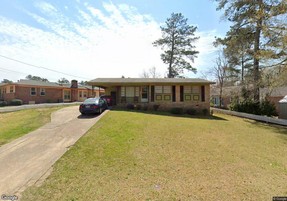
704 Pyracantha Dr Lagrange, GA 30241
Estimated Value: $103,000 - $125,000
2
Beds
2
Baths
983
Sq Ft
$114/Sq Ft
Est. Value
About This Home
This home is located at 704 Pyracantha Dr, Lagrange, GA 30241 and is currently estimated at $112,081, approximately $114 per square foot. 704 Pyracantha Dr is a home located in Troup County with nearby schools including Callaway Elementary School, Hogansville Elementary School, and Callaway Middle School.
Ownership History
Date
Name
Owned For
Owner Type
Purchase Details
Closed on
May 15, 1998
Sold by
Bank Of Illinois
Bought by
Greene Oliver and Greene Annie L
Current Estimated Value
Purchase Details
Closed on
Feb 25, 1998
Sold by
Mary Thornhill
Bought by
Bank Of Illinois
Purchase Details
Closed on
Dec 28, 1993
Sold by
Mary H Thornhill
Bought by
Mary Thornhill
Purchase Details
Closed on
Jan 1, 1965
Sold by
Donald R Jenkins
Bought by
Mary H Thornhill
Create a Home Valuation Report for This Property
The Home Valuation Report is an in-depth analysis detailing your home's value as well as a comparison with similar homes in the area
Home Values in the Area
Average Home Value in this Area
Purchase History
| Date | Buyer | Sale Price | Title Company |
|---|---|---|---|
| Greene Oliver | $31,000 | -- | |
| Bank Of Illinois | -- | -- | |
| Mary Thornhill | -- | -- | |
| Mary H Thornhill | -- | -- |
Source: Public Records
Tax History Compared to Growth
Tax History
| Year | Tax Paid | Tax Assessment Tax Assessment Total Assessment is a certain percentage of the fair market value that is determined by local assessors to be the total taxable value of land and additions on the property. | Land | Improvement |
|---|---|---|---|---|
| 2024 | $829 | $30,400 | $4,040 | $26,360 |
| 2023 | $724 | $26,560 | $4,040 | $22,520 |
| 2022 | $707 | $25,320 | $4,040 | $21,280 |
| 2021 | $678 | $22,480 | $3,720 | $18,760 |
| 2020 | $678 | $22,480 | $3,720 | $18,760 |
| 2019 | $615 | $20,392 | $3,712 | $16,680 |
| 2018 | $615 | $20,392 | $3,712 | $16,680 |
| 2017 | $615 | $20,392 | $3,712 | $16,680 |
| 2016 | $606 | $20,079 | $3,712 | $16,367 |
| 2015 | $607 | $20,079 | $3,712 | $16,367 |
| 2014 | $582 | $19,218 | $3,712 | $15,506 |
| 2013 | -- | $20,293 | $3,712 | $16,581 |
Source: Public Records
Map
Nearby Homes
- 0 E Fendig St
- 113 E Fendig St
- 311 Colquitt St
- 901 Whiteline St
- 114 Brenda Blvd
- 626 Smoot St
- 510 Smoot St
- 130 Edgewood Ave
- 0 Brown St Unit 10550761
- 0 Brown St Unit 10550754
- 137 Edgewood Ave
- LOT 15 Edgewood Ave
- 1404 Hamilton Rd
- 213 Euclid Ave
- 216 Euclid Ave
- 200 Mccall St
- 0 Boggs St Unit 10550243
- 0 Boggs St Unit 10550231
- 0 Boggs St Unit 10550239
- 0 Boggs St Unit 10550250
- 701 Miami St
- 712 Pyracantha Dr
- 714 Pyracantha Dr
- 707 Pyracantha Dr
- 615 Miami St
- 707 Miami St
- 716 Pyracantha Dr
- 940 Kissler St
- 711 Pyracantha Dr
- 715 Pyracantha Dr
- 611 Miami St
- 708 Miami St
- 718 Pyracantha Dr
- 719 Pyracantha Dr
- 616 Miami St
- 712 Miami St
- 936 Kissler St
- 941 Kissler St
- 612 Miami St
- 723 Pyracantha Dr