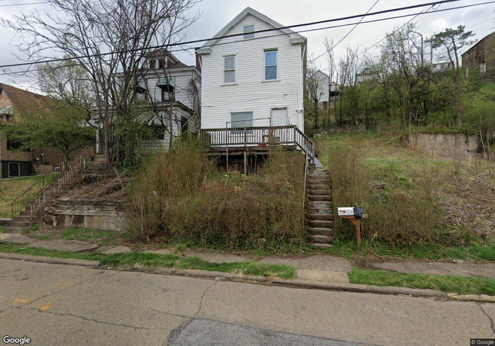
704 Ridge Ave Mc Kees Rocks, PA 15136
Stowe Township NeighborhoodEstimated Value: $77,000 - $118,000
2
Beds
1
Bath
1,332
Sq Ft
$75/Sq Ft
Est. Value
About This Home
This home is located at 704 Ridge Ave, Mc Kees Rocks, PA 15136 and is currently estimated at $100,333, approximately $75 per square foot. 704 Ridge Ave is a home located in Allegheny County with nearby schools including Sto-Rox Upper Elementary School, Sto-Rox Primary Center, and Sto-Rox Junior/Senior High School.
Ownership History
Date
Name
Owned For
Owner Type
Purchase Details
Closed on
Oct 26, 2021
Sold by
Albert Patrick S
Bought by
Co Investments Llc
Current Estimated Value
Purchase Details
Closed on
Aug 24, 2015
Sold by
J & P Real Estate Llc
Bought by
Albert Patrick S
Home Financials for this Owner
Home Financials are based on the most recent Mortgage that was taken out on this home.
Original Mortgage
$5,000
Interest Rate
4.07%
Mortgage Type
New Conventional
Purchase Details
Closed on
Oct 17, 2014
Sold by
Marcinko Exr Daniel
Bought by
J And P Real Estate Llc
Purchase Details
Closed on
Jun 6, 1988
Bought by
Marcinko George and John Marcinko
Create a Home Valuation Report for This Property
The Home Valuation Report is an in-depth analysis detailing your home's value as well as a comparison with similar homes in the area
Home Values in the Area
Average Home Value in this Area
Purchase History
| Date | Buyer | Sale Price | Title Company |
|---|---|---|---|
| Co Investments Llc | $1,000 | -- | |
| Albert Patrick S | $5,000 | -- | |
| J And P Real Estate Llc | $5,000 | -- | |
| Marcinko George | -- | -- |
Source: Public Records
Mortgage History
| Date | Status | Borrower | Loan Amount |
|---|---|---|---|
| Previous Owner | Albert Patrick S | $5,000 |
Source: Public Records
Tax History Compared to Growth
Tax History
| Year | Tax Paid | Tax Assessment Tax Assessment Total Assessment is a certain percentage of the fair market value that is determined by local assessors to be the total taxable value of land and additions on the property. | Land | Improvement |
|---|---|---|---|---|
| 2025 | $1,633 | $37,800 | $11,800 | $26,000 |
| 2024 | $1,633 | $37,800 | $11,800 | $26,000 |
| 2023 | $1,570 | $37,800 | $11,800 | $26,000 |
| 2022 | $1,520 | $37,800 | $11,800 | $26,000 |
| 2021 | $179 | $37,800 | $11,800 | $26,000 |
| 2020 | $1,486 | $37,800 | $11,800 | $26,000 |
| 2019 | $1,486 | $37,800 | $11,800 | $26,000 |
| 2018 | $179 | $37,800 | $11,800 | $26,000 |
| 2017 | $1,452 | $37,800 | $11,800 | $26,000 |
| 2016 | $179 | $37,800 | $11,800 | $26,000 |
| 2015 | $179 | $37,800 | $11,800 | $26,000 |
| 2014 | $1,452 | $37,800 | $11,800 | $26,000 |
Source: Public Records
Map
Nearby Homes
- 125 Frazier Ave
- 813 8th St
- 810 Woodward Ave
- 705 Broadway Ave
- 82 Harlem Ave
- 837 Benwood Ave
- 634 Broadway Ave
- 815 Broadway Ave
- 620 Broadway Ave
- 705 Russellwood Ave
- 713 Russellwood Ave
- 815 10th St
- 813 10th St
- 802 10th St
- 810 10th St
- 45 Harlem Ave
- 932 Ridge Ave
- 908 Russellwood Ave
- 809 11th St
- 533 Woodward Ave