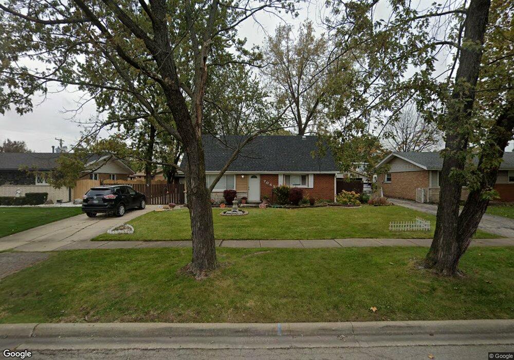
7042 Dover St Bridgeview, IL 60455
Little Palestine NeighborhoodEstimated Value: $324,496 - $372,000
3
Beds
2
Baths
1,460
Sq Ft
$235/Sq Ft
Est. Value
About This Home
This home is located at 7042 Dover St, Bridgeview, IL 60455 and is currently estimated at $343,374, approximately $235 per square foot. 7042 Dover St is a home located in Cook County with nearby schools including George W Lieb Elementary School, Simmons Middle School, and Oak Lawn Community High School.
Ownership History
Date
Name
Owned For
Owner Type
Purchase Details
Closed on
May 11, 2022
Sold by
Contreras Magdalena
Bought by
Morales Vanessa
Current Estimated Value
Home Financials for this Owner
Home Financials are based on the most recent Mortgage that was taken out on this home.
Original Mortgage
$274,725
Outstanding Balance
$259,162
Interest Rate
5.13%
Mortgage Type
FHA
Estimated Equity
$84,212
Purchase Details
Closed on
Mar 18, 1994
Sold by
Lomalie David and Lomalie Cindy P
Bought by
Feichter David J and Stenson Kathleen B
Home Financials for this Owner
Home Financials are based on the most recent Mortgage that was taken out on this home.
Original Mortgage
$116,850
Interest Rate
7.27%
Create a Home Valuation Report for This Property
The Home Valuation Report is an in-depth analysis detailing your home's value as well as a comparison with similar homes in the area
Home Values in the Area
Average Home Value in this Area
Purchase History
| Date | Buyer | Sale Price | Title Company |
|---|---|---|---|
| Morales Vanessa | $300,000 | Citywide Title | |
| Feichter David J | $82,000 | -- |
Source: Public Records
Mortgage History
| Date | Status | Borrower | Loan Amount |
|---|---|---|---|
| Open | Morales Vanessa | $274,725 | |
| Previous Owner | Feichter David J | $116,850 |
Source: Public Records
Tax History
| Year | Tax Paid | Tax Assessment Tax Assessment Total Assessment is a certain percentage of the fair market value that is determined by local assessors to be the total taxable value of land and additions on the property. | Land | Improvement |
|---|---|---|---|---|
| 2025 | $7,766 | $23,000 | $4,137 | $18,863 |
| 2024 | $7,766 | $23,000 | $4,137 | $18,863 |
| 2023 | $5,329 | $23,000 | $4,137 | $18,863 |
| 2022 | $5,329 | $16,776 | $3,597 | $13,179 |
| 2021 | $5,216 | $16,776 | $3,597 | $13,179 |
| 2020 | $5,197 | $16,776 | $3,597 | $13,179 |
| 2019 | $4,672 | $15,676 | $3,237 | $12,439 |
| 2018 | $5,296 | $17,964 | $3,237 | $14,727 |
| 2017 | $5,280 | $17,964 | $3,237 | $14,727 |
| 2016 | $4,628 | $14,542 | $2,697 | $11,845 |
| 2015 | $4,369 | $14,542 | $2,697 | $11,845 |
| 2014 | $4,268 | $14,542 | $2,697 | $11,845 |
| 2013 | $4,502 | $16,662 | $2,697 | $13,965 |
Source: Public Records
Map
Nearby Homes
- 7117 W 93rd St Unit 104
- 7117 W 93rd St Unit 306
- 9112 Homestead Ln
- 9405 S 69th Ct
- 6759 W 91st St
- 6934 W 96th St
- 8808 Cranbrook Ln
- 8200 Normandy Ave
- 6630 W 95th St Unit 3D
- 6630 W 95th St Unit 66301B
- 9645 S Harlem Ave Unit 1H
- 6800 W 97th St
- 9708 Nottingham Ave Unit 11
- 9708 Nottingham Ave Unit 9
- 6896 W 87th St Unit 3W
- 9606 Natoma Ave
- 9170 Crescent Ct
- 8632 New England Ave
- 7012 98th St Unit 1A
- 9109 Crescent Ct
Your Personal Tour Guide
Ask me questions while you tour the home.