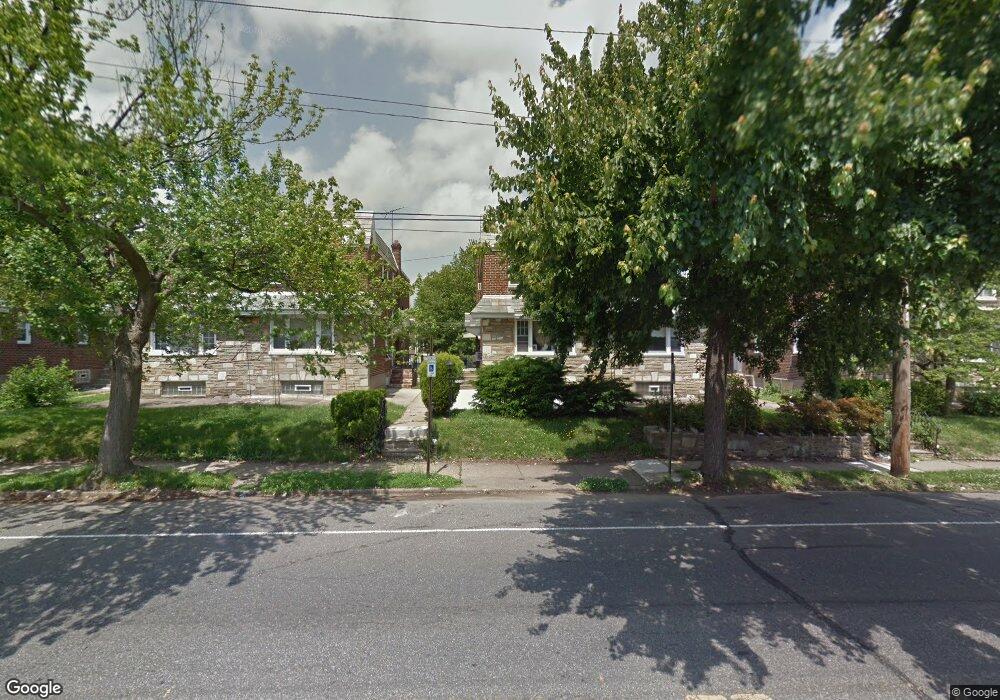
7046 Algon Ave Philadelphia, PA 19111
Castor Gardens NeighborhoodEstimated Value: $322,233 - $379,000
3
Beds
2
Baths
1,550
Sq Ft
$224/Sq Ft
Est. Value
About This Home
This home is located at 7046 Algon Ave, Philadelphia, PA 19111 and is currently estimated at $346,558, approximately $223 per square foot. 7046 Algon Ave is a home with nearby schools including J. Hampton Moore School, Castor Gardens Middle School, and Northeast High School.
Ownership History
Date
Name
Owned For
Owner Type
Purchase Details
Closed on
Jun 20, 2001
Sold by
Mitnick Florence
Bought by
Anderson Courtney G and Anderson Vanessa Gayle
Current Estimated Value
Home Financials for this Owner
Home Financials are based on the most recent Mortgage that was taken out on this home.
Original Mortgage
$87,750
Outstanding Balance
$33,572
Interest Rate
7.2%
Estimated Equity
$312,986
Create a Home Valuation Report for This Property
The Home Valuation Report is an in-depth analysis detailing your home's value as well as a comparison with similar homes in the area
Home Values in the Area
Average Home Value in this Area
Purchase History
| Date | Buyer | Sale Price | Title Company |
|---|---|---|---|
| Anderson Courtney G | $88,500 | -- |
Source: Public Records
Mortgage History
| Date | Status | Borrower | Loan Amount |
|---|---|---|---|
| Open | Anderson Courtney G | $87,750 |
Source: Public Records
Tax History Compared to Growth
Tax History
| Year | Tax Paid | Tax Assessment Tax Assessment Total Assessment is a certain percentage of the fair market value that is determined by local assessors to be the total taxable value of land and additions on the property. | Land | Improvement |
|---|---|---|---|---|
| 2025 | $3,432 | $292,200 | $58,440 | $233,760 |
| 2024 | $3,432 | $292,200 | $58,440 | $233,760 |
| 2023 | $3,432 | $245,200 | $49,040 | $196,160 |
| 2022 | $1,884 | $200,200 | $49,040 | $151,160 |
| 2021 | $2,514 | $0 | $0 | $0 |
| 2020 | $2,514 | $0 | $0 | $0 |
| 2019 | $2,412 | $0 | $0 | $0 |
| 2018 | $2,290 | $0 | $0 | $0 |
| 2017 | $2,290 | $0 | $0 | $0 |
| 2016 | $1,870 | $0 | $0 | $0 |
| 2015 | $1,790 | $0 | $0 | $0 |
| 2014 | -- | $163,600 | $61,819 | $101,781 |
| 2012 | -- | $22,400 | $4,472 | $17,928 |
Source: Public Records
Map
Nearby Homes
- 1114 Brighton St
- 1007 Brighton St
- 1055 Tyson Ave
- 1116 Friendship St
- 1019 Disston St
- 1012 Saint Vincent St
- 1217 Princeton Ave
- 1202 Disston St
- 6839 Summerdale Ave
- 1133 Knorr St
- 829 Disston St
- 1305 Glenview St
- 1341 Tyson Ave
- 1216 Knorr St
- 1329 Saint Vincent St
- 1300 Glenview St
- 7004 Loretto Ave
- 1136 Kerper St
- 1336 Longshore Ave
- 1117 Unruh Ave
- 7048 Algon Ave
- 7044 Algon Ave
- 7050 Algon Ave
- 7042 Algon Ave
- 7052 Algon Ave
- 7043 Dorcas St
- 7040 Algon Ave
- 7054 Algon Ave
- 1017 Brighton St
- 1019 Brighton St
- 1021 Brighton St
- 1015 Brighton St
- 1013 Brighton St
- 1023 Brighton St
- 7051 Dorcas St
- 1018 Friendship St
- 1100 Princeton Ave
- 1020 Friendship St
- 1014 Friendship St
- 7053 Dorcas St