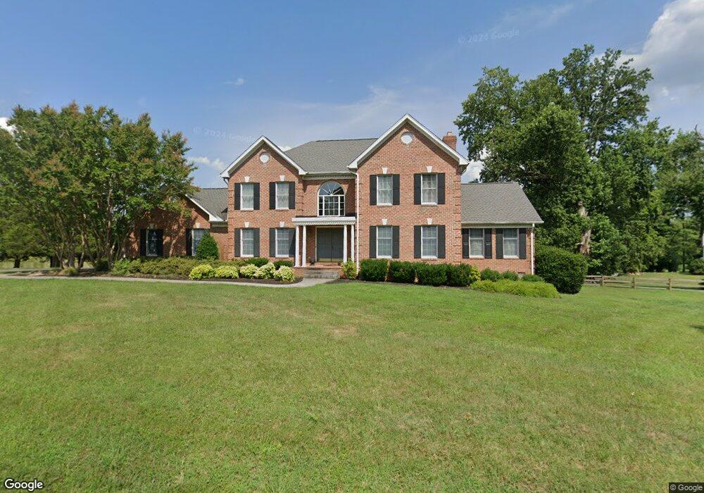
7049 Sundance Dr Warrenton, VA 20187
Estimated Value: $840,000 - $1,246,000
4
Beds
4
Baths
3,534
Sq Ft
$287/Sq Ft
Est. Value
About This Home
This home is located at 7049 Sundance Dr, Warrenton, VA 20187 and is currently estimated at $1,015,303, approximately $287 per square foot. 7049 Sundance Dr is a home located in Fauquier County with nearby schools including P.B. Smith Elementary School, Marshall Middle School, and Fauquier High School.
Ownership History
Date
Name
Owned For
Owner Type
Purchase Details
Closed on
Aug 19, 1994
Sold by
Hensley R
Bought by
Dyer James E
Current Estimated Value
Home Financials for this Owner
Home Financials are based on the most recent Mortgage that was taken out on this home.
Original Mortgage
$302,500
Interest Rate
8.61%
Purchase Details
Closed on
Apr 25, 1994
Sold by
Sundance Partners
Bought by
Hensley Raymond
Create a Home Valuation Report for This Property
The Home Valuation Report is an in-depth analysis detailing your home's value as well as a comparison with similar homes in the area
Home Values in the Area
Average Home Value in this Area
Purchase History
| Date | Buyer | Sale Price | Title Company |
|---|---|---|---|
| Dyer James E | $336,140 | -- | |
| Hensley Raymond | $56,000 | -- |
Source: Public Records
Mortgage History
| Date | Status | Borrower | Loan Amount |
|---|---|---|---|
| Closed | Hensley Raymond | $302,500 |
Source: Public Records
Tax History Compared to Growth
Tax History
| Year | Tax Paid | Tax Assessment Tax Assessment Total Assessment is a certain percentage of the fair market value that is determined by local assessors to be the total taxable value of land and additions on the property. | Land | Improvement |
|---|---|---|---|---|
| 2025 | $8,214 | $849,400 | $152,100 | $697,300 |
| 2024 | $8,023 | $849,400 | $152,100 | $697,300 |
| 2023 | $7,684 | $849,400 | $152,100 | $697,300 |
| 2022 | $7,684 | $849,400 | $152,100 | $697,300 |
| 2021 | $6,746 | $677,300 | $127,100 | $550,200 |
| 2020 | $6,746 | $677,300 | $127,100 | $550,200 |
| 2019 | $6,746 | $677,300 | $127,100 | $550,200 |
| 2018 | $6,665 | $677,300 | $127,100 | $550,200 |
| 2016 | $5,914 | $567,900 | $127,100 | $440,800 |
| 2015 | -- | $567,900 | $127,100 | $440,800 |
| 2014 | -- | $567,900 | $127,100 | $440,800 |
Source: Public Records
Map
Nearby Homes
- 7131 Northampton St
- 7038 Beaconsfield Ln
- 7057 Blackwell Rd
- 6416 Airlie Rd
- 7213 Princess Anne Ct
- 6397 Tazewell St
- 7241 Blackwell Rd
- 0 Hwy Unit VAFQ2018052
- 0 Airlie Road Lee Hwy Unit VAFQ2018058
- 7245 Blackwell Rd
- 7253 Blackwell Rd
- 7333 Hazelwood Ct
- 7085 Bramble Way
- 116 Oak Tree Ln
- 7176 Homestead Ct
- 5985 Whippoorwill Dr
- 7323 Bayfield Ln
- 7040 Hi Rock Ridge Rd
- 541 Highland Towne Ln
- LOT 1 Blackwell Rd
- 7052 Sundance Dr
- 7044 Sundance Dr
- 6558 Airlie Rd
- 7037 Sundance Dr
- 7036 Sundance Dr
- 0 Beaconsfield Ln Unit 1000159979
- 6558 Lancaster Dr
- 6562 Lancaster Dr
- 6550 Lancaster Dr
- 6568 Lancaster Dr
- 6812 Spruce Hill Ct
- 6546 Lancaster Dr
- 7069 Highland Ct
- 6798 Spruce Hill Ct
- 6540 Lancaster Dr
- 7068 Highland Ct
- 10115 Highland Ct
- 7082 Beaconsfield Ln
- 6532 Lancaster Dr
- 6561 Lancaster Dr