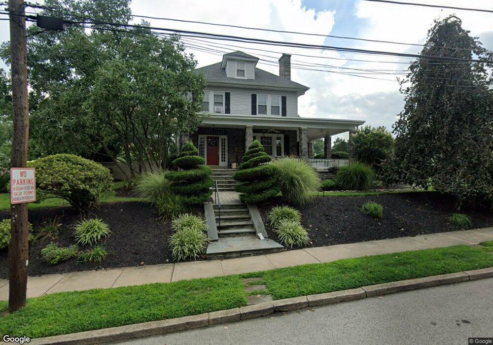
705 Ashurst Rd Havertown, PA 19083
Estimated Value: $798,000 - $914,000
5
Beds
2
Baths
2,593
Sq Ft
$326/Sq Ft
Est. Value
About This Home
This home is located at 705 Ashurst Rd, Havertown, PA 19083 and is currently estimated at $845,807, approximately $326 per square foot. 705 Ashurst Rd is a home located in Delaware County with nearby schools including Chatham Park Elementary School, Haverford Middle School, and Haverford Senior High School.
Ownership History
Date
Name
Owned For
Owner Type
Purchase Details
Closed on
May 20, 2009
Sold by
Buckley Bruce A and Buckley Constance P
Bought by
Buckley Constance P
Current Estimated Value
Home Financials for this Owner
Home Financials are based on the most recent Mortgage that was taken out on this home.
Original Mortgage
$225,000
Outstanding Balance
$146,839
Interest Rate
5.47%
Mortgage Type
New Conventional
Estimated Equity
$698,968
Purchase Details
Closed on
Jul 24, 1995
Sold by
Mccunney Kathleen
Bought by
Mccunney Kathleen and Lanctot Dexter
Home Financials for this Owner
Home Financials are based on the most recent Mortgage that was taken out on this home.
Original Mortgage
$112,507
Interest Rate
7.61%
Mortgage Type
Purchase Money Mortgage
Purchase Details
Closed on
Apr 27, 1995
Sold by
Mccunney William D and Mccunney Kathleen
Bought by
Mccunney Kathleen
Create a Home Valuation Report for This Property
The Home Valuation Report is an in-depth analysis detailing your home's value as well as a comparison with similar homes in the area
Home Values in the Area
Average Home Value in this Area
Purchase History
| Date | Buyer | Sale Price | Title Company |
|---|---|---|---|
| Buckley Constance P | -- | None Available | |
| Mccunney Kathleen | $61,294 | -- | |
| Mccunney Kathleen | -- | -- |
Source: Public Records
Mortgage History
| Date | Status | Borrower | Loan Amount |
|---|---|---|---|
| Open | Buckley Constance P | $225,000 | |
| Previous Owner | Mccunney Kathleen | $112,507 |
Source: Public Records
Tax History Compared to Growth
Tax History
| Year | Tax Paid | Tax Assessment Tax Assessment Total Assessment is a certain percentage of the fair market value that is determined by local assessors to be the total taxable value of land and additions on the property. | Land | Improvement |
|---|---|---|---|---|
| 2025 | $11,863 | $461,360 | $145,920 | $315,440 |
| 2024 | $11,863 | $461,360 | $145,920 | $315,440 |
| 2023 | $11,526 | $461,360 | $145,920 | $315,440 |
| 2022 | $11,256 | $461,360 | $145,920 | $315,440 |
| 2021 | $18,338 | $461,360 | $145,920 | $315,440 |
| 2020 | $10,109 | $217,500 | $73,880 | $143,620 |
| 2019 | $9,923 | $217,500 | $73,880 | $143,620 |
| 2018 | $9,752 | $217,500 | $0 | $0 |
| 2017 | $9,546 | $217,500 | $0 | $0 |
| 2016 | $1,218 | $217,500 | $0 | $0 |
| 2015 | $1,218 | $217,500 | $0 | $0 |
| 2014 | $1,218 | $217,500 | $0 | $0 |
Source: Public Records
Map
Nearby Homes
- 633 E Manoa Rd
- 755 Lawson Ave
- 529 Covington Rd
- 304 Earlington Rd
- 758 Lawson Ave
- 501 E Manoa Rd
- 214 Brentwood Rd
- 628 Lawson Ave
- 116 Brentwood Rd
- 516 Brookline Blvd
- 147 Juniper Rd
- 978 Township Line Rd
- 212 Henley Rd
- 247 Sagamore Rd
- 324 Brookline Blvd
- 142 Foster Ave
- 228 N Linden Ave
- 1455 Braddock Ln
- 235 N Linden Ave
- 109 Overbrook Pkwy
- 713 Ashurst Rd
- 651 Ashurst Rd
- 715 Ashurst Rd
- 645 Ashurst Rd
- 700 Ashurst Rd
- 706 Ashurst Rd
- 721 Ashurst Rd
- 712 Ashurst Rd
- 641 Ashurst Rd
- 800 Myrtle Ave
- 718 Ashurst Rd
- 524 Cumberland Rd
- 725 Ashurst Rd
- 639 Ashurst Rd
- 722 Ashurst Rd
- 522 Cumberland Rd
- 701 E Manoa Rd
- 635 Ashurst Rd
- 724 Ashurst Rd
- 731 Ashurst Rd