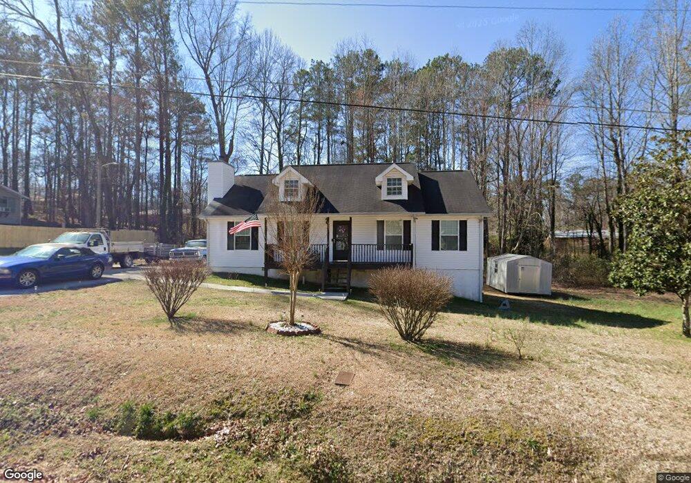
705 Britt Rd SW Mableton, GA 30126
Estimated Value: $218,000 - $264,000
3
Beds
3
Baths
1,242
Sq Ft
$198/Sq Ft
Est. Value
About This Home
This home is located at 705 Britt Rd SW, Mableton, GA 30126 and is currently estimated at $246,485, approximately $198 per square foot. 705 Britt Rd SW is a home located in Cobb County with nearby schools including Bryant Elementary School, Lindley Middle School, and Pebblebrook High School.
Ownership History
Date
Name
Owned For
Owner Type
Purchase Details
Closed on
Jun 28, 2004
Sold by
Hester Barron
Bought by
Hester Barron P
Current Estimated Value
Home Financials for this Owner
Home Financials are based on the most recent Mortgage that was taken out on this home.
Original Mortgage
$100,500
Outstanding Balance
$49,950
Interest Rate
6.25%
Mortgage Type
New Conventional
Estimated Equity
$196,535
Create a Home Valuation Report for This Property
The Home Valuation Report is an in-depth analysis detailing your home's value as well as a comparison with similar homes in the area
Home Values in the Area
Average Home Value in this Area
Purchase History
| Date | Buyer | Sale Price | Title Company |
|---|---|---|---|
| Hester Barron P | -- | -- |
Source: Public Records
Mortgage History
| Date | Status | Borrower | Loan Amount |
|---|---|---|---|
| Open | Hester Barron P | $100,500 |
Source: Public Records
Tax History Compared to Growth
Tax History
| Year | Tax Paid | Tax Assessment Tax Assessment Total Assessment is a certain percentage of the fair market value that is determined by local assessors to be the total taxable value of land and additions on the property. | Land | Improvement |
|---|---|---|---|---|
| 2025 | $2,226 | $95,024 | $33,988 | $61,036 |
| 2024 | $2,228 | $95,024 | $33,988 | $61,036 |
| 2023 | $1,438 | $83,632 | $33,988 | $49,644 |
| 2022 | $1,550 | $63,272 | $21,468 | $41,804 |
| 2021 | $1,370 | $55,040 | $18,604 | $36,436 |
| 2020 | $1,267 | $50,748 | $14,312 | $36,436 |
| 2019 | $1,267 | $50,748 | $14,312 | $36,436 |
| 2018 | $998 | $41,908 | $8,228 | $33,680 |
| 2017 | $624 | $30,628 | $5,368 | $25,260 |
| 2016 | $625 | $30,628 | $5,368 | $25,260 |
| 2015 | $639 | $30,520 | $3,576 | $26,944 |
| 2014 | $554 | $27,492 | $0 | $0 |
Source: Public Records
Map
Nearby Homes
- 760 W Starling Dr SW
- 377 Waterbluff Dr SW
- 373 Waterbluff Dr SW
- 369 Waterbluff Dr SW
- 767 Kenneth Ln SW
- 368 Waterbluff Dr SW
- Magnolia Plan at The Overlook at Factory Shoals - Georgian Series
- Axley Plan at The Overlook at Factory Shoals - Georgian Series
- Chatsworth Plan at The Overlook at Factory Shoals - Georgian Series
- 365 Waterbluff Dr SW
- 364 Waterbluff Dr SW
- 6281 Denny Ln SW
- 846 Orris Ln SW
- 537 Elizabeth Ln SW
- 6365 Susan Dr SW
- 496 Elizabeth Ln SW
- 6650 Valley Hill Dr SW
- 6266 Britt Rd SW
- 361 Gordon Valley Ln SW
- 6649 Valley Hill Dr SW
- 683 Britt Rd SW
- 727 Britt Rd SW
- 860 Howard Ct SW
- 720 Britt Rd SW
- 870 Howard Ct SW
- 850 Howard Ct SW
- 716 Britt Rd SW
- 645 Britt Rd SW
- 712 Britt Rd SW
- 648 Britt Rd SW
- 840 Howard Ct SW
- 880 Howard Ct SW
- 708 Britt Rd SW
- 830 Howard Ct SW
- 613 Charity Ln SW
- 611 Charity Ln SW
- 609 Charity Ln SW
- 869 Howard Ct SW
- 859 Howard Ct SW
- 879 Howard Ct SW