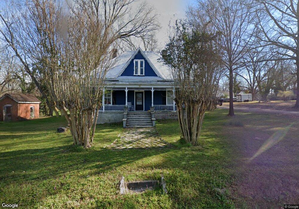
705 Carlton Ave Union Point, GA 30669
Estimated Value: $143,245 - $215,000
Studio
2
Baths
1,679
Sq Ft
$116/Sq Ft
Est. Value
About This Home
This home is located at 705 Carlton Ave, Union Point, GA 30669 and is currently estimated at $195,061, approximately $116 per square foot. 705 Carlton Ave is a home located in Greene County with nearby schools including Greene County High School.
Ownership History
Date
Name
Owned For
Owner Type
Purchase Details
Closed on
Jan 11, 1999
Sold by
Barden Howell L
Bought by
Mcnaughton Charlene
Current Estimated Value
Purchase Details
Closed on
Jan 1, 1989
Sold by
Braden Howell S
Bought by
Barden Howell L
Purchase Details
Closed on
Jan 1, 1986
Sold by
Facilities Service Inc
Bought by
Braden Howell S
Purchase Details
Closed on
Jan 1, 1985
Sold by
Rainwater W C
Bought by
Facilities Service Inc
Purchase Details
Closed on
Jan 1, 1950
Bought by
Rainwater W C
Create a Home Valuation Report for This Property
The Home Valuation Report is an in-depth analysis detailing your home's value as well as a comparison with similar homes in the area
Purchase History
| Date | Buyer | Sale Price | Title Company |
|---|---|---|---|
| Mcnaughton Charlene | $35,000 | -- | |
| Barden Howell L | -- | -- | |
| Braden Howell S | -- | -- | |
| Facilities Service Inc | -- | -- | |
| Rainwater W C | -- | -- |
Source: Public Records
Tax History
| Year | Tax Paid | Tax Assessment Tax Assessment Total Assessment is a certain percentage of the fair market value that is determined by local assessors to be the total taxable value of land and additions on the property. | Land | Improvement |
|---|---|---|---|---|
| 2025 | $727 | $52,080 | $3,960 | $48,120 |
| 2024 | $681 | $48,680 | $3,960 | $44,720 |
| 2023 | $246 | $47,440 | $3,960 | $43,480 |
| 2022 | $298 | $43,560 | $3,960 | $39,600 |
| 2021 | $298 | $25,280 | $3,960 | $21,320 |
| 2020 | $227 | $19,280 | $2,680 | $16,600 |
| 2019 | $230 | $19,280 | $2,680 | $16,600 |
| 2018 | $91 | $19,280 | $2,680 | $16,600 |
| 2017 | $203 | $19,333 | $2,700 | $16,633 |
| 2016 | $225 | $20,269 | $2,700 | $17,569 |
| 2015 | $196 | $20,269 | $2,700 | $17,569 |
| 2014 | $184 | $19,601 | $2,700 | $16,901 |
Source: Public Records
Map
Nearby Homes
- 202 Veazey St
- 607 Bryan Ave
- 324 N Rhodes St
- 215 Hunter St
- 0 S Rhodes St Unit 10618488
- 405 Crawfordville Rd
- 0 Woodland Ct Unit 10543600
- 1160 Moody St
- 1041 Hillcrest Dr
- 1241 Old Siloam Rd
- 000 Washington Hwy
- 1581 Highway 77 S Hwy
- 1581 Highway 77 S
- 5401 Union Point Hwy
- 1201 Buffalo Lick Rd
- 0 Buffalo Lick Rd Unit 10551234
- 0 Buffalo Lick Rd Unit 10551325
- 1251 Adams Rd
- 0 Old Union Point Rd Unit 1 10557753
- 1251 Brick House Rd
- 707 Carlton Ave
- 701 Thornton St
- 104 Thornton St
- 106 Thornton St
- 702 Hart Ave
- 715 Carlton Ave
- 715 Carlton Ave Unit Lot 36
- 108 Thornton St
- 704 Hart Ave
- 4740 Lamb Ave
- 607 Carlton Ave
- 4750 Lamb Ave
- 200 Thornton St
- 1144 Farm Rd
- 105 Thornton St
- 624 Sibley Ave
- 5 N Rhodes St
- 620 Sibley Ave
- 101 N Rhodes St
- 614 Sibley Ave
Your Personal Tour Guide
Ask me questions while you tour the home.