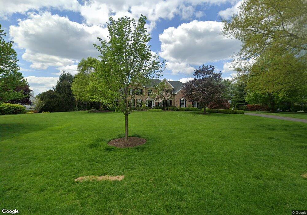
705 Commonwealth Dr Moorestown, NJ 08057
Estimated Value: $1,283,781 - $1,550,000
--
Bed
--
Bath
4,276
Sq Ft
$336/Sq Ft
Est. Value
About This Home
This home is located at 705 Commonwealth Dr, Moorestown, NJ 08057 and is currently estimated at $1,438,260, approximately $336 per square foot. 705 Commonwealth Dr is a home located in Burlington County with nearby schools including South Valley Elementary School, Moorestown Upper Elementary School, and William Allen Middle School.
Ownership History
Date
Name
Owned For
Owner Type
Purchase Details
Closed on
Aug 5, 2002
Sold by
Sattel Andrew B and Sattel Lisa U
Bought by
Weldon Raymond F and Weldon Lea M
Current Estimated Value
Home Financials for this Owner
Home Financials are based on the most recent Mortgage that was taken out on this home.
Original Mortgage
$500,000
Interest Rate
6.06%
Create a Home Valuation Report for This Property
The Home Valuation Report is an in-depth analysis detailing your home's value as well as a comparison with similar homes in the area
Home Values in the Area
Average Home Value in this Area
Purchase History
| Date | Buyer | Sale Price | Title Company |
|---|---|---|---|
| Weldon Raymond F | $725,000 | Infinity Title Agency Inc |
Source: Public Records
Mortgage History
| Date | Status | Borrower | Loan Amount |
|---|---|---|---|
| Closed | Weldon Raymond F | $500,000 |
Source: Public Records
Tax History Compared to Growth
Tax History
| Year | Tax Paid | Tax Assessment Tax Assessment Total Assessment is a certain percentage of the fair market value that is determined by local assessors to be the total taxable value of land and additions on the property. | Land | Improvement |
|---|---|---|---|---|
| 2025 | $21,451 | $756,100 | $141,000 | $615,100 |
| 2024 | $20,800 | $756,100 | $141,000 | $615,100 |
| 2023 | $20,800 | $756,100 | $141,000 | $615,100 |
| 2022 | $20,589 | $756,100 | $141,000 | $615,100 |
| 2021 | $20,316 | $756,100 | $141,000 | $615,100 |
| 2020 | $20,188 | $756,100 | $141,000 | $615,100 |
| 2019 | $19,833 | $756,100 | $141,000 | $615,100 |
| 2018 | $19,099 | $748,400 | $141,000 | $607,400 |
| 2017 | $19,264 | $748,400 | $141,000 | $607,400 |
| 2016 | $19,196 | $748,400 | $141,000 | $607,400 |
| 2015 | $18,964 | $742,900 | $141,000 | $601,900 |
| 2014 | $17,874 | $742,900 | $141,000 | $601,900 |
Source: Public Records
Map
Nearby Homes
- 901 Mcelwee Rd
- 97 Brooks Rd
- 39 Bramley Rd
- 5 Murray Rd
- 40 Palmer Dr Unit 110
- 801 Cox Rd
- 57 Brooks Rd
- 712 Kimberly Dr
- 700 Bentley Ct
- 14 Baltusrol Terrace
- 950 Bortons Landing Rd
- 740 Garwood Rd
- 158 Sarazen Dr
- 12 Cove Rd
- 751 Garwood Rd
- 359 Creek Rd
- 693 Garwood Rd
- 22 Sun Haven Place
- 27 Firethorn Ln
- 103 Congressional Ct
- 703 Commonwealth Dr
- 707 Commonwealth Dr
- 710 Commonwealth Dr
- 708 Commonwealth Dr
- 706 Commonwealth Dr
- 604 Mcelwee Rd Unit RD2
- 606 Mcelwee Rd Unit RD2
- 610 Mcelwee Rd
- 701 Commonwealth Dr
- 704 Commonwealth Dr
- 602 Mcelwee Rd Unit RD2
- 707 Worthington Dr
- 702 Commonwealth Dr
- 705 Worthington Dr
- 603 Mcelwee Rd Unit RD2
- 613 Mcelwee Rd Unit RD2
- 601 Mcelwee Rd Unit RD2
- 709 Worthington Dr
- 703 Worthington Dr
- 710 Worthington Dr