Estimated Value: $216,000 - $240,000
3
Beds
3
Baths
1,658
Sq Ft
$139/Sq Ft
Est. Value
About This Home
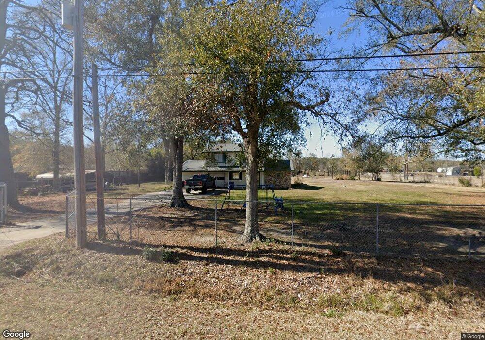
This home is located at 705 Doty Rd, Vidor, TX 77662 and is currently estimated at $230,534, approximately $139 per square foot. 705 Doty Rd is a home located in Orange County.
Ownership History
Date
Name
Owned For
Owner Type
Purchase Details
Closed on
Jun 24, 2016
Sold by
Cartus Financial Corp
Bought by
Allinder Brendan
Current Estimated Value
Home Financials for this Owner
Home Financials are based on the most recent Mortgage that was taken out on this home.
Original Mortgage
$135,990
Interest Rate
3.48%
Mortgage Type
FHA
Purchase Details
Closed on
May 28, 2016
Sold by
Goodwyn John G and Goodwyn Sherry L
Bought by
Cartus Financial Corp
Home Financials for this Owner
Home Financials are based on the most recent Mortgage that was taken out on this home.
Original Mortgage
$135,990
Interest Rate
3.48%
Mortgage Type
FHA
Purchase Details
Closed on
Dec 12, 2014
Sold by
Coleman Billy W
Bought by
Goodwyn John B and Goodwyn Sherry L
Home Financials for this Owner
Home Financials are based on the most recent Mortgage that was taken out on this home.
Original Mortgage
$103,098
Interest Rate
4.12%
Mortgage Type
FHA
Create a Home Valuation Report for This Property
The Home Valuation Report is an in-depth analysis detailing your home's value as well as a comparison with similar homes in the area
Home Values in the Area
Average Home Value in this Area
Purchase History
| Date | Buyer | Sale Price | Title Company |
|---|---|---|---|
| Allinder Brendan | -- | Multiple | |
| Cartus Financial Corp | -- | Multiple | |
| Goodwyn John B | -- | Stc | |
| Allinder Brendan | -- | -- |
Source: Public Records
Mortgage History
| Date | Status | Borrower | Loan Amount |
|---|---|---|---|
| Previous Owner | Allinder Brendan | $135,990 | |
| Previous Owner | Allinder Brendan | $103,098 |
Source: Public Records
Tax History
| Year | Tax Paid | Tax Assessment Tax Assessment Total Assessment is a certain percentage of the fair market value that is determined by local assessors to be the total taxable value of land and additions on the property. | Land | Improvement |
|---|---|---|---|---|
| 2025 | $2,992 | $193,345 | $20,550 | $172,795 |
| 2024 | $3,061 | $197,777 | $20,550 | $177,227 |
| 2023 | $2,790 | $178,673 | $20,550 | $158,123 |
| 2022 | $2,871 | $161,030 | $13,700 | $147,330 |
| 2021 | $2,820 | $151,600 | $13,700 | $137,900 |
| 2020 | $2,503 | $130,610 | $13,700 | $116,910 |
| 2019 | $2,486 | $128,620 | $13,700 | $114,920 |
| 2018 | $1,304 | $68,290 | $13,700 | $54,590 |
| 2017 | $2,434 | $122,880 | $13,700 | $109,180 |
| 2016 | $2,192 | $114,780 | $13,700 | $101,080 |
| 2015 | $1,596 | $110,159 | $13,700 | $96,459 |
| 2014 | $1,596 | $107,244 | $13,700 | $93,544 |
Source: Public Records
Map
Nearby Homes
- 0 Fm 1132 Unit 93970706
- 3530 Evangeline Dr
- 3540 Evangeline Dr
- 3665 E Railroad St
- 4585 Eaves Rd
- 4595 Eaves Rd
- 1025 Strickland St
- 3118 Flora St
- 260 Lawrence Ln
- 305 Oakland Dr
- 3455 Michelle Ave
- tbd Oakland St
- 230 Christel
- 210 Christel
- 160 S Linscomb Rd
- 410 Lee Ln
- 4560 Townsend Dr
- 16595 Interstate 10
- 425 Lawrence Ln
- 970 S Mayhaw Dr
Your Personal Tour Guide
Ask me questions while you tour the home.