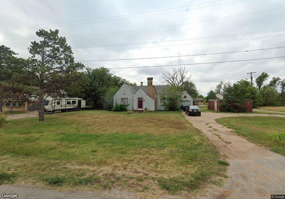
705 E Euclid Ave Waukomis, OK 73773
Estimated Value: $81,000 - $126,000
2
Beds
1
Bath
1,364
Sq Ft
$79/Sq Ft
Est. Value
About This Home
This home is located at 705 E Euclid Ave, Waukomis, OK 73773 and is currently estimated at $107,790, approximately $79 per square foot. 705 E Euclid Ave is a home located in Garfield County with nearby schools including Waukomis Elementary School and Waukomis High School.
Ownership History
Date
Name
Owned For
Owner Type
Purchase Details
Closed on
Dec 16, 2022
Sold by
Robinson Eloisa
Bought by
Robinson Eloisa and Benson Cynthia Marie
Current Estimated Value
Purchase Details
Closed on
Apr 26, 2019
Sold by
Pospisil Don Lee and Pospisil Donald L
Bought by
Robinson Charles R and Robinson Eloisa
Home Financials for this Owner
Home Financials are based on the most recent Mortgage that was taken out on this home.
Original Mortgage
$40,300
Interest Rate
4.3%
Mortgage Type
Unknown
Purchase Details
Closed on
Oct 6, 2011
Sold by
Thornton Mcdaniel Julie Annette and Pospisil Julie Annette
Bought by
Pospisil Don Lee and Pospisil Donald L
Purchase Details
Closed on
Aug 6, 1986
Sold by
Markes Orval L
Bought by
Pospisil Don
Create a Home Valuation Report for This Property
The Home Valuation Report is an in-depth analysis detailing your home's value as well as a comparison with similar homes in the area
Home Values in the Area
Average Home Value in this Area
Purchase History
| Date | Buyer | Sale Price | Title Company |
|---|---|---|---|
| Robinson Eloisa | -- | None Listed On Document | |
| Robinson Eloisa | -- | None Listed On Document | |
| Robinson Charles R | $32,500 | None Available | |
| Pospisil Don Lee | -- | None Available | |
| Pospisil Don | $18,000 | -- |
Source: Public Records
Mortgage History
| Date | Status | Borrower | Loan Amount |
|---|---|---|---|
| Previous Owner | Robinson Charles R | $40,300 |
Source: Public Records
Tax History Compared to Growth
Tax History
| Year | Tax Paid | Tax Assessment Tax Assessment Total Assessment is a certain percentage of the fair market value that is determined by local assessors to be the total taxable value of land and additions on the property. | Land | Improvement |
|---|---|---|---|---|
| 2024 | $785 | $7,508 | $349 | $7,159 |
| 2023 | $785 | $7,508 | $349 | $7,159 |
| 2022 | $797 | $7,508 | $349 | $7,159 |
| 2021 | $793 | $3,543 | $172 | $3,371 |
| 2020 | $314 | $3,374 | $164 | $3,210 |
| 2019 | $198 | $3,213 | $139 | $3,074 |
| 2018 | $196 | $3,120 | $175 | $2,945 |
| 2017 | $186 | $3,029 | $171 | $2,858 |
| 2016 | $177 | $3,028 | $991 | $2,037 |
| 2015 | $160 | $2,940 | $962 | $1,978 |
| 2014 | $160 | $2,940 | $962 | $1,978 |
Source: Public Records
Map
Nearby Homes
- 10112 U S 81
- 228 S 2nd St
- 220 N Main St
- 616 W Euclid Ave
- 118 E Skeleton Rd
- 301 E0470 Rd
- 1183 E Skeleton Rd
- 1182 E Skeleton Rd
- 4205 S Van Buren St
- 2802 Paradise Ln
- 0 S 16th St Unit Tract C 22207085
- 0 S 16th St Unit Tract D 22207086
- 0 S 16th St Unit Tract A 22194573
- 0 S 16th St Unit B 22194572
- 0 S 30th St Unit Tract I 22207848
- 0 S 30th St Unit Tract F 22207846
- 0 S 30th St Unit Tract H 22207847
- 0 S 30th St Unit Tract G 22207845
- 0 S 30th St Unit Tract E 22207088
- 0 S 30th St Unit Tract J