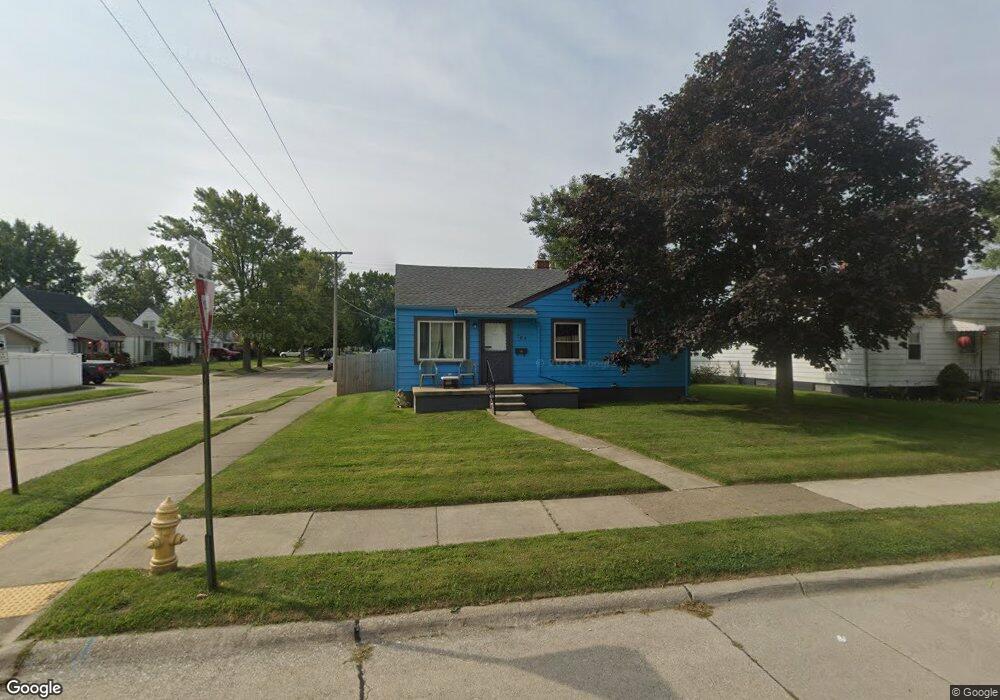
705 Hudson St Wyandotte, MI 48192
Estimated Value: $142,393 - $177,000
--
Bed
--
Bath
830
Sq Ft
$190/Sq Ft
Est. Value
About This Home
This home is located at 705 Hudson St, Wyandotte, MI 48192 and is currently estimated at $157,348, approximately $189 per square foot. 705 Hudson St is a home located in Wayne County with nearby schools including Jefferson Elementary School, Woodrow Wilson School, and Roosevelt High School.
Ownership History
Date
Name
Owned For
Owner Type
Purchase Details
Closed on
Oct 23, 2015
Sold by
Maddix Dennis W and Hamill Bonnie J
Bought by
Johnson Eric
Current Estimated Value
Home Financials for this Owner
Home Financials are based on the most recent Mortgage that was taken out on this home.
Original Mortgage
$66,748
Outstanding Balance
$53,374
Interest Rate
4.37%
Mortgage Type
FHA
Estimated Equity
$103,974
Purchase Details
Closed on
May 16, 2005
Sold by
Maddix Samuel W and Maddix Betty J
Bought by
Maddix Samuel W
Create a Home Valuation Report for This Property
The Home Valuation Report is an in-depth analysis detailing your home's value as well as a comparison with similar homes in the area
Home Values in the Area
Average Home Value in this Area
Purchase History
| Date | Buyer | Sale Price | Title Company |
|---|---|---|---|
| Johnson Eric | $68,000 | 1St Security Title Agency | |
| Maddix Samuel W | -- | 1St Security Title Agency In |
Source: Public Records
Mortgage History
| Date | Status | Borrower | Loan Amount |
|---|---|---|---|
| Open | Johnson Eric | $66,748 |
Source: Public Records
Tax History Compared to Growth
Tax History
| Year | Tax Paid | Tax Assessment Tax Assessment Total Assessment is a certain percentage of the fair market value that is determined by local assessors to be the total taxable value of land and additions on the property. | Land | Improvement |
|---|---|---|---|---|
| 2025 | $1,753 | $74,800 | $0 | $0 |
| 2024 | $1,753 | $67,200 | $0 | $0 |
| 2023 | $1,672 | $61,800 | $0 | $0 |
| 2022 | $1,937 | $56,000 | $0 | $0 |
| 2021 | $1,898 | $50,900 | $0 | $0 |
| 2020 | $1,872 | $45,500 | $0 | $0 |
| 2019 | $1,846 | $42,900 | $0 | $0 |
| 2018 | $1,474 | $35,100 | $0 | $0 |
| 2017 | $1,231 | $35,100 | $0 | $0 |
| 2016 | $2,078 | $31,900 | $0 | $0 |
| 2015 | $2,797 | $29,600 | $0 | $0 |
| 2013 | $2,710 | $27,100 | $0 | $0 |
| 2012 | $1,563 | $28,400 | $7,200 | $21,200 |
Source: Public Records
Map
Nearby Homes