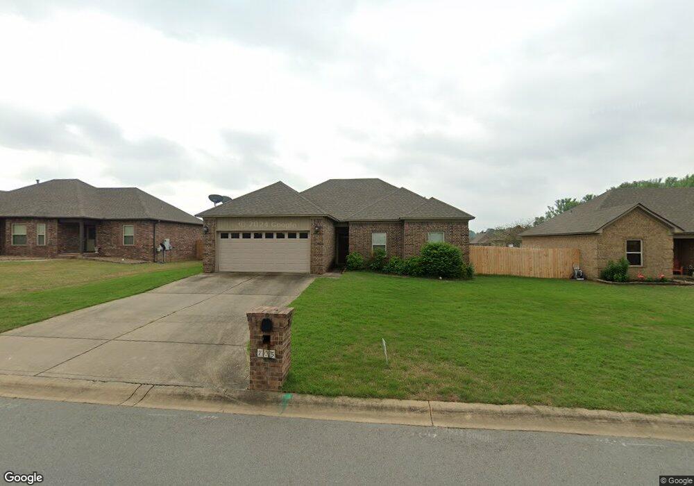
705 Mango Loop Austin, AR 72007
Estimated Value: $238,957 - $267,000
4
Beds
2
Baths
1,500
Sq Ft
$165/Sq Ft
Est. Value
About This Home
This home is located at 705 Mango Loop, Austin, AR 72007 and is currently estimated at $247,739, approximately $165 per square foot. 705 Mango Loop is a home located in Lonoke County with nearby schools including Eastside Elementary School, Cabot Middle School North, and Cabot Junior High North.
Ownership History
Date
Name
Owned For
Owner Type
Purchase Details
Closed on
Jan 16, 2011
Bought by
Moore & Moore Development Llc
Current Estimated Value
Create a Home Valuation Report for This Property
The Home Valuation Report is an in-depth analysis detailing your home's value as well as a comparison with similar homes in the area
Purchase History
| Date | Buyer | Sale Price | Title Company |
|---|---|---|---|
| Moore & Moore Development Llc | $22,000 | -- |
Source: Public Records
Tax History
| Year | Tax Paid | Tax Assessment Tax Assessment Total Assessment is a certain percentage of the fair market value that is determined by local assessors to be the total taxable value of land and additions on the property. | Land | Improvement |
|---|---|---|---|---|
| 2025 | $1,122 | $30,570 | $4,400 | $26,170 |
| 2024 | $1,122 | $30,570 | $4,400 | $26,170 |
| 2023 | $1,122 | $30,570 | $4,400 | $26,170 |
| 2022 | $1,172 | $30,570 | $4,400 | $26,170 |
| 2021 | $1,172 | $30,570 | $4,400 | $26,170 |
| 2020 | $1,127 | $29,690 | $4,400 | $25,290 |
| 2019 | $1,127 | $29,690 | $4,400 | $25,290 |
| 2018 | $1,152 | $29,690 | $4,400 | $25,290 |
| 2017 | $1,398 | $29,690 | $4,400 | $25,290 |
| 2016 | $1,149 | $29,690 | $4,400 | $25,290 |
| 2015 | $1,332 | $28,210 | $4,400 | $23,810 |
| 2014 | $1,077 | $28,210 | $4,400 | $23,810 |
Source: Public Records
Map
Nearby Homes
- 160 Creekside Dr
- 503 Nectarine St
- 241 Plum Dr
- 164 Crystal Lake Rd
- 63 Hudson Branch Dr
- 788 Mango Loop
- 2614 Highway 38
- 761 Mango Loop
- 44 Shadow Creek Cir
- 741 E Main St
- TBD E Main St
- E Main St
- Lot 99 Vernon Ct
- 0 Rainbow Lake Unit 25045643
- 00 N 2nd St
- 1703 N Lincoln St
- 1172 Stagecoach Blvd
- 1166 Stagecoach Blvd
- 1144 Stagecoach Blvd
- 1136 Stagecoach Blvd
- 707 Mango Loop
- 703 Mango Loop
- 701 Mango Loop
- 704 Mango Loop
- 161 Creekside Dr
- 195 Hudson Branch Dr
- 702 Mango Loop
- 706 Mango Loop
- 711 Mango Loop
- 167 Creekside Dr
- 710 Mango Loop
- 712 Mango Loop
- 713 Mango Loop
- 166 Creekside Dr
- 162 Creekside Dr
- 164 Creekside Dr
- 714 Mango Loop
- 155 Creekside Dr
- 715 Mango Loop
- 158 Creekside Dr
Your Personal Tour Guide
Ask me questions while you tour the home.