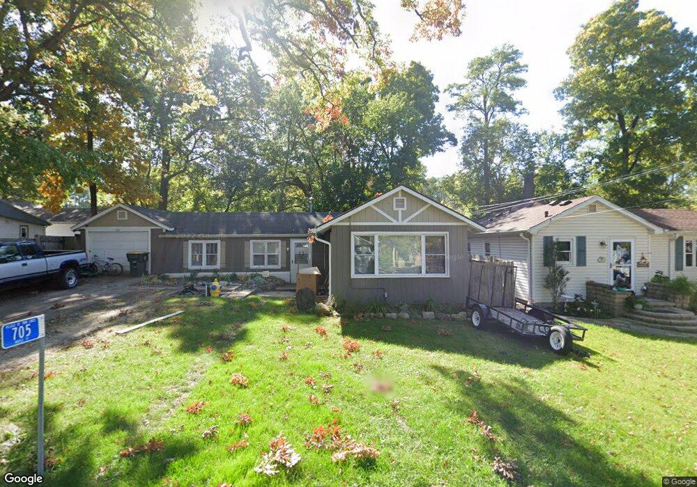
705 Maple St Twin Lakes, WI 53181
Estimated Value: $161,000 - $258,000
2
Beds
1
Bath
864
Sq Ft
$253/Sq Ft
Est. Value
About This Home
This home is located at 705 Maple St, Twin Lakes, WI 53181 and is currently estimated at $218,549, approximately $252 per square foot. 705 Maple St is a home located in Kenosha County with nearby schools including Lakewood Elementary School and Wilmot High School.
Ownership History
Date
Name
Owned For
Owner Type
Purchase Details
Closed on
May 13, 2019
Sold by
Krey Richard and Krey Teresa M
Bought by
Olson Nicholas
Current Estimated Value
Home Financials for this Owner
Home Financials are based on the most recent Mortgage that was taken out on this home.
Original Mortgage
$143,355
Outstanding Balance
$128,839
Interest Rate
5.37%
Mortgage Type
FHA
Estimated Equity
$89,710
Purchase Details
Closed on
Sep 18, 2014
Sold by
Arnold Robert J and Arnold Margaret M
Bought by
Krey Richard
Home Financials for this Owner
Home Financials are based on the most recent Mortgage that was taken out on this home.
Original Mortgage
$98,910
Interest Rate
4.07%
Mortgage Type
New Conventional
Purchase Details
Closed on
Mar 5, 2013
Sold by
Associated Bank Na
Bought by
Arnold Robert J and Arnold Margaret M
Purchase Details
Closed on
Nov 19, 2012
Sold by
Bartel Jerry J
Bought by
Associated Bank Na
Create a Home Valuation Report for This Property
The Home Valuation Report is an in-depth analysis detailing your home's value as well as a comparison with similar homes in the area
Home Values in the Area
Average Home Value in this Area
Purchase History
| Date | Buyer | Sale Price | Title Company |
|---|---|---|---|
| Olson Nicholas | $146,000 | None Available | |
| Krey Richard | $109,900 | -- | |
| Arnold Robert J | $28,000 | Portage County Title | |
| Associated Bank Na | -- | None Available |
Source: Public Records
Mortgage History
| Date | Status | Borrower | Loan Amount |
|---|---|---|---|
| Open | Olson Nicholas | $143,355 | |
| Previous Owner | Krey Richard | $98,910 |
Source: Public Records
Tax History Compared to Growth
Tax History
| Year | Tax Paid | Tax Assessment Tax Assessment Total Assessment is a certain percentage of the fair market value that is determined by local assessors to be the total taxable value of land and additions on the property. | Land | Improvement |
|---|---|---|---|---|
| 2024 | $1,329 | $108,000 | $30,500 | $77,500 |
| 2023 | $2,740 | $146,000 | $24,400 | $121,600 |
| 2022 | $2,982 | $146,000 | $24,400 | $121,600 |
| 2021 | $2,824 | $146,000 | $24,400 | $121,600 |
| 2020 | $2,739 | $120,900 | $24,400 | $96,500 |
| 2019 | $2,609 | $120,900 | $24,400 | $96,500 |
| 2018 | $2,790 | $120,900 | $24,400 | $96,500 |
| 2017 | $2,860 | $109,900 | $24,400 | $85,500 |
| 2016 | $2,864 | $109,900 | $24,400 | $85,500 |
| 2015 | $2,638 | $109,900 | $24,400 | $85,500 |
| 2014 | $1,710 | $68,800 | $24,500 | $44,300 |
Source: Public Records
Map
Nearby Homes
- 816 Maple St
- 624 Lake St
- 517 Oakwood Trail
- 509 Sunset Rd
- 605 Gatewood Dr
- 43 Roseann Ct
- 35324 110th St
- 237 E Main St
- 202 E Main St Unit 8
- 202 E Main St Unit 5
- 202 E Main St Unit 7
- 202 E Main St Unit 6
- 202 E Main St
- 131 Lance Dr Unit 21
- 441 Tindall's Nest
- 610 Tindall's Nest
- 596 Tindall's Nest
- 586 Tindall's Nest
- 201 Lance Dr
- 690 Lincoln Dr