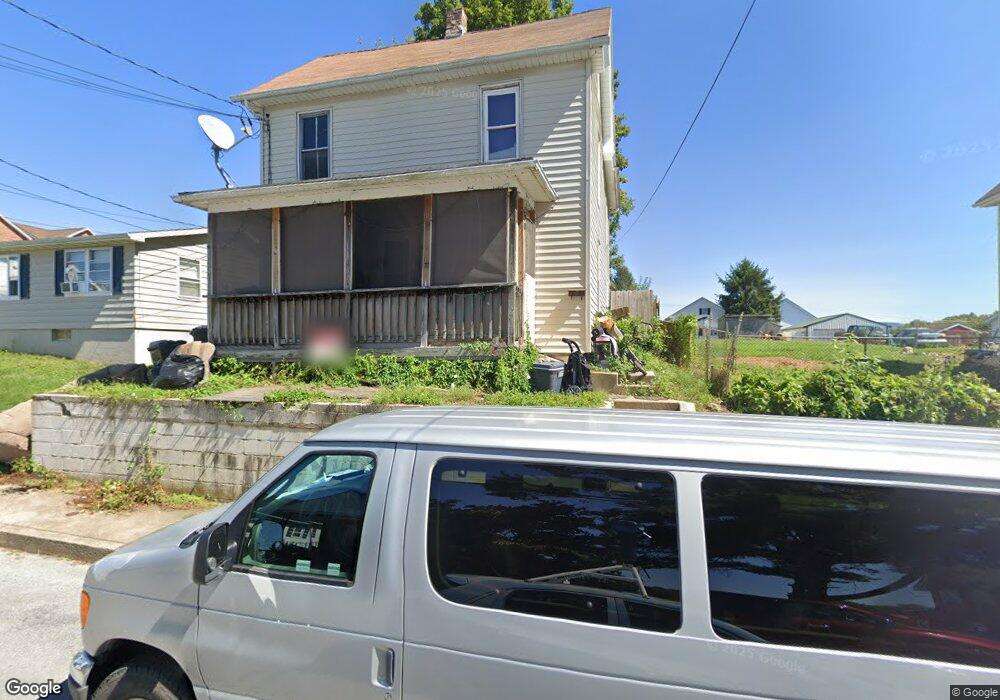
705 Maple St Waynesboro, PA 17268
Estimated Value: $108,000 - $207,000
3
Beds
2
Baths
1,556
Sq Ft
$103/Sq Ft
Est. Value
About This Home
This home is located at 705 Maple St, Waynesboro, PA 17268 and is currently estimated at $160,565, approximately $103 per square foot. 705 Maple St is a home located in Franklin County with nearby schools including Waynesboro Area Senior High School, Noah's Ark Christian Child Care Center, and St. Andrew Catholic School.
Ownership History
Date
Name
Owned For
Owner Type
Purchase Details
Closed on
Nov 30, 2010
Sold by
Beneficial Consumer Discount Company
Bought by
Santa Richard T
Current Estimated Value
Home Financials for this Owner
Home Financials are based on the most recent Mortgage that was taken out on this home.
Original Mortgage
$36,160
Outstanding Balance
$24,108
Interest Rate
4.4%
Mortgage Type
Purchase Money Mortgage
Estimated Equity
$136,457
Purchase Details
Closed on
Oct 7, 2010
Sold by
Baumgardner Robert L and Baumgardner Karen S
Bought by
Beneficial Consumer Discount Company and Beneficial Mortage Company Of Pennsylvan
Home Financials for this Owner
Home Financials are based on the most recent Mortgage that was taken out on this home.
Original Mortgage
$36,160
Outstanding Balance
$24,108
Interest Rate
4.4%
Mortgage Type
Purchase Money Mortgage
Estimated Equity
$136,457
Create a Home Valuation Report for This Property
The Home Valuation Report is an in-depth analysis detailing your home's value as well as a comparison with similar homes in the area
Home Values in the Area
Average Home Value in this Area
Purchase History
| Date | Buyer | Sale Price | Title Company |
|---|---|---|---|
| Santa Richard T | $45,200 | None Available | |
| Beneficial Consumer Discount Company | $803 | None Available |
Source: Public Records
Mortgage History
| Date | Status | Borrower | Loan Amount |
|---|---|---|---|
| Open | Santa Richard T | $36,160 |
Source: Public Records
Tax History Compared to Growth
Tax History
| Year | Tax Paid | Tax Assessment Tax Assessment Total Assessment is a certain percentage of the fair market value that is determined by local assessors to be the total taxable value of land and additions on the property. | Land | Improvement |
|---|---|---|---|---|
| 2025 | $1,999 | $11,030 | $450 | $10,580 |
| 2024 | $1,949 | $11,030 | $450 | $10,580 |
| 2023 | $1,906 | $11,030 | $450 | $10,580 |
| 2022 | $1,846 | $11,030 | $450 | $10,580 |
| 2021 | $1,752 | $11,030 | $450 | $10,580 |
| 2020 | $1,738 | $11,030 | $450 | $10,580 |
| 2019 | $1,705 | $11,030 | $450 | $10,580 |
| 2018 | $1,609 | $11,030 | $450 | $10,580 |
| 2017 | $1,578 | $11,030 | $450 | $10,580 |
| 2016 | $316 | $11,030 | $450 | $10,580 |
| 2015 | $295 | $11,030 | $450 | $10,580 |
| 2014 | $295 | $11,030 | $450 | $10,580 |
Source: Public Records
Map
Nearby Homes
- 824 S Church St
- 27 W 6th St
- 305 W 7th St
- 911 Park St
- 511 Hamilton Ave
- 118 W 5th St
- 202 W 5th St
- 313 Park St
- 417 Fairview Ave
- 462 Scott Ave Unit 4
- 208 Hamilton Ave
- 220 Cleveland Ave
- 223 E 3rd St
- 115 Cleveland Ave
- 130 Hamilton Ave
- 0 Westview Ave
- Fulton I Plan at Brimington Farm
- Bristol III Plan at Brimington Farm - Brimington
- Hanover Plan at Brimington Farm - Brimington
- Montgomery Plan at Brimington Farm