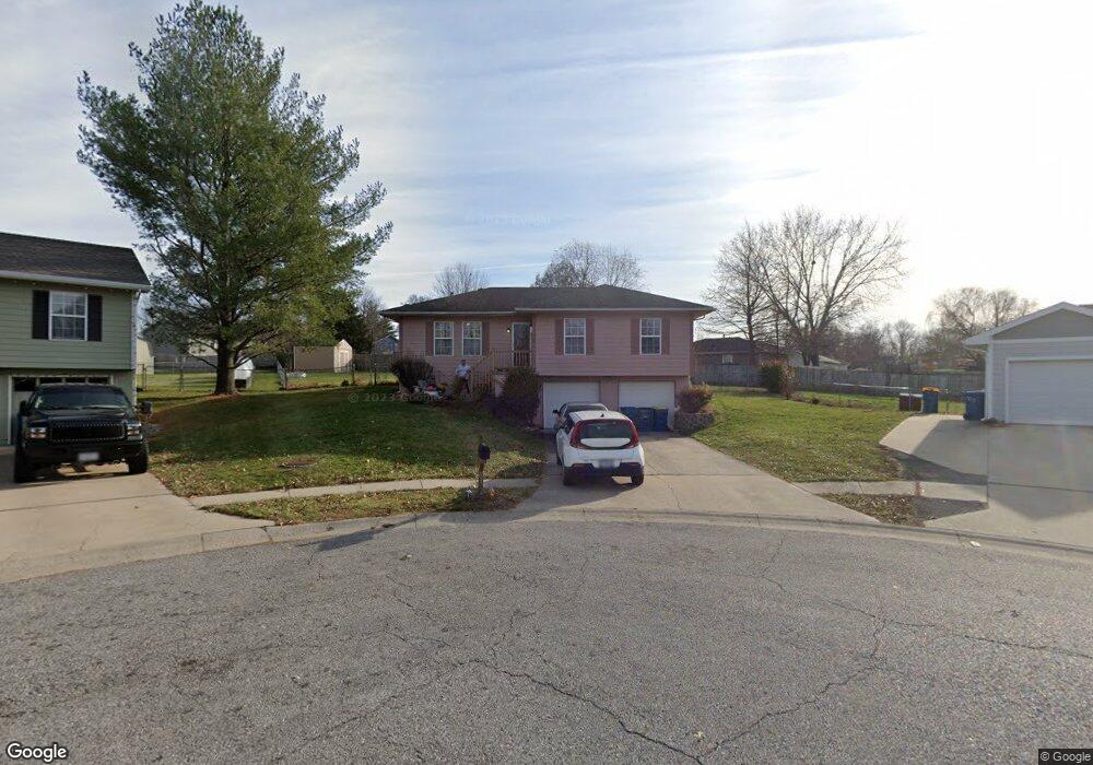
705 N Jesse Cir Kearney, MO 64060
Estimated Value: $253,000 - $269,000
3
Beds
1
Bath
1,096
Sq Ft
$237/Sq Ft
Est. Value
About This Home
This home is located at 705 N Jesse Cir, Kearney, MO 64060 and is currently estimated at $260,076, approximately $237 per square foot. 705 N Jesse Cir is a home located in Clay County with nearby schools including Kearney Junior High School, Kearney High School, and Northern Hills Christian Academy.
Ownership History
Date
Name
Owned For
Owner Type
Purchase Details
Closed on
Mar 9, 2018
Sold by
Roach Kirby D
Bought by
Roach Kirby D
Current Estimated Value
Purchase Details
Closed on
Sep 9, 2002
Sold by
Edwards Christopher L
Bought by
Roach Kirby D and Roach Virginia
Home Financials for this Owner
Home Financials are based on the most recent Mortgage that was taken out on this home.
Original Mortgage
$97,000
Interest Rate
6.41%
Mortgage Type
Balloon
Purchase Details
Closed on
Jan 19, 2000
Sold by
Blair Lori J
Bought by
Edwards Christopher L
Home Financials for this Owner
Home Financials are based on the most recent Mortgage that was taken out on this home.
Original Mortgage
$92,022
Interest Rate
7.86%
Mortgage Type
FHA
Create a Home Valuation Report for This Property
The Home Valuation Report is an in-depth analysis detailing your home's value as well as a comparison with similar homes in the area
Home Values in the Area
Average Home Value in this Area
Purchase History
| Date | Buyer | Sale Price | Title Company |
|---|---|---|---|
| Roach Kirby D | -- | None Available | |
| Roach Kirby D | -- | Thomson Title Corp | |
| Edwards Christopher L | -- | First American Title Ins Co |
Source: Public Records
Mortgage History
| Date | Status | Borrower | Loan Amount |
|---|---|---|---|
| Closed | Roach Kirby D | $97,000 | |
| Previous Owner | Edwards Christopher L | $92,022 |
Source: Public Records
Tax History Compared to Growth
Tax History
| Year | Tax Paid | Tax Assessment Tax Assessment Total Assessment is a certain percentage of the fair market value that is determined by local assessors to be the total taxable value of land and additions on the property. | Land | Improvement |
|---|---|---|---|---|
| 2025 | $2,050 | $34,370 | -- | -- |
| 2024 | $2,050 | $29,910 | -- | -- |
| 2023 | $2,043 | $29,910 | $0 | $0 |
| 2022 | $1,913 | $27,090 | $0 | $0 |
| 2021 | $1,876 | $27,094 | $4,180 | $22,914 |
| 2020 | $1,890 | $24,830 | $0 | $0 |
| 2019 | $1,880 | $24,833 | $4,180 | $20,653 |
| 2018 | $1,754 | $22,380 | $0 | $0 |
| 2017 | $1,650 | $22,380 | $3,040 | $19,340 |
| 2016 | $1,650 | $21,280 | $3,420 | $17,860 |
| 2015 | $1,651 | $21,280 | $3,420 | $17,860 |
| 2014 | $1,659 | $21,280 | $3,420 | $17,860 |
Source: Public Records
Map
Nearby Homes
- 608 Woodson St
- 102 W Lawrence St
- Lot 15 Melinda Dr
- Lot 14 Melinda Dr
- Lot 13 Melinda Dr
- Lot 12 Melinda Dr
- Lot 11 Melinda Dr
- Lot 10 Melinda Dr
- Lot 8 Melinda Dr
- Lot 5 Melinda Dr
- Lot 4 Melinda Dr
- Lot 3 Melinda Dr
- Lot 2 Melinda Dr
- Lot 1 Melinda Dr
- 204 N Clark St
- 201 E Washington St
- 205 E Washington St
- 0 W Washington (Parcel A) St
- 0 W Washington St
- 108 S Grove St